
Mapstack for government
The AI teammate for government GIS work.
Ask in plain words. Mapstack makes the map, the analysis or the report.
Free to start. No card.
Where government stands today
Most public decisions have a “where” in them. Getting the answer is the slow part.
Everyone needs it, few can make it
Requests come from every department, from elected officials and from the public. They land on a small GIS team, or on someone with another job to do.
The same work comes round again
Plans, funding cycles and boundary changes mean last year’s maps are remade on this year’s data.
It is public, and someone signs it
The work goes in front of councils, boards, funders and residents. It can be challenged, so every figure needs its source.
Evidence for every public decision, when it is needed.
What changes with Mapstack
Today a question waits for the one person who knows the GIS software. With Mapstack, anyone on staff asks in a sentence and has the answer while the decision is still live.
Anyone on staff can ask
Ask in plain words or in GIS terms. A map, a list, an analysis or a report comes back, ready to check.
- Or ask
How many residents live in each council district?
Where do serious crashes cluster after dark?
Serious crashes: evening and night hot spots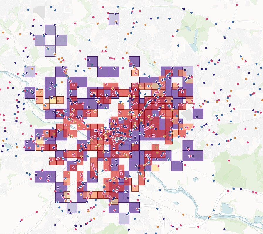
- Or ask
Know who and what a decision touches
Find everyone and everything inside an area, within a distance or within reach: for a rezoning, a road closure, a hazard zone or a new clinic.
- Or ask
Which schools and nursing homes are in the evacuation zone?
Which parcels does this rezoning touch?
The parcels a rezoning touches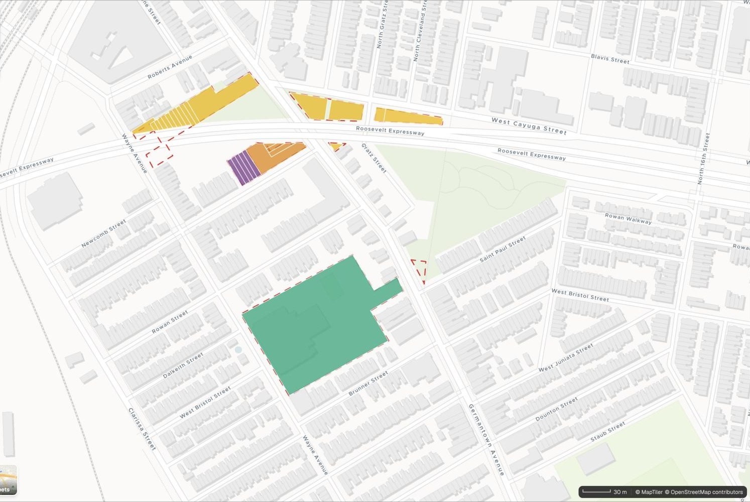
- Or ask
See where need is, and where it is not met
Compare areas on any measure, find the gaps and rank where to spend first, whether the subject is health, housing, parks or broadband.
- Or ask
Which block groups qualify for the grant?
Where is income lowest and diabetes highest?
Income and diabetes prevalence, by census tract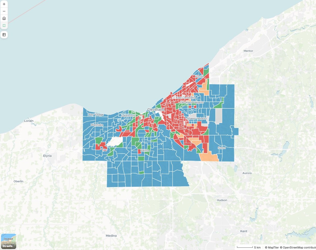
- Or ask
Put it in front of the public, with the working shown
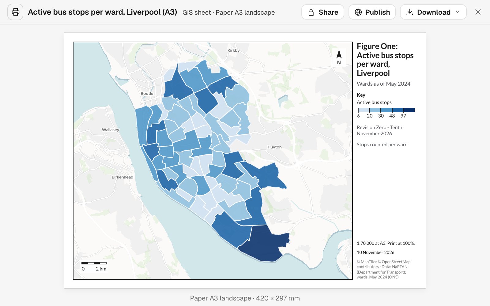
A print sheet to scale, a map residents can search or a written report. Each carries its sources, its dates and its method.
- Or ask
Publish it so residents can look up their own street.
Make this a print sheet for the board paper.
- Or ask
Three examples
Three of many, from different corners of government. Each shows the request, what came back and who decides.
Zoning and a mailing list around a site
A county planning department
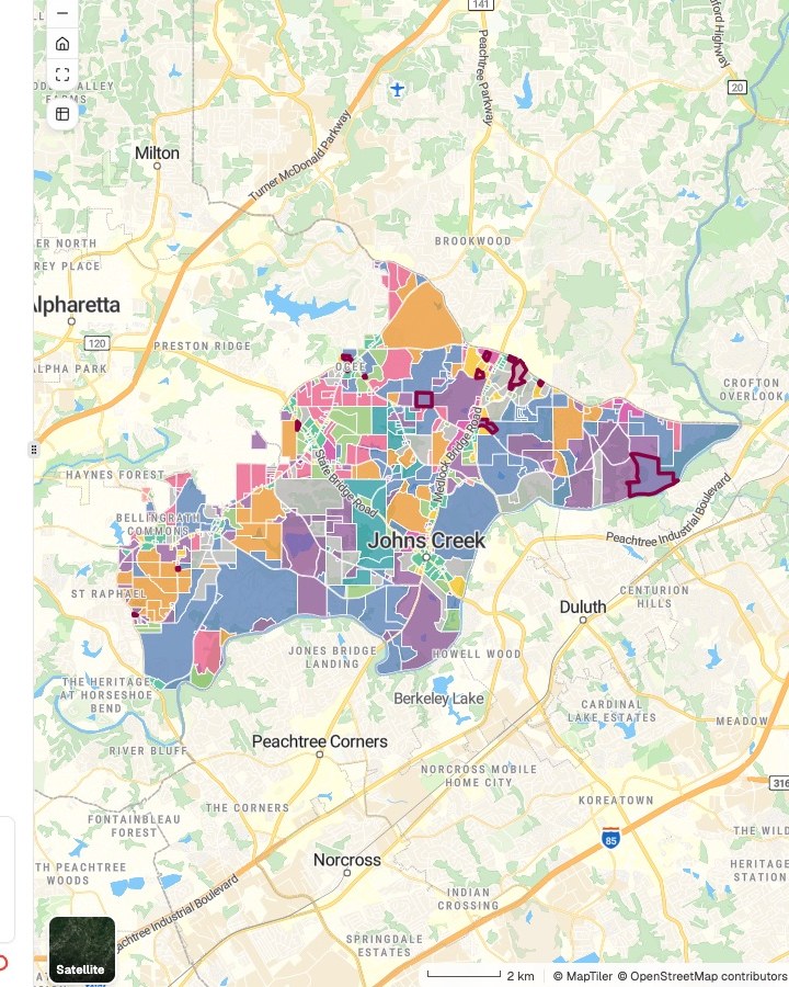
Zoning districts
Current zoning, and cases approved since 2024
- Residential
- Commercial and mixed use
- Office and institutional
- Rezoned since 2024
The request
Map current zoning around the attached site, with rezonings since 2024, and list every parcel and owner within 500 feet.
What came back
- A zoning map sized for the report
- A draft mailing list, with each parcel’s distance from the site
- The parcel and zoning data named, with their dates
Goes toThe case planner, for the staff report.
Mapstack prepares the map and the draft list, while the planner makes the recommendation and certifies the notice.
Who cannot walk to a grocery store
A food policy analyst in a city health department, with no GIS training
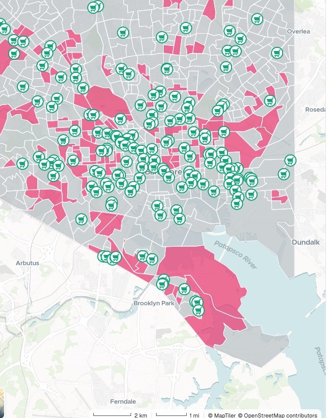
Block groups
Walking access to a grocery store
- Priority area · 108
- Other block groups
- Grocery stores
The request
Which neighborhoods have low walking access to a grocery store and many households without a car, and how many people live in them?
What came back
- Walking access to grocery stores, worked out for every block group
- The priority areas, and the residents in each
- A briefing report with the method and the date of the data
Goes toThe health department’s food access plan.
Mapstack measures the access, while the department decides where to act first.
Street cuts that would dig up a new surface
A city public works department
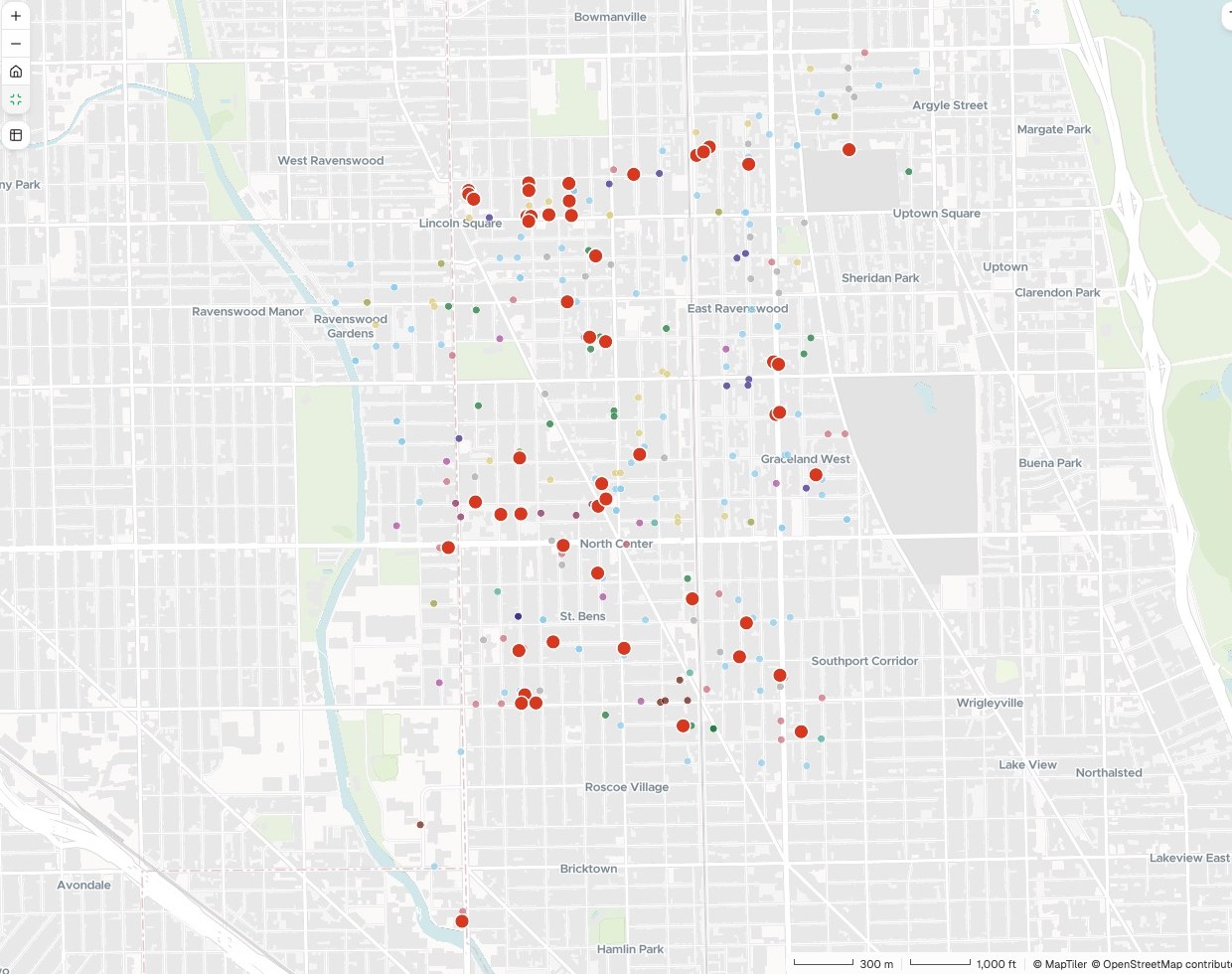
Clashes
Permit and project on the same block within two years
- Permit inside a planned project · 87
The request
Show every block where an open street-cut permit falls on a street we plan to resurface, within two years either way.
What came back
- Every clash, as a point on the map and a row in a table
- The permit holder and the dates for each
- A sheet for the coordination meeting
Goes toPublic works and finance, for the capital program.
Mapstack finds the clashes, while you decide what gets resequenced.
An example of how it goes
Four departments asked on Monday. None of them waited.
Marcus is the GIS coordinator for a county, and half of its GIS staff. On Monday morning planning, public works, parks and public health each have a request in.
- site-parcel.geojson
Map current zoning around the attached site, and list every parcel within 500 feet.
Monday 8:40
Planning asks first
One sentence and the site. Marcus hands it to Mapstack and opens the next request.
- Zoning, with rezonings since 2024
Monday 8:55
The zoning map is back
Sized for the report, with the parcel data and its date named.
- Income and diabetes prevalence, by census tract
Where is income lowest and diabetes highest, by census tract?
Monday 9:10
Public health is next
A different question on different data, asked the same way. Parks and public works follow.
- Income and diabetes prevalence, by census tractBack with the officers
Four requests, four departments
Each checked and signed by the officer who asked
Monday 11:30
The officers take over
Each one checks what came back and makes the call that is theirs to make.
Marcus cleared Monday’s queue on Monday.
He checked each result and passed it on. The departments got their answers while the questions were still live, and he spent the afternoon on the data only he looks after.
Works with the records you already keep
Your parcel, zoning and address records stay where they are. Mapstack works from what you give it.
- What you bringExports from the systems you run today.
- Parcels and zoningPermits and capital projectsAddress and assessor recordsFacilities and assetsCase files and site boundaries
- What Mapstack finds for youPublished data, fetched when you ask and named on the result.
- Census and deprivation figuresFlood and hazard zonesBoundaries and districtsOpen data from other agencies
- What you hand onIn the form the reader expects.
- Maps for the staff reportLists and tablesPrint-ready plan sheetsA public map residents can search
Made for the public record
What government publishes can be challenged. So nothing here is taken on trust.

- An officer signs, not Mapstack. It does not make a determination, certify a notice or decide eligibility. It prepares what your staff check.
- Sources and dates on every map. Which parcel layer, which census, which flood map, and when each was current.
- The method is written out. How a distance was measured or a figure worked out comes back with the result.
- Nothing is public until you publish it. Work stays inside your workspace until a member of staff chooses to open it up.
- It sits beside the GIS you have. Your system of record stays the record. Mapstack reads your exports and hands data back.
The parts of Mapstack government teams use most
One teammate, whichever department is asking.
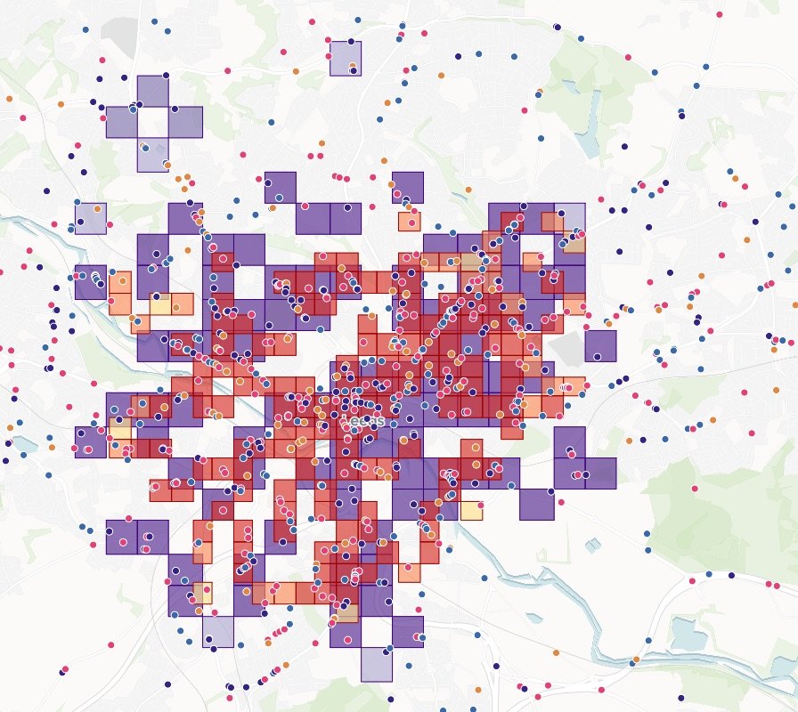
Analysis
Who is inside, who is nearest, where the gaps are.
Reports and print maps
Report figures and print sheets, to scale.
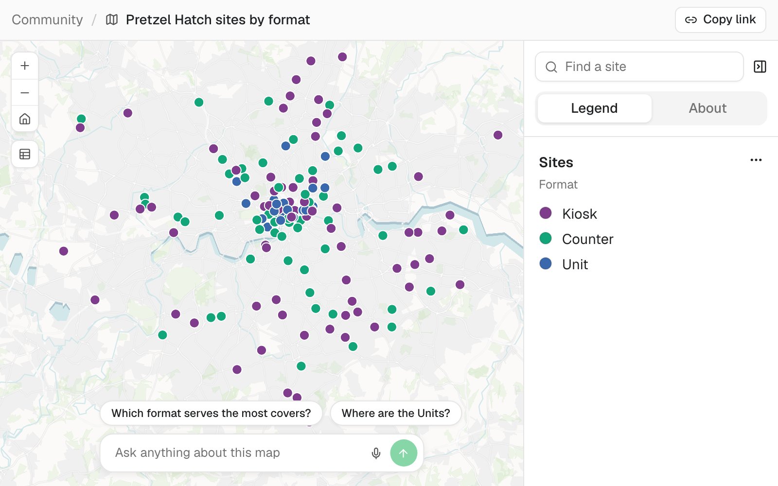
Maps
A public map residents can search.
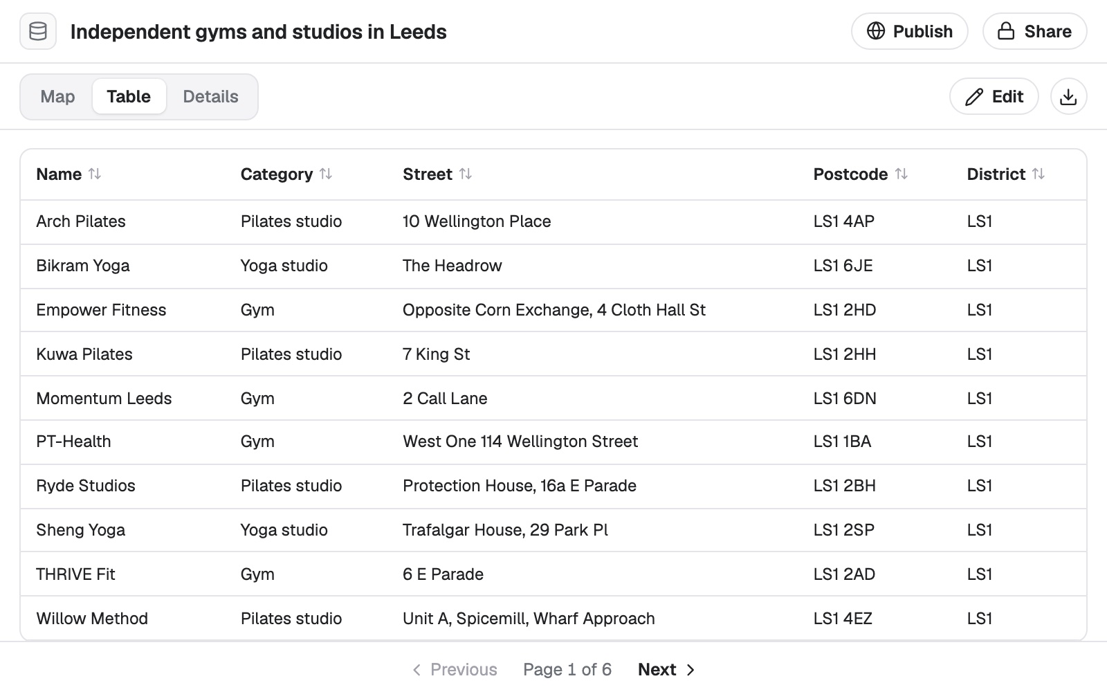
Data
Address and parcel lists cleaned and matched.
Looking for a particular job? These go step by step.
- See every parcel a rezoning touchesEach parcel’s district and its zoning now and after, summed up by bill.
- Check your zoning map against approved rezoningsClass, case number and date checked case by case, and the clear ones corrected.
- Find the dig permits that clash, street by streetDifferent holders digging close together at the same time, and who to call.
- Keep a register of your assets on a mapA survey as a register, and the list a contractor needs.
- Count what each hazard puts at riskBuildings in each hazard area, and every exposed critical facility by name.
- See how much of your city each station reaches in timeDrive-time coverage, and the residents inside and outside.
- Map an official statistic, area by areaA published figure for every small area, shaded by its value.
- Find what share of residents can walk to a stopWalking access to a service, area by area.
- Test your districts against the censusHow far each district sits from an equal share, and a balanced test plan to compare.
- Update the parcel register from recorded deedsEach sale on its parcel, at its recorded price, and the deeds to check.
- Publish open data as a map and a downloadYour portal export tidied, mapped by kind, with the licence and attribution on the map.
- Put a plan online for residentsOne public map, a display sheet and a plain page.
What it costs
Mapstack is priced per person and free to start, with no minimum and no sales call.
Free
$0for one person
Ask about your own files. What comes back stays private to you until you choose to share it.
Creator
$16a person a month, billed yearly
Adds sharing with your team, reports and print sheets, and work that reruns without you.
Creator Max
$80a person a month, billed yearly
The same, with a larger monthly allowance for people who ask all day.
Colleagues who only need the answers take a Viewer seat at $10 a month. They open every result and ask it their own questions. See every plan.
Questions government staff ask
What GIS work can Mapstack do for a local government?
Most of what a department asks a GIS team for: maps, spatial analysis, lists of what falls inside an area, cleaned and matched data, public web maps, small apps, print sheets and written reports. You ask in plain words or in GIS terms, and your staff check the result.
Is it only for GIS staff?
No. It is for the GIS team and for the staff who wait on them, in any department whose work involves places.
How do I make the maps for a planning staff report?
Attach the site and say which maps the report needs: vicinity, current zoning, future land use, aerial context. Mapstack makes each one at the size you ask for, with the data and its date named. You can ask for the same set for every case on the agenda.
Can Mapstack build a public hearing notification list?
It builds the draft: every parcel within the distance you give, with its owner and mailing address from your records and its distance from the site. Checking and certifying the list remains your staff’s job.
Can it help with a hazard mitigation plan update?
Yes. Give it your critical facilities and it shows which fall inside each hazard zone, as maps by community and tables by facility type for the risk assessment. The planning committee sets the priorities.
Can it help with a local plan’s evidence base?
Yes. For a site assessment it can map each site against the constraints you name and tabulate the results, and it can rerun monitoring figures each year from updated data. Officers judge the sites.
Do we have to replace our GIS?
No. Mapstack reads the standard formats your GIS exports and hands data back in formats it opens. Your parcel, zoning and address records stay where they are.
Can residents see what we make?
Only what you publish. A published map opens from a link with no account, with a search box and a legend, and can be made private again at any time.
Is the data I upload private?
Yes, on every plan, Free included. Your files and everything made from them are private to your workspace by default. Nothing is public unless you choose to publish it, and you can make it private again.
What happens to my data?
It stays in your workspace and it stays yours. Only the people you give a seat to can see it. It is stored in the United States, it is not used to train AI, and when you delete it, it is removed.
Ask the question you are waiting on.
Free to start. No card.