
Mapstack
The AI teammate for GIS work.
Ask in plain words or GIS terms. Mapstack finds the data, does the work and hands it back.
Free to start. No card.
Watch a piece of work get done
One request, start to finish: asked in plain words, planned, carried out, handed back for your review.
Your expertise, with a second pair of hands.
A teammate, not a toolbox
You say what you need. Mapstack works out the steps, does them and shows you what it did.
Say it your way
Ask in plain words and get a plain answer. Ask in GIS terms and it answers in kind. Either way you skip the menus.
Mapstack plans before it acts
For anything open-ended, Mapstack says what it understood and what it will use, and waits for your yes.
Mapstack asks when it matters
When a choice would change the result, you get the options with a recommendation. Not twenty questions, and not a silent guess.
Mapstack shows its working
The method, the date of each input and the calls it made for you come back with the result, so you can check it as you would a colleague’s.
Mapstack keeps going while you do something else
Hand over the job and get on with your own. The work carries on if you close the tab.
Everything it makes is kept
Datasets, maps and reports go into your library, ready to be used again by name in the next piece of work.
One teammate, every kind of deliverable
Mapstack hands back whatever the job calls for, and each kind is made from the same data.
Which sites reach the most households?
Harbour Road reaches the most.
Site Households Harbour Road 61,200 Mill Lane 48,900 Station Square 44,300 Answers
A figure, a ranking or a short table, in the conversation.
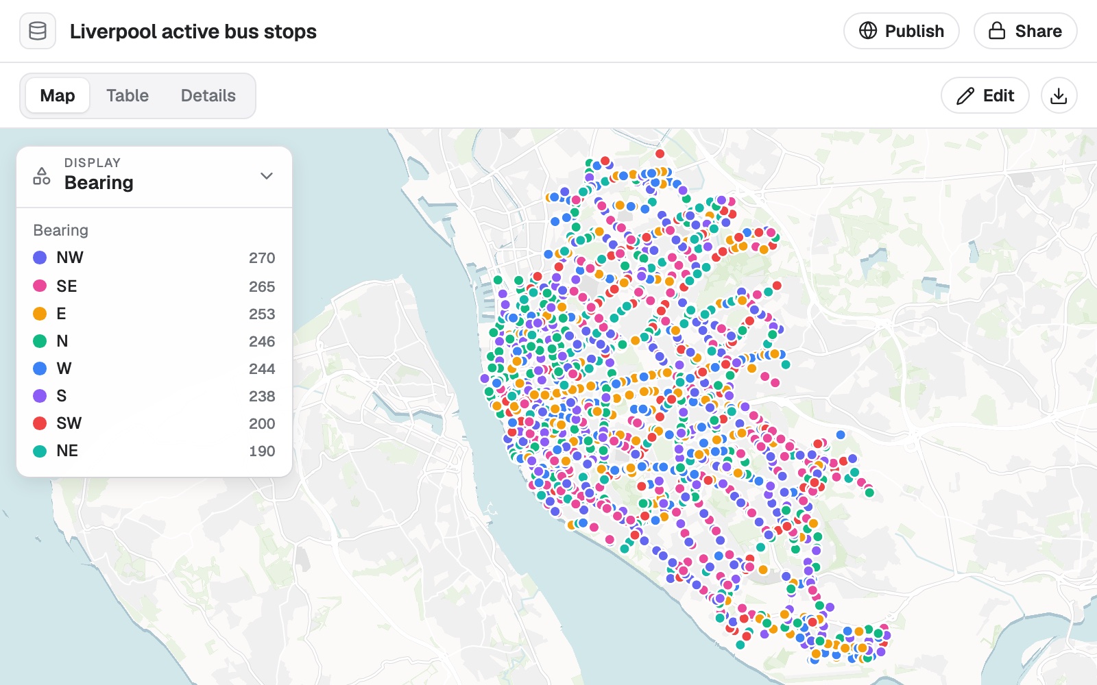
Datasets
Cleaned, joined and described, yours to take away.
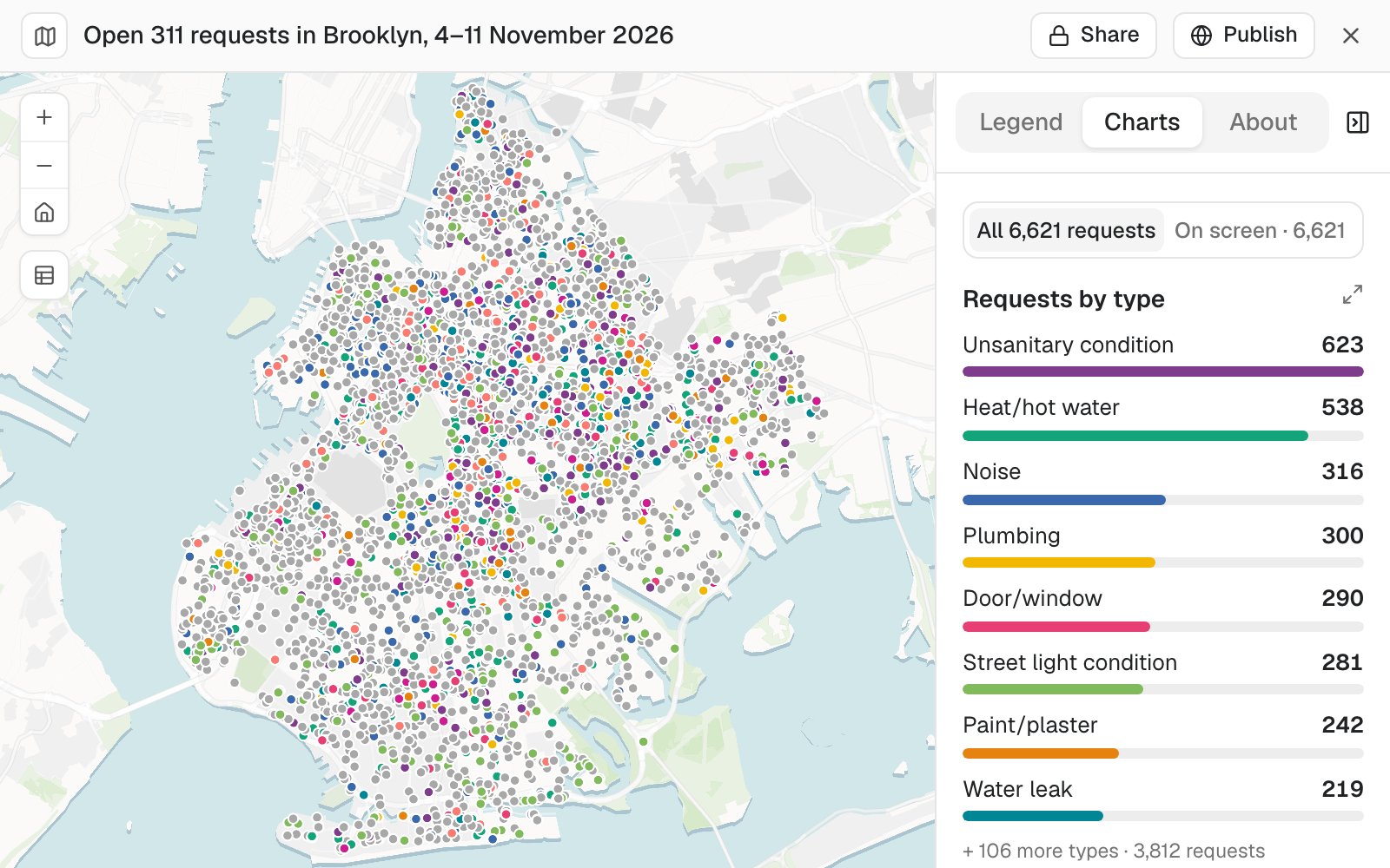
Maps
Interactive, with a legend, search and charts.
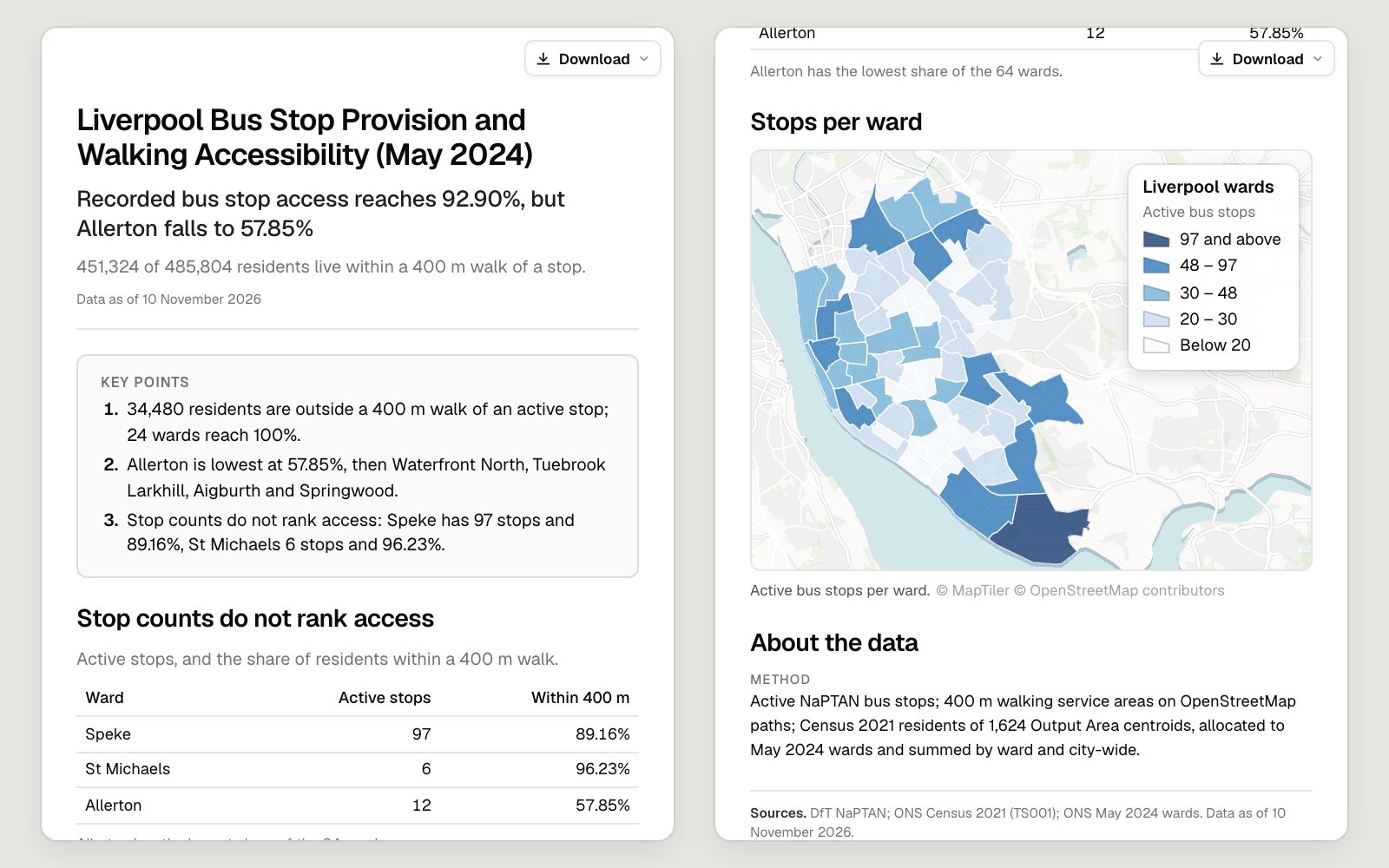
Reports
The finding first, the method and sources last.
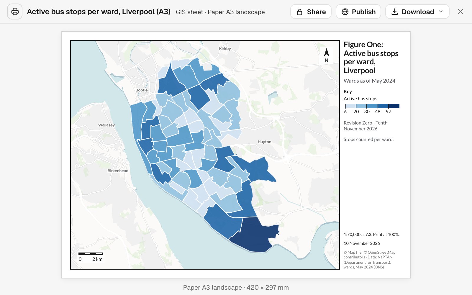
Prints
Map sheets to scale, slides and figures.
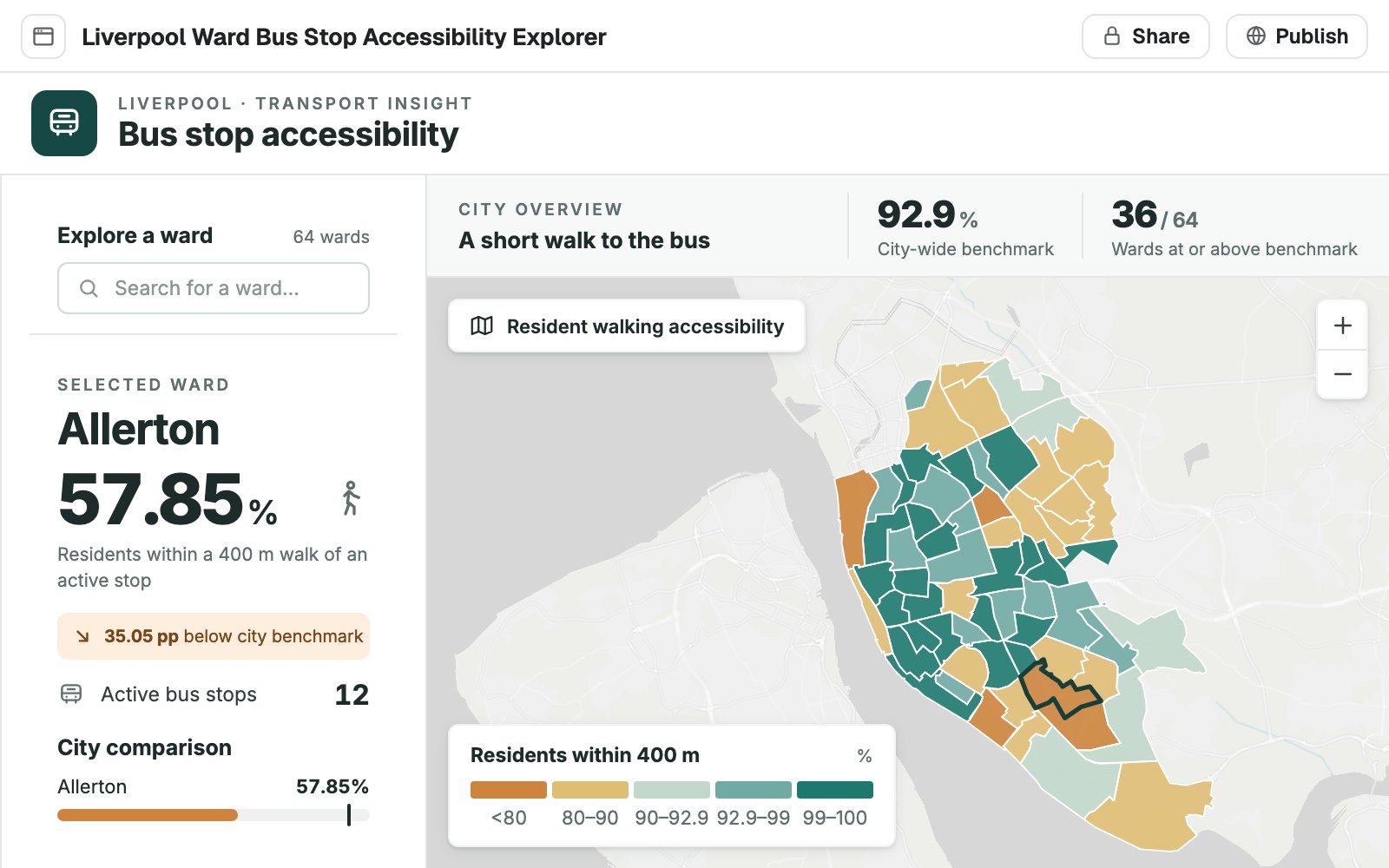
Apps
A tool built around one job, for people who are not GIS users.
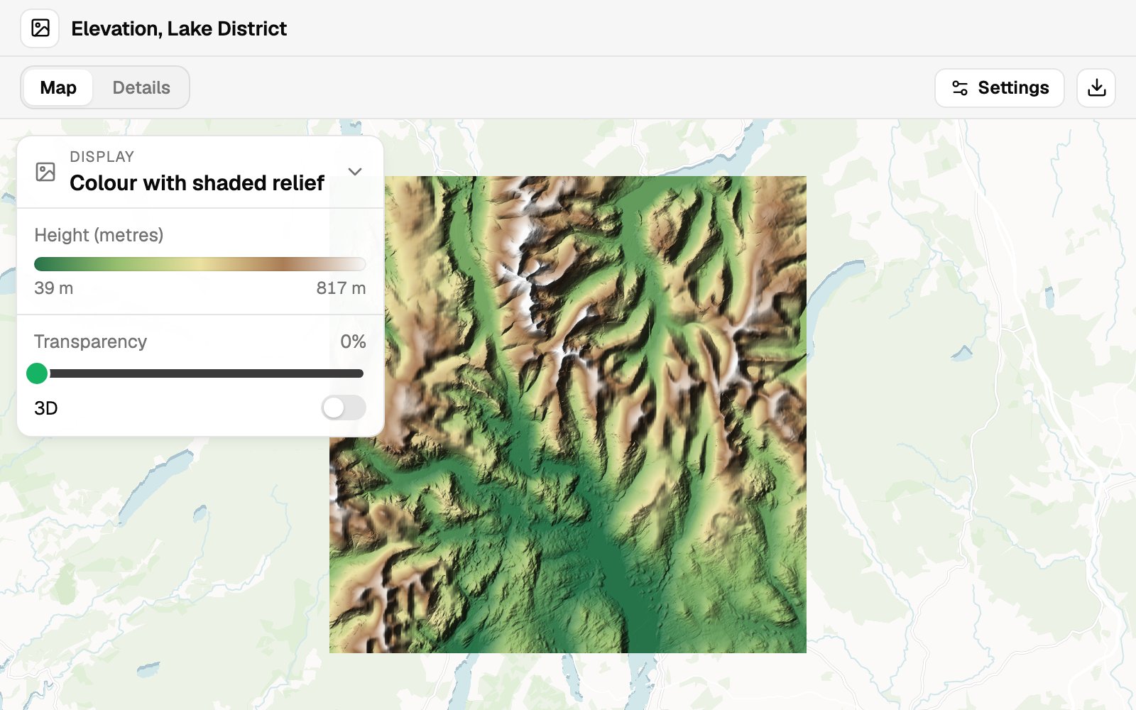
Imagery
Orthophotos, satellite scenes and elevation on a map.
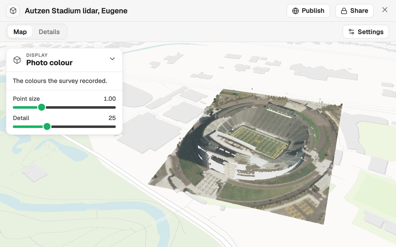
Scenes
Point clouds and models standing on their site in 3D.
A conversation on one side, the work on the other
There is no toolbar to learn. You talk to Mapstack on the left and the thing it is making sits on the right, where you can check it.
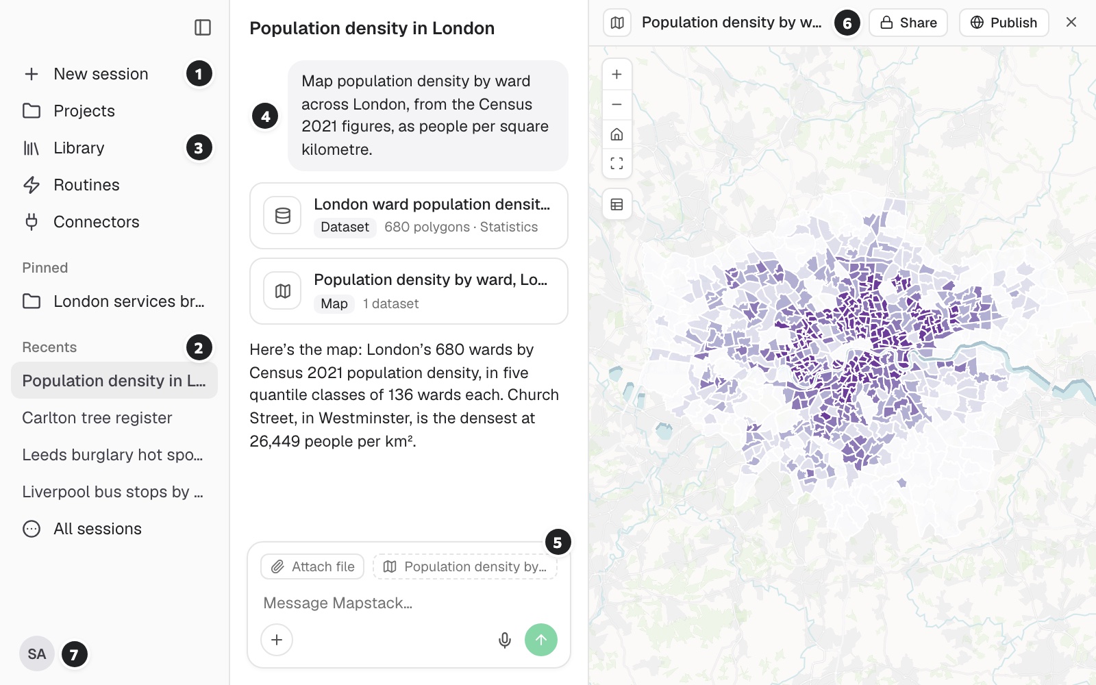
- Start a piece of work. Each job is its own session, so nothing gets tangled.
- Pick up where you left off. Recent sessions keep their whole history.
- Your library. Everything made so far, ready to be used again by name.
- Your request, in your words. With what was made from it listed underneath.
- Attach a file, or point at what is open. Mapstack works on what you give it or what it finds.
- The result, beside the conversation. Open, checkable, and yours to share or publish.
- Your seat and your allowance. How much of your monthly allowance is left, in plain view.
Hand off the work that fills your week
Four requests, as someone would type them, and what came back.
Get an answer you can check
Kindred, a modern vet-clinic group choosing its next site
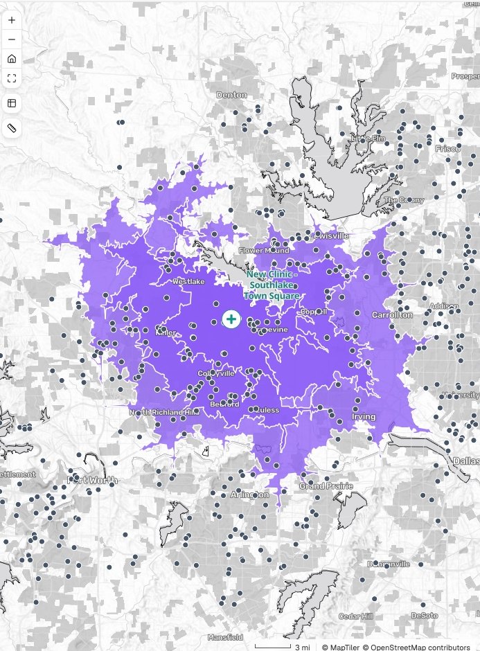
Drive time
Households inside each band
- 10 minutes · 44,600
- 15 minutes · 184,900
- 20 minutes · 423,700
The request
We are looking at a site in the town square for our next clinic. How many households are within a 10, 15 and 20-minute drive?
What came back
- Three drive-time bands, by road
- Households counted in each
- The method and sources stated
Get a map made for its readers
Pretzel Hatch, a bakery chain with three store formats
The request
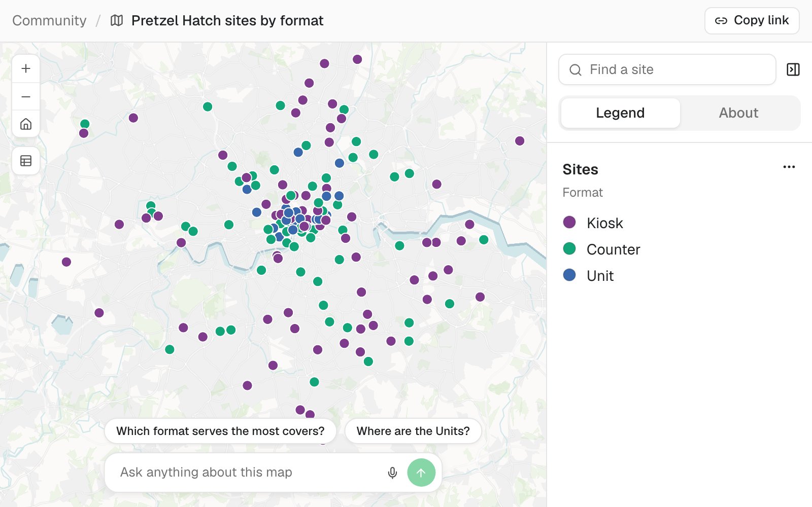
Map our sites for the franchise partners, coloured by format, with a search box so each partner can find their own.
What came back
- Every site placed and coloured by format
- Search, a legend and suggested questions
- A link the partners open in a browser
Get it written up
Arrow, a bus operator reviewing its network
The request
Write a report for the network committee on how many residents live within a 400-metre walk of an active stop. Lead with the areas that fall short.
What came back
- The headline finding and key points
- Tables and maps in each section
- Method, sources and the date of the data
Get a tool built for someone else
Fibra, a rural broadband provider
The request
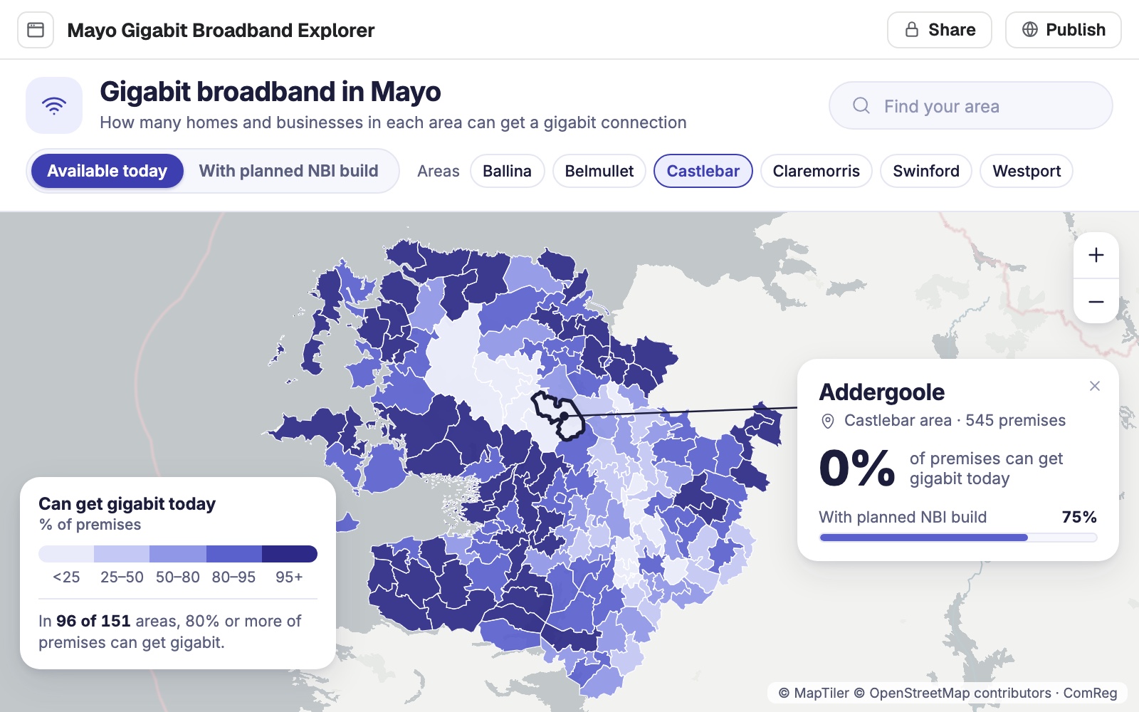
Build an explorer for the support team: search an area and see what share of premises can get gigabit today and after the planned build.
What came back
- An app with its own search and layout
- Tested at phone and tablet sizes
- Private until it is published
Works alongside the GIS you have
Mapstack takes the work you would rather hand off. Your desktop GIS stays where it is.
- What you bringAttach it, or name something already in your library.
- ShapefileGeoPackageFile GeodatabaseGeoJSONSpreadsheet or CSVImagery, elevation and lidar
- What Mapstack finds for youAsk, and it goes and gets it. That is time you do not spend searching.
- Public datasets from around the worldData it finds on the web
- What you take awayA link for people. A file for everything else.
- A live map or appWord and PDFPNGGeoPackage, GeoJSON or CSV
Mapstack does the work. You stay in charge.
You would review a colleague’s work before you put your name to it. It works the same way here.

- It asks before it makes. Nothing is made or changed without your say-so.
- It does what you approved. Nothing more.
- Every figure comes from the data. Each one is traced to its source and date.
- You can stop it. The work is visible while it happens, and one press halts it.
- You can go back. Earlier versions of your data are kept, so a change is never a one-way door.
An example of how it goes
Asked at 9:15. Reviewed by 9:30.
Dev is the only GIS analyst at a vet-clinic group. The property team has a site visit at ten and wants to know who lives within reach of it.
- candidate-site
How many households are within a 10, 15 and 20-minute drive of the town square site?
Thursday 9:15
He asks
One question, typed as he would say it. Then he goes back to the lease review he was doing.
- Drive time to the new clinic
Thursday 9:22
The answer is back
Three bands by road, households counted in each, with the method written out.
- Drive time to the new clinic
Count the other vet clinics inside each band as well.
Thursday 9:24
He asks the next question
Competitors are counted into the same bands. Nothing is set up again.
- Drive time to the new clinicSent to the property team
One link
Opened on a phone at the site
Thursday 9:30
He checks it and sends it
He reads the method, agrees with it, and shares the link before the visit.
Dev did two jobs in one morning.
On his own he would have had to pick between the lease review and the site question. He reviewed one while Mapstack worked on the other, and put his name to both.
Some of the jobs people hand off
- Turn an address list into a shared mapFrom a spreadsheet of addresses to a link your team can open.
- Compare a shortlist of sites before you signYour candidate sites, set side by side on who lives around them.
- Clean up a messy file, with a logFiltered, placed and tidied, with every change counted.
- Write the decision report for a committeeEvery area ranked, the first few recommended, with a map, the full table and a method note.
- Build one screen that shows what is happening whereOpen work on a map, with charts and filters.
- Publish a map that keeps itself currentA public link, refreshed on a schedule.
What it costs
Mapstack is priced per person. Each seat comes with a monthly allowance of work, and you can start on the free plan.
Free
$0for one person
Maps, datasets and analysis from your own files, with a public link when you choose to publish.
Creator
$16a person a month, billed yearly
Adds reports, prints, apps, imagery and 3D, routines, and private sharing with your team.
Creator Max
$80a person a month, billed yearly
The same, with a far larger monthly allowance for people who work in Mapstack all day.
Colleagues who only need the results take a Viewer seat at $10 a month. They open everything in the workspace and ask it their own questions in plain words. See every plan.
Common questions
What is an AI teammate?
Software you hand work to, the way you would hand it to a colleague. You say what you need; Mapstack finds the data, does the GIS work, and gives it back with its working for you to review.
How is this different from a chatbot?
A chatbot tells you how to do the work, or writes a script you then have to run. Mapstack does the work itself, on real data, and hands you the finished map, dataset, report or app.
Do I need to know GIS to use it?
No, though it helps you judge the result. Ask in plain words and Mapstack chooses the method. If you know the method you want, name it and that is the one it uses.
How do I know the work is right?
Every result comes back with what was done, on which data and with which choices, for your review. Mapstack never makes up a figure, and it says what it did not check.
Do I have to leave the GIS I use now?
No. Mapstack reads the formats your desktop GIS writes and hands data back in formats it opens. Most people use it for the work they would rather not do by hand.
What does the monthly allowance mean?
Each seat has a monthly allowance of usage, shown as a percentage, and every piece of work uses some of it. Before a large job Mapstack tells you roughly how much it will use.
Is the data I upload private?
Yes, on every plan, Free included. Your files and everything made from them are private to your workspace by default. Nothing is public unless you choose to publish it, and you can make it private again.
What happens to my data?
It stays in your workspace and it stays yours. Only the people you give a seat to can see it. It is stored in the United States, it is not used to train AI, and when you delete it, it is removed.
Hand off your first piece of work.
Free to start. No card.