
Mapstack for transport and logistics
The AI teammate for transport and logistics GIS work.
Ask in plain words. Mapstack makes the map, the analysis or the report.
Free to start. No card.
Where transport and logistics stand today
Moving people and goods is a string of decisions about places. Getting the evidence for each one is the slow part.
Every change comes in versions
A route, a stop, a depot or a road project is tested as options against how things run now. Each option is the same analysis again.
The records sit in other systems
Schedules, counts, crash records and shipments live where operations keeps them. Getting them out, cleaned and located is most of the work.
Someone else decides
A board, a council, a funder, senior managers or a customer. They want to see how the answer was reached before they accept it.
Evidence for every route and every stop.
What changes with Mapstack
Today one option gets tested because there was only time for one, and the map is redone by hand for the next. With Mapstack, you ask, and ask again for the next version.
See what a change would touch, before you make it
Find everyone and everything along a route, around a stop or within reach of a depot: residents, customers, roads, rivers and other networks.
- Or ask
Which customers are within a 45-minute drive of each candidate depot?
What does the proposed route cross, in order?
A proposed route near Wigan, England, and the 17 things it crosses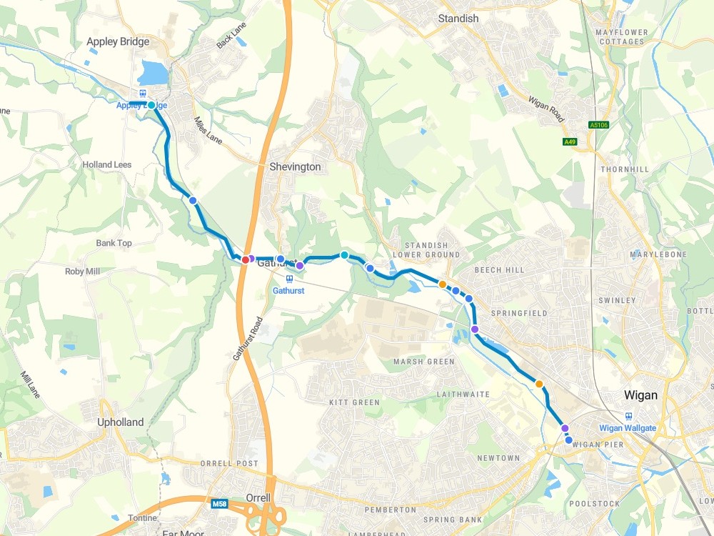
- Or ask
See where it goes wrong, and when
Put dated records on the map, count them by place, hour or year, and find out which clusters are more than chance.
- Or ask
Where do late deliveries cluster, by ZIP code?
What share of buses ran on time in each area last year?
Bus punctuality by local authority, southern England, 2025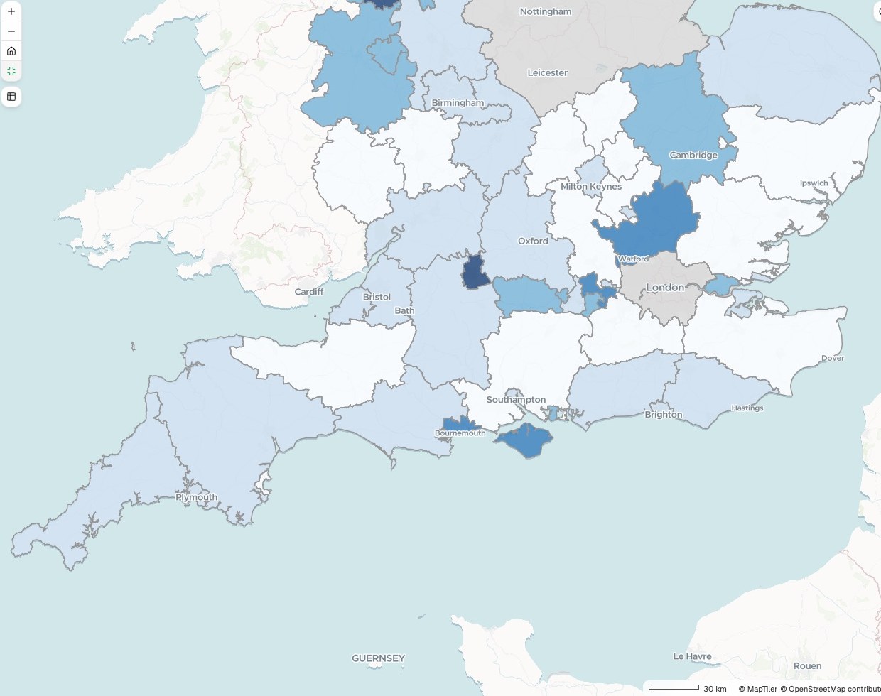
- Or ask
Know where to act first
Compare segments, blocks, areas or sites on your own measure, cost them at your own rates and rank them.
- Or ask
Which of our three candidate depots reaches the most customers?
Which block faces are fullest at midday, and which sit half empty?
Midday parking occupancy by block face, Ballard, Seattle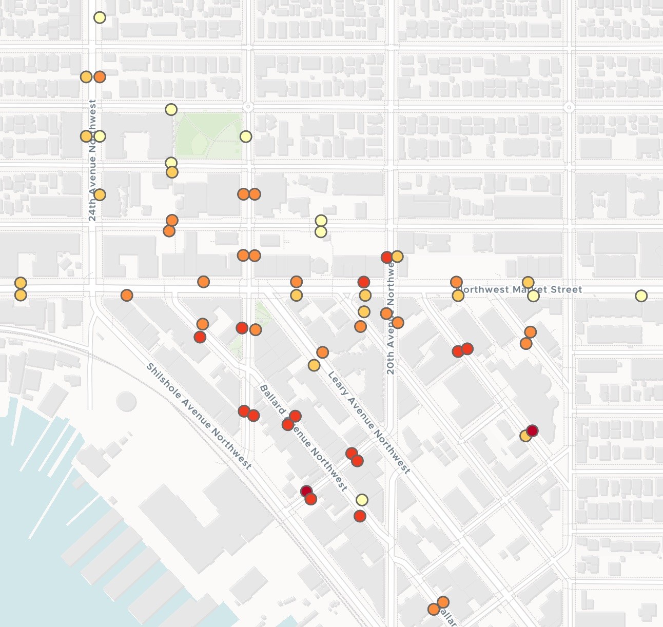
- Or ask
Make the case, with the working shown
A print sheet to scale, a written report or a map others can open. Each carries its sources, its dates and its method.
- Or ask
Write it up for the customer, with the method.
Make a one-page sheet of this for the rate review meeting.
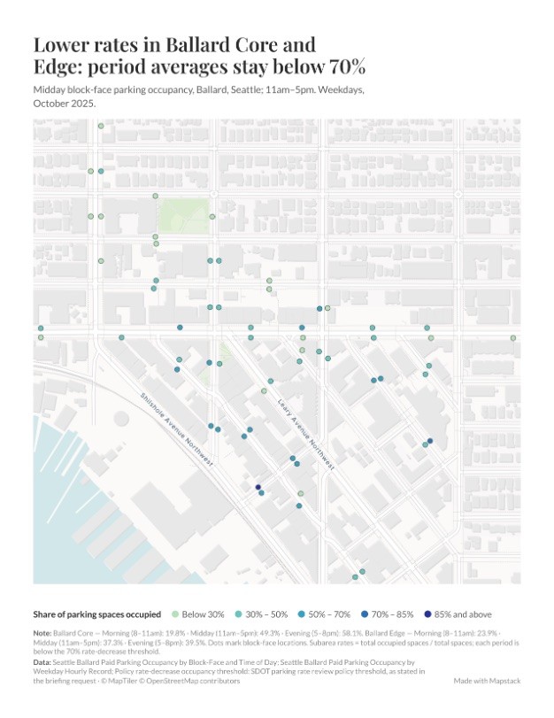
- Or ask
Three examples
Three of many, from different corners of transport and logistics. Each shows the request, what came back and who decides.
Commuting flows for a member county
A regional planning agency
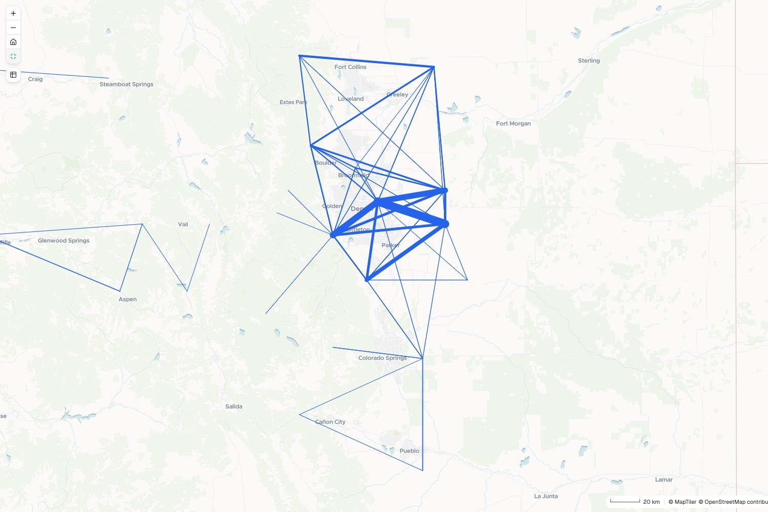
Commuting flows
Workers, home county to work county
- Thicker line, more workers
The request
A member county wants its commuting flows. From the attached table, map each flow between counties, thicker for more workers, and rank the fifteen biggest.
What came back
- A flow map, with a line for every flow
- The biggest flows ranked, and each county’s net commuting
- The table to download and send on
Goes toThe member county, and the long-range plan.
Mapstack maps and ranks the flows, while the agency’s board adopts the plan.
Next year’s road repairs from the pavement survey
A county road agency
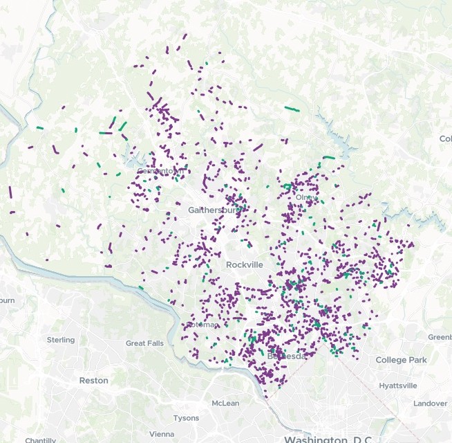
Funded segments
Repair treatment
- Slurry seal
- Full-depth reconstruction
The request
Attached is our pavement condition survey. Build next year’s program on $40 million: $28 million for reconstruction, worst first, and $12 million for preservation where it buys most.
What came back
- Every funded segment mapped by treatment
- Totals by treatment, beside a worst-first version
- The backlog the budget leaves behind
Goes toThe council, with the capital budget.
Mapstack costs and ranks the segments, while the county engineer sets the program and the council adopts the budget.
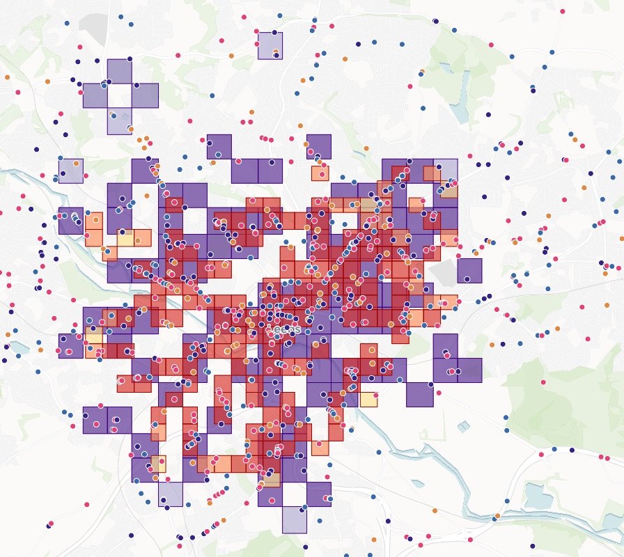
Where demand sits, before testing a second depot
A parcel carrier’s network design team
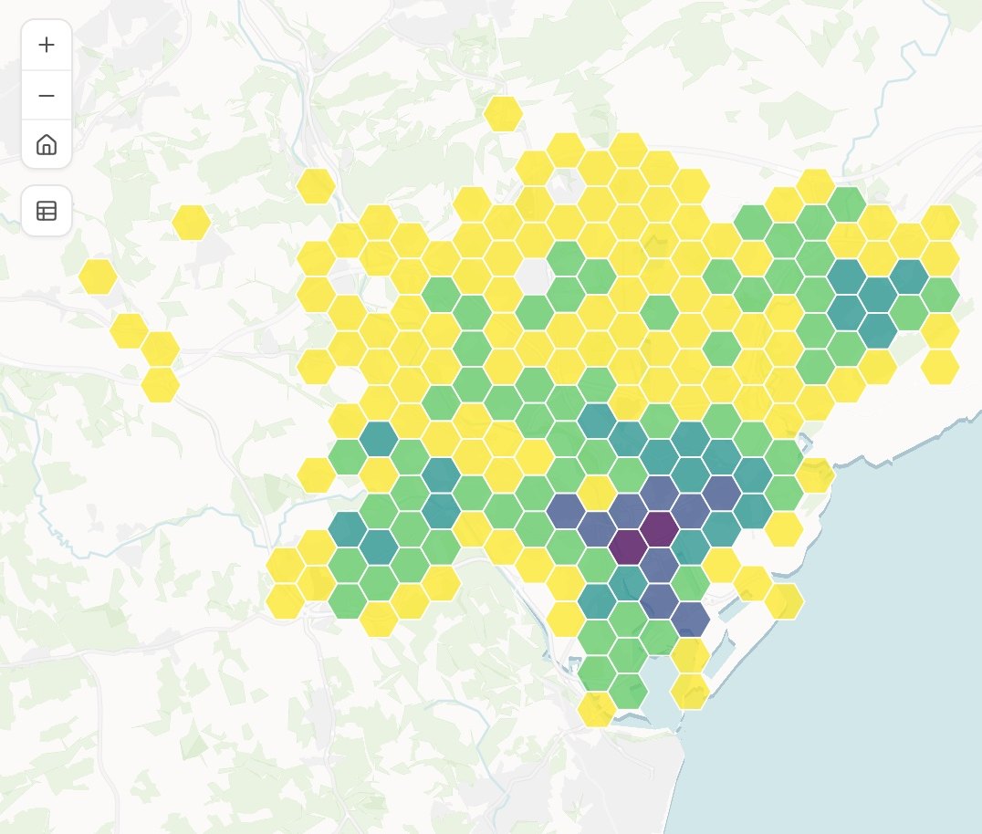
Orders per hexagon
Count, in five classes
- Most orders
- Fewest orders
The request
Attached are last month’s orders. Count them into 700-meter hexagons, so we can see where demand sits before we test a second depot.
What came back
- Orders per hexagon, on a map
- The busiest and quietest cells named
- The grid as a table, for the scenario model
Goes toSenior managers, in the business case.
Mapstack prepares the baseline, while the network design team runs the scenarios and makes the case.
An example of how it goes
Four teams asked on Monday. None of them waited.
Dana is the network analyst at a regional delivery company, and the only person there who makes maps. On Monday morning sales, operations, property and customer service each have a request in.
- accounts.csv
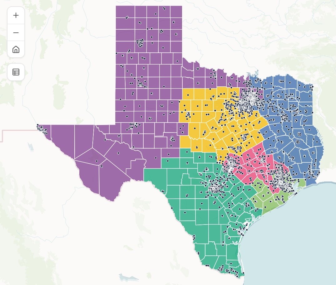
Split the attached accounts into six territories of whole counties, balanced by number of accounts.
Monday 8:40
Sales asks first
One sentence and the account list. Dana hands it to Mapstack and opens the next request.
- Accounts in six territories
Monday 8:55
The territories are back
Six of them, made of whole counties, with the accounts counted in each.
- Orders per hexagon, last month
Count last month’s orders into hexagons, so we can see where demand sits.
Monday 9:10
Operations is next
A different question on different data, asked the same way. Property and customer service follow.
- Orders per hexagon, last monthBack with the teams
Four requests, four teams
Each checked by Dana and decided by the team that asked
Monday 11:30
The teams take over
Each one checks what came back and makes the call that is theirs to make.
Dana cleared Monday’s queue on Monday.
She checked each result and passed it on. The teams got their answers while the questions were still live, and she spent the afternoon on the network study only she can run.
Works with the data you already hold
Your scheduling, dispatch, asset and crash systems stay where they are. Mapstack works from their exports.
- What you bringExports from the systems you run today.
- Routes and stopsRidership and on-time figuresCrash recordsRoad segments and condition surveysOrders, deliveries and accounts
- What Mapstack finds for youPublished data, fetched when you ask and named on the result.
- Census population and incomeBoundaries and districtsRoads, railways and waterwaysDrive and walk times
- What you hand onIn the form the reader expects.
- Maps and tables for the boardFigures for the planA one-page briefing sheetData for a member city or a customer
Made to be checked
A board, a funder or a customer will ask how the answer was reached. So nothing here is taken on trust.

- Not an operations system. Mapstack does not dispatch, track vehicles live, give arrival times or plan each day’s routes. It does not build schedules, run a travel demand model or a network optimization solver, or collect data in the field.
- It sits beside the systems you have. Your route network, crash database and asset inventory stay the record. Mapstack reads their exports and hands data back.
- The finding is yours. Which locations get treated, which option goes forward and what the business case says are decided by a named person.
- Sources and dates on every map. Which crash file, which census, which survey, and when each was current.
- The method is written out. How a distance was measured, a count was made or a cost worked out comes back with the result, the same way for every option.
- Bring your own data. Mapstack does not supply telematics, freight or mobility data. It works from what you hold and from published sources.
The parts of Mapstack transport and logistics teams use most
One teammate, whichever team is asking.
Analysis
What is within reach, where it clusters, where to act first.
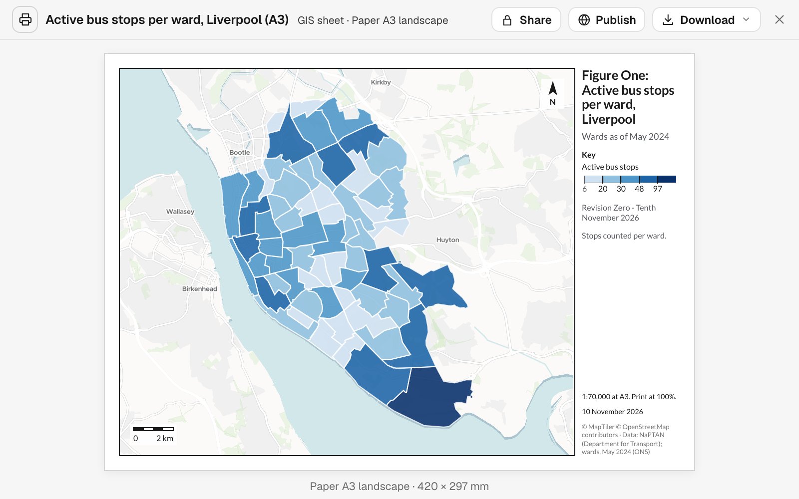
Reports and print maps
Briefing sheets and report figures, to scale.
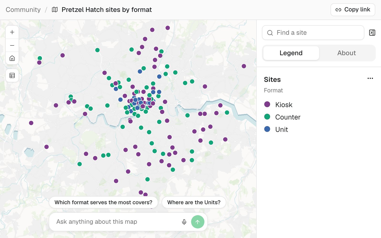
Maps
A map the board or a customer can open.
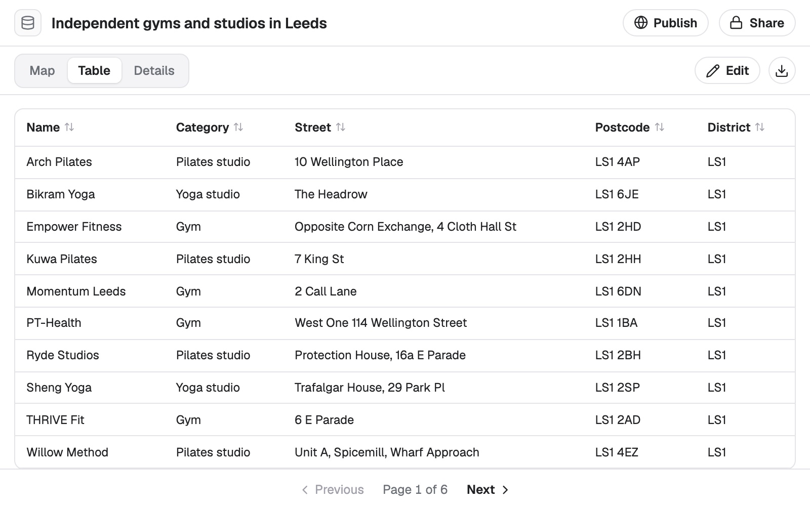
Data
Crash, stop and delivery records cleaned and located.
Looking for a particular job? These go step by step.
- Map where people commute, county to countyA line for every flow, the biggest ranked, and each county’s net commuting.
- See when and where incidents happenThe worst hours, days and months, and hot spots by time of day.
- Rank schools by the crashes around themCollisions near each school, the hot spots, and a crossing check for each.
- Map on-time running by area, year by yearThe share on time shaded by area, with the biggest falls and rises ranked.
- Find what share of residents can walk to a stopWalking access to a service, area by area.
- Find who lives too far from a serviceThe areas beyond the walk, and who there has no car.
- List everything a proposed route crossesEvery road, railway, river and pipeline, in order, with where and how far along.
- Price a route scheme at your own ratesLength, crossings, junctions and bus stops counted and costed, with a map.
- Turn a condition survey into a repair programmeEvery segment costed at your rates, ranked and funded to your budget.
- See how full every parking block isOccupancy by block face and rate period, with an up, down or stay call.
- Play back a day of vessel traffic on a mapEach vessel’s track, a time slider in local time, and what each one did.
- Find the accounts no rep reaches, and test a moveDrive-time patches, the gaps and overlaps, and what one change would do.
What it costs
Mapstack is priced per person and free to start, with no minimum and no sales call.
Free
$0for one person
Ask about your own files. What comes back stays private to you until you choose to share it.
Creator
$16a person a month, billed yearly
Adds sharing with your team, reports and print sheets, and work that reruns without you.
Creator Max
$80a person a month, billed yearly
The same, with a larger monthly allowance for people who ask all day.
Colleagues who only need the answers take a Viewer seat at $10 a month. They open every result and ask it their own questions. See every plan.
Questions transport and logistics teams ask
What GIS work can Mapstack do for a transport or logistics team?
Most of what a planning or network team is asked for: maps, spatial analysis, counts of who and what is within reach, hot spots, cleaned and located records, print sheets and written reports. You ask in plain words or in GIS terms, and you check the result.
Is it only for GIS staff?
No. It is for the planners and analysts who do the location work, and for the operations, engineering and commercial teams who wait on them.
Does it replace our scheduling, dispatch or GIS systems?
No. Mapstack reads the standard formats those systems export and hands data back in formats they open. Your records stay where they are.
Does Mapstack do routing, dispatch or live tracking?
No. It can share a set of stops between vehicles as a one-off study, and it can play back a past day of position records. It is not a dispatch or tracking system. Maps that need to stay current are refreshed on a schedule.
Can it work with our route and segment data?
Yes, as lines. Mapstack measures distance along a route, lists what a route crosses in order, splits a line into stretches and totals figures by segment. Your road network stays in the system that maintains it.
Can it count the people living near our stops?
Yes. Attach the stops and say the distance. Mapstack counts the residents within it from the census, by walking distance if you ask, and says how it shared the population out. What you conclude from the count is yours.
Can it show where crashes concentrate?
It maps your crash records by severity and time of day, and tests which concentrations are statistically significant. Your engineers decide which locations to treat and how.
Can it support a logistics network study?
It prepares the inputs and the maps: orders cleaned and located, demand counted into a grid, drive times from candidate depots, baseline and scenario maps. The optimization model and the business case remain yours.
Can I send a member city or a customer the data as well?
Yes. Every result is a dataset that downloads in standard GIS and spreadsheet formats.
Is the data I upload private?
Yes, on every plan, Free included. Your files and everything made from them are private to your workspace by default. Nothing is public unless you choose to publish it, and you can make it private again.
What happens to my data?
It stays in your workspace and it stays yours. Only the people you give a seat to can see it. It is stored in the United States, it is not used to train AI, and when you delete it, it is removed.
Ask the question you are waiting on.
Free to start. No card.