
A plan residents can follow
Put your plan online for residents to follow.
Attach the plan's layers. You get one map, each designation in its own colour, to publish at a link, and an A3 sheet for the consultation display.
Free to start. Display sheets and written pages on a paid seat.
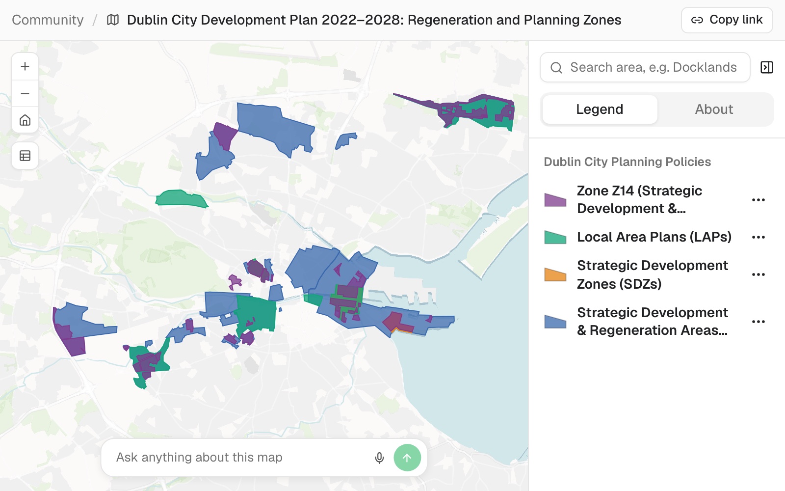
| Four layers, one map | Areas |
|---|---|
| Regeneration areas | 17 |
| Local area plans | 7 |
| Development zones | 3 |
| Zone Z14, in several parts | 1 zone |
Two shapes had geometry faults. Mapstack repaired both on the way in and said so.
For planners and communications staff
The plan is a set of GIS layers and a long policy document.
Residents want to know one thing: what applies to my area?
Turning the layers into something a resident can follow usually means a designer, a web team and weeks.
Here the layers become one map anyone can open on a phone, a sheet for the display, and a page that explains the designations.
The sheet for the consultation display
The same map, laid out for the wall.
Where your layers carry quirks, it keeps them as given and says so: two areas in the local area plans layer were named as development zones, and the sheet notes it.
Now a printable A3 sheet of the same map for the public consultation display, with a key, scale, north arrow and the plan's name and date.
Mapstack made an A3 landscape sheet with the plan's name as the title and 'Public consultation, November 2026' under it. Because the designations overlap, it drew them as different outlines, solid, dashed and dotted, over a pale fill for the zoning, so each stays readable.
How it goes
You bring the plan's layers. Mapstack makes the map, the sheet and the page.
Attach the layers and say who the map is for.
Publish it and copy the link.
Add the sheet and the page.
The step-by-step guide is in the documentation: Put a plan online in a form residents can follow.
Common questions
What does it cost?
Free to start. One seat, for you, with a starter amount of work each month. No card.
The map and its public link are on the free seat. With your own files and public sharing.
The display sheet and the written page are on a paid seat. Paid seats are per person, and bring more work each month.
The prices are on the pricing page.
What do residents see?
One link, no sign-in. On a phone or a computer.
Each designation named. Select an area to see its name and code. Turn layers on and off.
A search. Type an area's name, such as "Docklands", and the map goes there.
Who writes the explanations?
Mapstack drafts them. One section per designation, each with its own map.
You check them. Against the plan's own wording, or attach the policy text with the layers.
Publish yours.
Free to start. Display sheets and written pages on a paid seat.