
An asset register on a map
Keep your asset register on a map.
Trees, streetlights, signs, hydrants. Give Mapstack your survey. You get a register on a map, a count of what the survey is missing, and the list a contractor needs.
Free to start. No card.
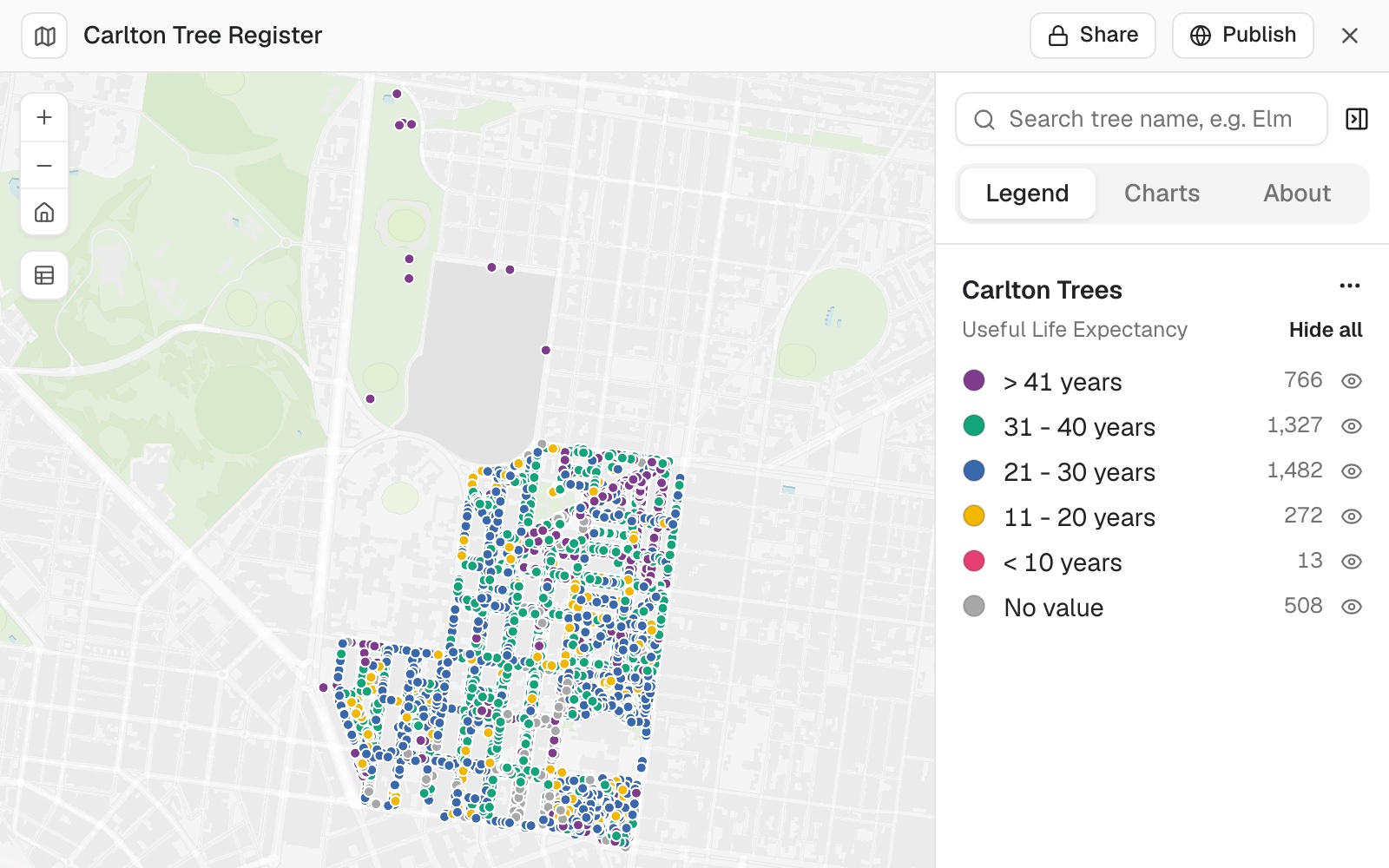
| Useful life expectancy | Trees |
|---|---|
| More than 41 years | 766 |
| 31 to 40 years | 1,327 |
| 21 to 30 years | 1,482 |
| 11 to 20 years | 272 |
| Less than 10 years | 13 |
508 trees have no life expectancy recorded. They show grey.
For whoever looks after things spread over a place
The survey is a spreadsheet.The questions are about places.Which trees are in the square we are renewing?
Which ones does the contractor need to see?
An asset register is the record of every asset you look after: what it is, where it is, and its condition.
Here the survey becomes the register, on a map, with coordinates or addresses, and the questions get answered against it.
One real survey
4,368 trees, and what the survey does not say
The City of Melbourne's open survey of street and park trees, cut to the suburb of Carlton. Mapstack counted the gaps field by field.
- The register
- 4,368trees, 3,180 in streets and 1,188 in parks
- Marked for works
- 92trees inside the square, set in a new column
- A stand-in date
- 1,732trees 'planted' on 1 January 1900, which means unknown
| Missing from the survey | Trees |
|---|---|
| Planted "1 January 1900" | 1,732 |
| No trunk diameter | 1,185 |
| No life expectancy | 508 |
| No common name | 1 |
A date of 1900 is a gap, not an old tree.
Mapstack read it that way. It then listed what tree registers often hold that this one does not, such as height, canopy spread and health, and said that list came from general knowledge.
City of Melbourne open data, Trees, with species and dimensions (Urban Forest), cut to Carlton. Run on 11 November 2026.
Pull out what a contractor needs
The register answers questions that mix place and condition.
The 81 trees came back as their own dataset and a map of the corridor, ready to download.
The contractor needs every street tree within 15 metres of Lygon Street with less than 10 years' life left. Give me that as a list I can send them, with a map of what you selected.
Mapstack found 81 street trees within 15 metres of the street. None had less than 10 years left: the whole survey has only 13. It said so, rather than sending an empty list, and offered the two with 11 to 20 years instead.
How it goes
You bring the survey. Mapstack keeps the register and answers what you ask of it.
Attach your survey and say how to colour it.
Mapstack makes the register, one record per asset.
You mark, select and send.
The step-by-step guide is in the documentation: Keep a register of your assets on a map, tag them by area and pull out what someone needs.
Common questions
What happens to my survey?
It stays in your workspace. Only people with a seat in your workspace can see it. Nothing leaves unless you publish it yourself.
It is not used to train AI. Your data and your conversations are not used to train AI models.
It is still yours. You keep ownership of what you bring in. Delete it and it is removed.
The full answer is in the documentation: Your data, privacy and security.
What does it cost?
Free to start. One seat, for you, with a starter amount of work each month. No card.
This job is on the free seat. Maps, datasets, analysis, your own files and public sharing are all included.
Pay per person for more. A paid seat brings more work each month, and seats for your team.
The prices are on the pricing page.
How does it decide what is inside an area?
Ask, and it tells you. Which boundary it used, and what it left out at the edge.
Name your rule, or attach the boundary. "Inside the park outline, park and street trees", and the count follows it.
Every change is kept. A new column is saved as a new version of the dataset.
Map yours.
Free to start. No card.