
Mapstack for energy and utilities
The AI teammate for utility and energy GIS work.
Ask in plain words. Mapstack makes the map, the list or the print sheet.
Free to start. No card.
Where energy and utility teams stand today
Most decisions about a network or a project have a “where” in them. Getting the answer is the slow part.
Everyone asks, and few can make it
Requests come from engineering, operations, land, permitting and management. They land on a few people, or on one.
It goes to someone outside, who can challenge it
A regulator, a grid operator, a county board or a landowner. The method has to stand up, and every figure needs its source.
The ground moves, so the work comes round again
Inventories and filings are updated every year. Setbacks change under live projects, and parcels sign one by one.
Evidence for every line, pipe and site.
What changes with Mapstack
Today a question waits behind the network record, or for a consultant’s next version. With Mapstack, people ask and have the answer when they need it.
Anyone on the team can ask
Ask in plain words or in GIS terms. A map, a list, an analysis or a report comes back, ready to check.
- Or ask
Which of the attached parcels are over 40 acres and within a mile of the substation?
Which mains are ours, and which are the region’s?
Water mains by owner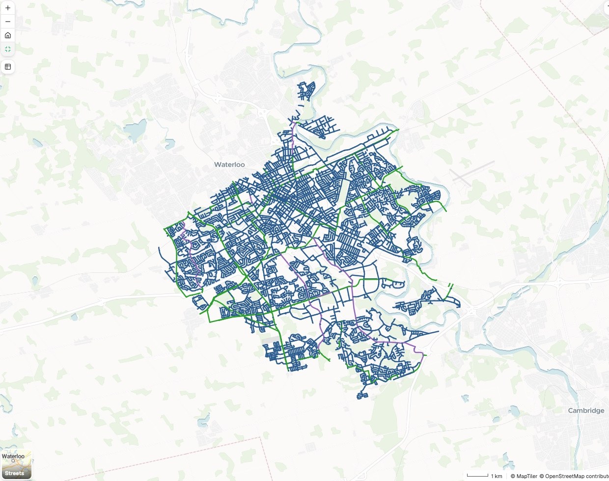
- Or ask
Know what is on and around every line and site
Find everything inside, crossing or within a distance of a line, a right-of-way or a site boundary.
- Or ask
What covers this site, and how far away is everything else?
How many people live within 660 feet of each mile of the line?
People near the pipeline, mile by mile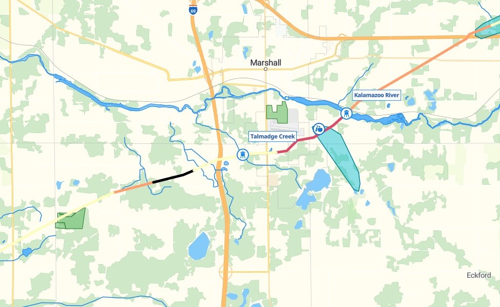
- Or ask
See where things stand, and what to do first
Count, compare and rank by parcel, mile, facility or area, on the rules you give.
- Or ask
Which parcels on the right-of-way are still open, and how many acres is that?
Which satellite methane plumes have no reporting facility nearby?
Reporting facilities and satellite methane plumes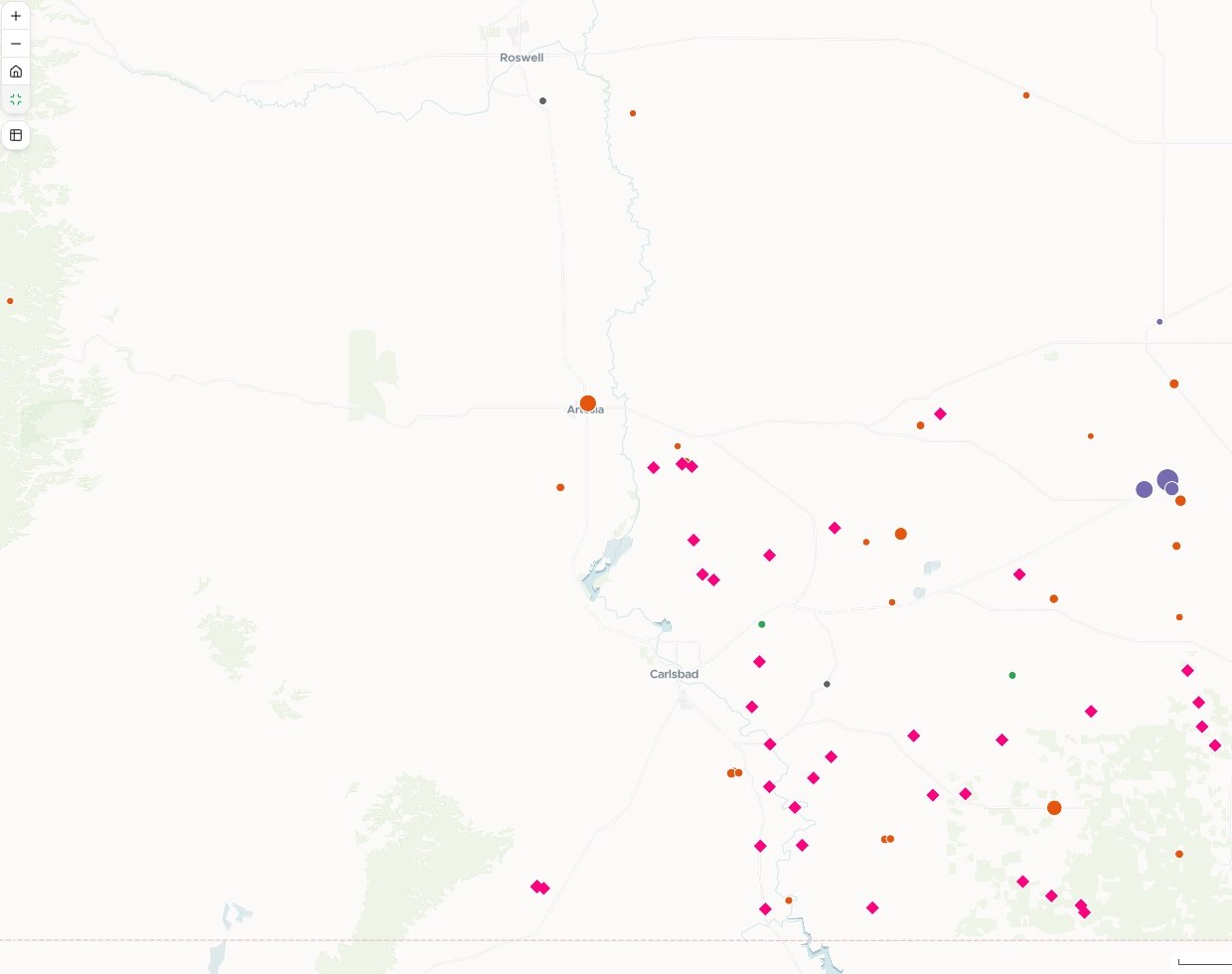
- Or ask
Hand it on, with the working shown
A print sheet to scale, a map people can search, a written report or data for your GIS. Each carries its sources, its dates and its method.
- Or ask
Make an exhibit of the site boundary and the setbacks for the county hearing.
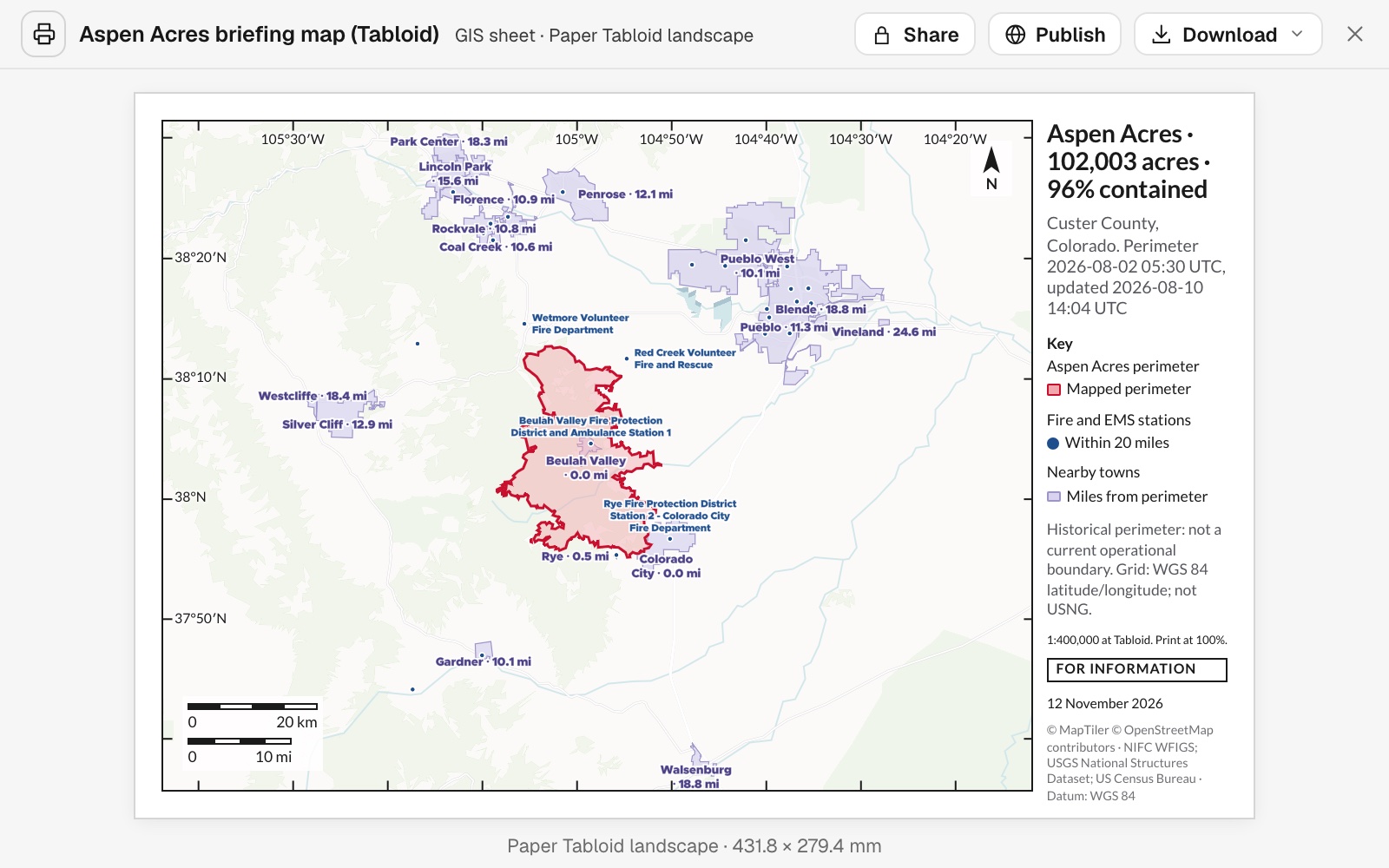
Put the fire perimeter and the towns around it on an 11x17 sheet.
- Or ask
Three examples
Three of many, from different corners of the industry. Each shows the request, what came back and who decides.
Every service line, mapped and counted
A city water utility, updating its inventory
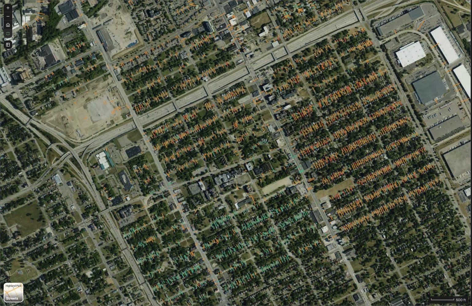
Service lines
Lead status in the inventory
- Presumed lead · 2,535
- Known lead · 292
- Non-lead or already replaced · 686
The request
This is our service line inventory. Map every line as known lead, presumed lead or non-lead, searchable by address, and count each group for the state report.
What came back
- Every line drawn at its address and colored by status
- The count for each group, with how it was counted
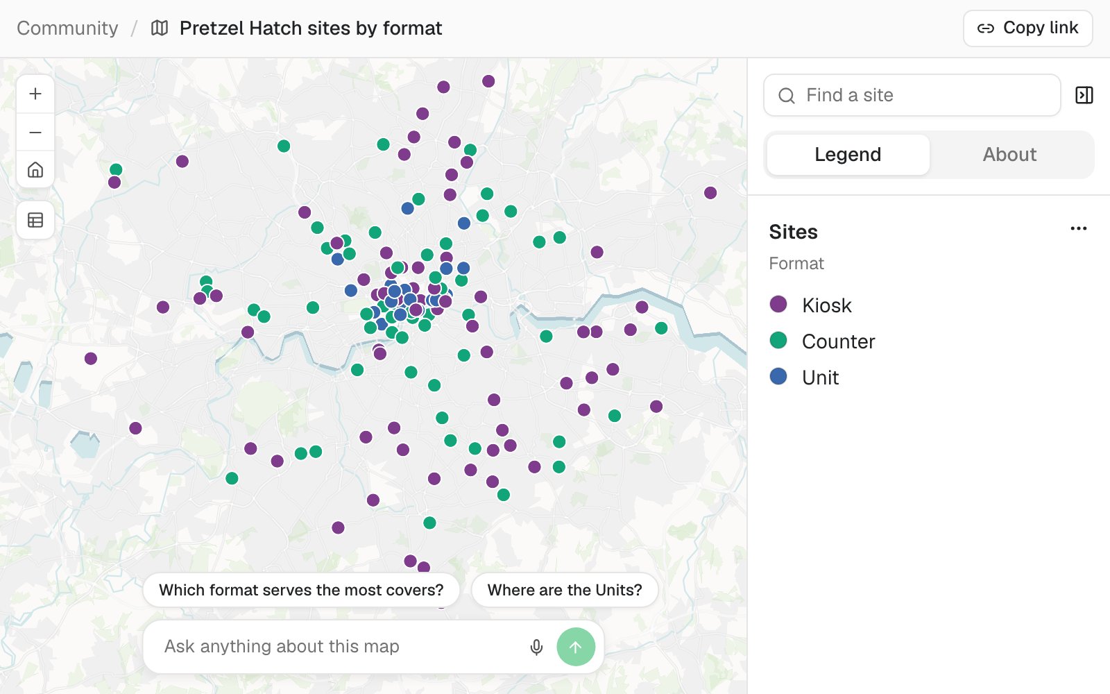
- A map residents can search by address
Goes toThe state drinking water agency, and the public.
Mapstack maps and counts the inventory, while the utility confirms the materials and sets the replacement priorities.
A candidate site, checked against its constraints
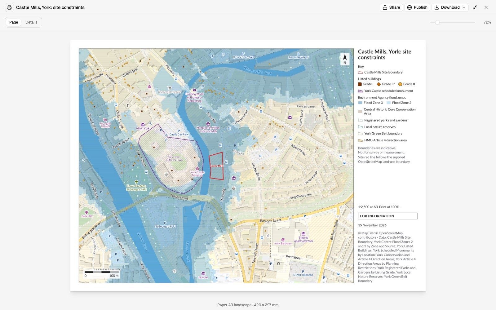
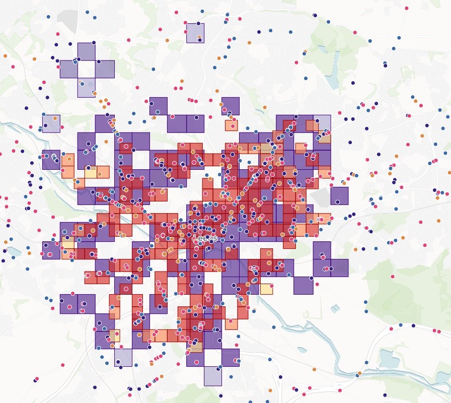
An analyst at an energy developer, checking a candidate site in York, England
The request
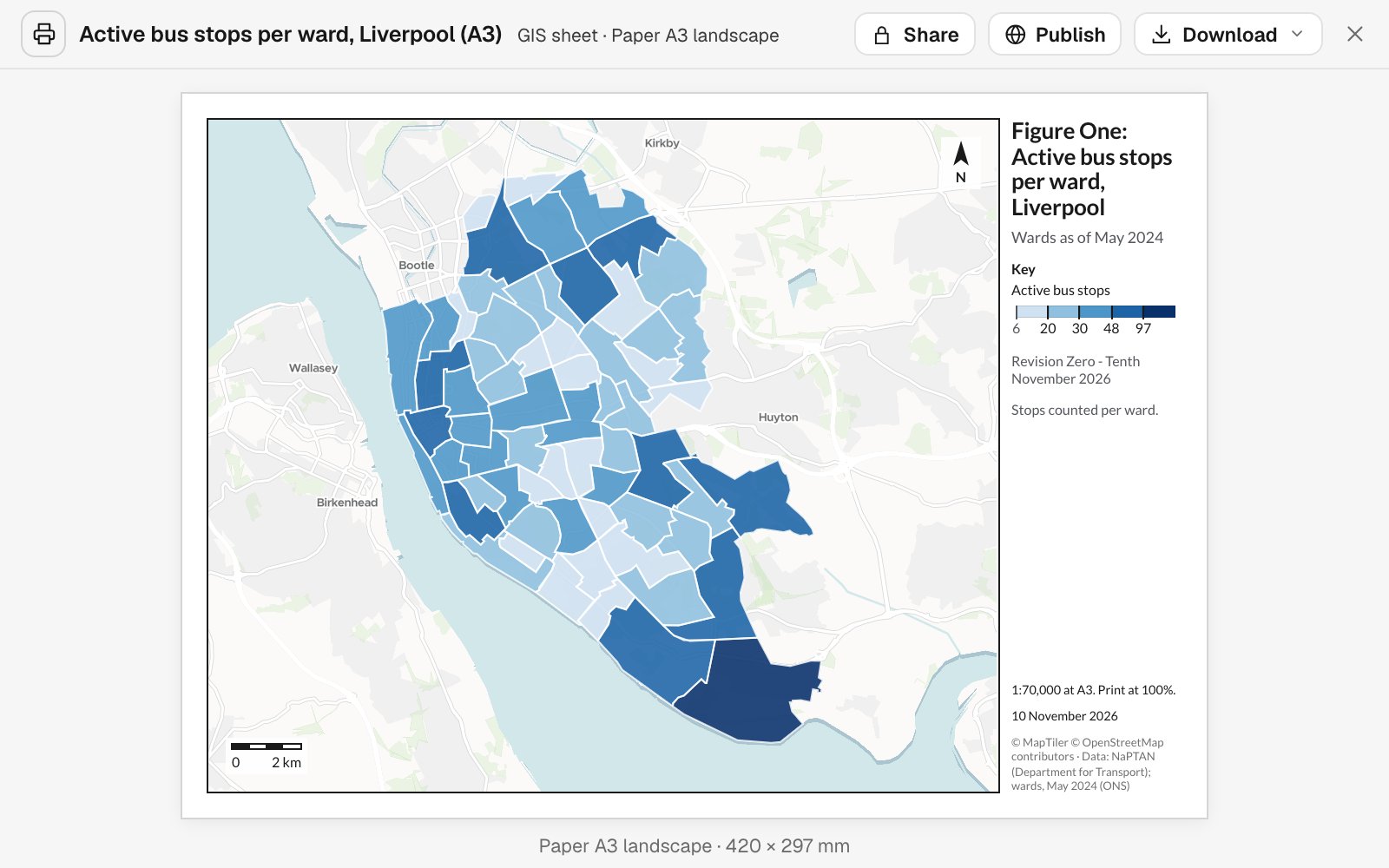
Attached are the site boundary and the constraint layers. Tell me what covers the site and how far the rest are, and make an A3 constraints plan.
What came back
- The boundary drawn over every constraint named
- What covers the site, and the distance to the nearest of the rest
- An A3 sheet with a key, a scale, a date and its sources
Goes toThe development manager and the land team.
Mapstack draws and measures the constraints, while the development manager decides whether the site goes forward.
Where every parcel on the right-of-way stands
A land team acquiring a right-of-way, parcel by parcel
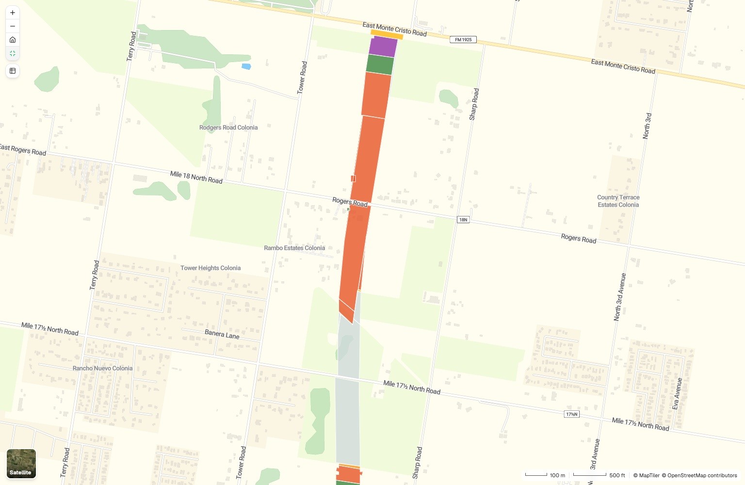
Parcels
Stage of each acquisition
- Created, not started
- Appraisal approved
- Final offer
- Acquired by deed
- Condemnation
The request
Attached is our parcel list with each parcel’s stage and acres. Color every parcel by stage, total the acres signed and open, and rank the open offers.
What came back
- One shared map, every parcel in the color of its stage
- Parcels and acres at each stage, signed against open
- The open offers ranked by acres, largest first
Goes toThe land agents and the project manager.
Mapstack keeps the picture current, while your land agents negotiate and decide what goes to condemnation.
An example of how it goes
Four departments asked on Monday. None of them waited.
Dana is the engineering GIS technician at an electric cooperative. On Monday morning engineering, land rights, operations and the general manager each have a request in, on top of the as-builts.
- rebuild-easements.geojson
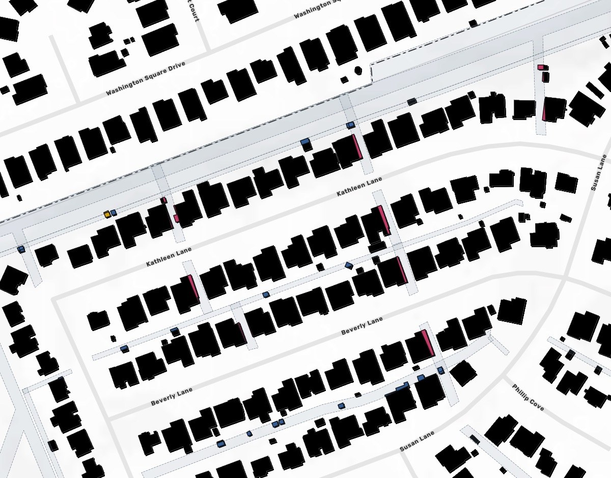
Find every building that crosses one of our easements along the rebuild, with the square feet inside.
Monday 8:40
Engineering asks first
One sentence and two files. Dana hands it to Mapstack and opens the next request.
- Buildings inside recorded easements
Monday 8:55
The easement check is back
Every building that crosses, listed by easement type, with the data and its date named.
Put the fire perimeter and the towns around it on an 11x17 sheet.
Monday 9:10
Operations is next
A different question on different data, asked the same way. Land rights and the manager follow.
- Back with the people who asked
Four requests, four departments
Each checked by the person who owns the decision
Monday 11:30
The owners take over
Each one checks what came back and makes the call that is theirs to make.
Dana cleared Monday’s queue on Monday.
She checked each result and passed it on. The departments got their answers while the questions were still live, and she spent the afternoon on the as-builts only she can post.
Works beside your system of record
Your network model and asset system stay the record. Mapstack works from what you export and hands results back.
- What you bringExports from the systems you run today, and the data you own or buy.
- Network and asset exportsInventories by addressEasements and rights-of-waySite boundaries and parcelsOutage and inspection records
- What Mapstack finds for youPublished data, fetched when you ask and named on the result.
- Census and populationFlood and fire hazard zonesProtected land and waterBoundaries and jurisdictions
- What you hand onIn the form the reader expects.
- Maps and tables for a filingExhibits and print sheetsA public map by addressData for your GIS
Checked by the people who sign
What you file or show a landowner can be challenged. So nothing here is taken on trust.

- Mapstack does not keep your network record. It does not post as-builts, manage outages, run engineering studies, collect data in the field or supply parcel and grid data. It works on what you bring.
- An engineer or a developer signs, not Mapstack. It does not determine a high consequence area, certify a filing or choose a site. It prepares what your people check.
- Sources and dates on every result. Which flood map, which census, which perimeter, and when each was current.
- Your rules, used as you give them. The buffer, the setback and the ranking are yours, and the method comes back written out.
- Nothing is public until you publish it. Work stays inside your workspace until one of your people chooses to open it up.
The parts of Mapstack these teams use most
One teammate, whichever department is asking.
Analysis
What is inside, what is near, and what comes first.
Reports and print maps
Filing figures, exhibits and print sheets, to scale.
Maps
A public map people can search by address.
Automation
The annual update, rerun on new data.
Looking for a particular job? These go step by step.
- Map your lead service lines and count them for the stateEvery line by lead status, searchable by address.
- Turn a water main layer into a network registerEvery stretch mapped by owner, summed up, and the gaps listed as a file.
- Find what a pipeline leak could reach, mile by milePeople, water and protected land along each stretch of the line.
- Find every building that sits in an easementSquare feet inside and share of each building, drainage first.
- Map the constraints on and around a siteWhat covers the red line, how far the rest are, and an A3 plan.
- Track every parcel of a land acquisition on one mapEach parcel by deal stage, the acres signed and open, the offers ranked.
- List everything a proposed route crossesEvery road, railway, river and pipeline, in order, with where and how far along.
- Map where emissions come from, on paper and from spaceA facility inventory beside satellite methane plumes, and the plumes no facility explains.
- Shortlist the places that pass every testTests on the figures and on distance, the shortlist with its figures, on a map.
- Score every site for fire, flood and earthquakeA rating per hazard and one score by your own points, ranked and mapped.
- Find which of your sites sit in a flood zoneEvery site flagged with the zone it is in.
- Make the map for the next incident briefingThe latest perimeter, laid out on a sheet to print.
What it costs
Mapstack is priced per person and free to start, with no minimum and no sales call.
Free
$0for one person
Ask about your own files. What comes back stays private to you until you choose to share it.
Creator
$16a person a month, billed yearly
Adds sharing with your team, reports and print sheets, and work that reruns without you.
Creator Max
$80a person a month, billed yearly
The same, with a larger monthly allowance for people who ask all day.
Colleagues who only need the answers take a Viewer seat at $10 a month. They open every result and ask it their own questions. See every plan.
Questions these teams ask
What GIS work can Mapstack do for a utility or an energy developer?
Most of what gets asked of a GIS desk: maps, spatial analysis, lists of what falls inside or near a line or a site, cleaned and matched data, public web maps, print sheets and written reports. You ask in plain words or in GIS terms, and your people check the result.
Is it only for GIS staff?
No. It is for the people who make the maps and for the people who wait on them: engineering, operations, land, permitting and management.
Does it replace our GIS or network model?
No. Your network model stays the system of record. Mapstack reads the standard formats it exports and hands data back the same way.
Does it handle outages or real-time operations?
No. It is for analysis, maps and documents. Where a map has to stay current, it is refreshed on a schedule from the data you update.
What data do we need to bring?
Your own: network exports, inventories, easements, site boundaries, and any parcel or grid data you own or buy. Mapstack finds published data such as census figures, flood zones and boundaries, and names each source on the result.
How do I map a lead service line inventory?
Attach the inventory. Mapstack draws each line at its address, colors it by status, counts each group and says what in the file makes the counts less reliable. You can publish the result as a map residents search by address.
Can it show what lies along a pipeline or a line?
Yes. Give it the line and the distance. It splits the line into stretches and reports the people, homes, water and protected land near each one. Your engineers make the determinations.
Can it check a candidate site against constraints?
Yes. Give it the site boundary and the constraints that matter. It reports what covers the site and how far the rest are, and draws the plan. You decide whether the site goes forward.
Can it make exhibits for a permit or a public meeting?
Yes: print-ready sheets at standard paper sizes with a title panel, a key, a scale bar and the sources, revised by asking when the boundary changes.
Is the data I upload private?
Yes, on every plan, Free included. Your files and everything made from them are private to your workspace by default. Nothing is public unless you choose to publish it, and you can make it private again.
What happens to my data?
It stays in your workspace and it stays yours. Only the people you give a seat to can see it. It is stored in the United States, it is not used to train AI, and when you delete it, it is removed.
Ask the question you are waiting on.
Free to start. No card.