
Accessibility analysis: walking access by area
Find what share of residents can walk to a stop.
Give Mapstack your stops and your areas. You get the share of residents in each area within a short walk of a stop, with the method.
Free to start. Reports and prints on a paid seat.
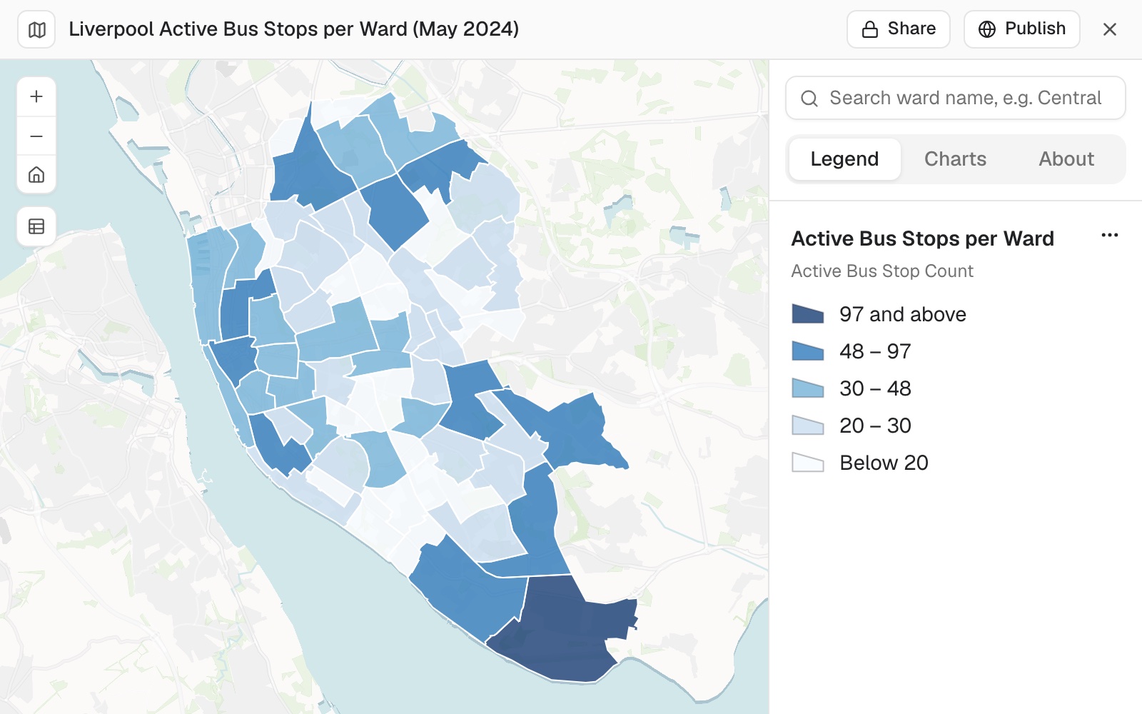
| The count | Number |
|---|---|
| Active stops in the city | 1,906 |
| Wards | 64 |
| Stops in the busiest ward | 97 |
More stops does not mean better access: the ward with 97 stops had lower access than one with 6.
For whoever has to show how well a service reaches people
A count of stops is easy.It does not say who can reach one.
A committee will ask the second question.
The usual answer is a circle round every stop, which walks people through rivers, railways and fences.
This measures the walk along paths, counts the residents inside it, and gives you the share for every area.
One real city
7,079 stops, 64 wards, a 400 m walk
Two public files: the Department for Transport's list of bus stops for Merseyside, and the Office for National Statistics' ward boundaries for Liverpool.
- In the file
- 7,079active bus stops across Merseyside
- In the city
- 1,906inside Liverpool's 64 wards
- The walk
- 400 malong paths, not in a straight line
| Active stops | Number |
|---|---|
| In the Merseyside file | 7,079 |
| Elsewhere in Merseyside, set aside | 5,173 |
| Inside Liverpool's 64 wards | 1,906 |
It says the judgement calls it made.
Here it kept the stops just outside the city, so that residents near the boundary were counted correctly. It wrote out the method step by step, the coordinate system at each step and the date of every input.
Stops: Department for Transport, NaPTAN. Wards: Office for National Statistics, May 2024. Population: Census 2021. Run on 10 November 2026.
Ask where a figure came from
Any figure in the table can be opened up. Ask the way you would ask a colleague.
Allerton is one of the 64 wards, and 57.85% was its result in this run.
Say the method in full, such as "use 800 m along paths", and it runs again. Anything you leave open, Mapstack chooses and tells you which.
Show me the rows and the steps behind Allerton's 57.85%.
Mapstack shows its working for any figure: the rows it counted and the steps it took to reach the share.
How it goes
You say the distance and how to measure it. Mapstack does the joining, the walking and the counting.
Attach your stops and your areas.
Mapstack counts the stops and works out who can walk to one.
You get the share for every area, and the method.
The step-by-step guide is in the documentation: Find what share of residents can walk to a bus stop, area by area.
The table is where it starts
Each of these is something you can ask for today.
Another service
Any set of places, any set of areas.
- Do the same for our clinics, with an 800 m walk.
- Use our school sites and the catchment areas.
A report
For the people who decide.
- Write this up as a report for the council's transport committee, with the five lowest wards called out and the method in an appendix.
A print
For the committee pack.
- Now a print: an A3 landscape sheet of walk access by ward, with a title block, a scale bar, a north arrow and a legend.
Common questions
What happens to my files?
It stays in your workspace. Only people with a seat in your workspace can see it. Nothing leaves unless you publish it yourself.
It is not used to train AI. Your data and your conversations are not used to train AI models.
It is still yours. You keep ownership of what you bring in. Delete it and it is removed.
The full answer is in the documentation: Your data, privacy and security.
What does it cost?
Free to start. One seat, for you, with a starter amount of work each month. No card.
The table and the map are on the free seat. With your own files and public sharing.
The report and the print are on a paid seat. Paid seats are per person, and bring more work each month.
The prices are on the pricing page.
How is access measured?
Along paths. A walking area is drawn round every stop on the path network, not as a circle.
Residents from the census. Fetched for you at the smallest areas published.
Dates stated. The date of the stop list, the paths and the population are part of the answer.
Judgement calls named. Such as keeping stops just outside the boundary.
Measure yours.
Free to start. Reports and prints on a paid seat.