Find open maps and data — just describe it

Describe the data you need in plain language — our AI finds the matching dataset and puts it on the map.

Browse the library

A growing, free library of community maps and open data. Search, or describe what you need above.

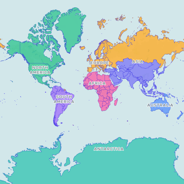
World Countries (Natural Earth Admin-0, 1:10m)

Dataset

OPERATOR NOTE. Global ADM0, 258 countries/territories from Natural Earth 1:10m Cultural Vectors, ne_10m_admin_0_countries, VERSION.txt reports 5.1.1 (naciscdn.org; latest GitHub tag on nvkelso/natural-earth-vector is v5.1.2, 2022-05-13, so 5.1.x is current - there is no v6). DUPLICATE CHECK: all 228 prod Community Library datasets were enumerated; no other world-country or global ADM0 boundary exists. KEY COLUMN - IMPORTANT: key_column is ADM0_A3, NOT ISO_A3. Natural Earth writes the placeholder '-99' into ISO_A2 (22 rows), ISO_A3 (22 rows) and ISO_N3 (21 rows), and those rows INCLUDE FRANCE AND NORWAY - a join keyed on ISO_A3 would silently fail to match two major countries. ADM0_A3 is 258-distinct and 100% populated (FRA, NOR correct). The other 20 placeholder rows are dependencies, leases and indeterminate areas that genuinely have no ISO code (Akrotiri, Dhekelia, Baikonur, Bir Tawil, Spratly Is., Scarborough Reef, Siachen Glacier, Bajo Nuevo Bank, Serranilla Bank, Clipperton I., Coral Sea Is., Ashmore and Cartier Is., Indian Ocean Ter., Brazilian I., Southern Patagonian Ice Field, Cyprus U.N. Buffer Zone, USNB Guantanamo Bay, Kosovo, N. Cyprus, Somaliland); they are retained per the belonging-not-count rule. FORMAL_EN is empty on 25 rows (optional field, not an identifier). GEOMETRY: produce reported geometry-repaired count 1 - Egypt, a ring self-intersection near Bir Tawil; MakeValid returns a MultiPolygon with IDENTICAL area (90.730190 -> 90.730190), no GeometryCollection, nothing dropped. produce also reported antimeridian-unsplit count 7, which is a BBOX FALSE POSITIVE and was verified as such: Russia, USA, Fiji, New Zealand, Kiribati and U.S. Minor Outlying Is. all have rings_crossing=0 (MultiPolygons with parts cleanly separated either side of 180 deg, which render correctly); the only ring spanning 360 deg is Antarctica's legitimate polar cap. No antimeridian splitting was required or performed; the full world view was confirmed rendering correctly on dev. Statistics (POP_EST, GDP_MD) dropped per the keep/drop rule. UNRESOLVED INCUMBENT: prod dataset BG092LBQVE5k 'World Countries (Natural Earth Admin-0)' covers the same geography but was published with an EMPTY S3 prefix and renders 'This dataset has no viewable files'. It has no cm_ catalogue entry and is absent from list_pending, so it cannot be passed as replace_catalog_id nor retracted via reject - it needs an app-side removal. data-search run ro_e457c5eab1a644f6b647c4fa97caf1c8 (2026-07-31) was serving that empty row to a user chat.

258 features
250

Departments (Departamentos) (Uruguay, 2019)

Dataset

OPERATOR NOTE. Uruguay ADM1, the 19 departamentos. Source: 'Limites Departamentales', an official product of the Servicio Geografico Militar (SGM) republished by IDE Uruguay on catalogodatos.gub.uy under the SALB standard at 1:50,000, v1.0 (created 2019-06-24, portal record last updated 2020-07-30); shapefile internal dates 2019-06-21. ACQUISITION: every .gub.uy / .ide.uy / impo.com.uy host TCP-timed-out from this vantage (DNS resolves to ANTEL 179.27.x.x) - a geo-fence, re-probed in curl AND a real browser. Canonical bytes obtained via the Internet Archive: LimitesDepartamentales_SHP.zip capture 20220831044812 (3,545,555 B, zip integrity OK). The sibling GeoJSON capture 20240722181442 was TRUNCATED at exactly 1 MiB and discarded. GEOMETRY TRANSFORM: the official product ships boundary LINES (19 LineString/MultiLineString), not polygons, so it is unusable for choropleth joins as distributed. 16/19 rings were already closed; Rocha (20 m), Durazno (7 m) and Montevideo (1 m) had sub-pixel digitising gaps at 1:50,000 which were closed, then each ring was built into a polygon. VALIDATION: computed land area 174,588 km2 vs 175,015 km2 official national land area (0.24% delta); every department within +1.8%/-2.8% of its published area. Artigas and Cerro Largo emerged from GDAL MakeValid as GeometryCollections (polygon + zero-area degenerate line); CollectionExtract kept polygonal parts only, area delta exactly 0.000e+00, then rewound to RFC7946 last. produce returned fixes: [] on both dev and prod. REJECTED ALTERNATIVES: geoBoundaries URY ADM1 (ODbL / OSM-derived, vintage 2017) declined under the share-alike last-resort gate, decision 0012, because this licence-clean official source exists; HDX COD-AB URY (cc-by-igo) declined because its dataset_source is www.gadm.org, whose upstream terms forbid commercial redistribution, so the CC BY-IGO relabel does not safely establish rights (deal breaker 2); UN SALB portal publishes no Uruguay dataset. NAME ORTHOGRAPHY CAVEAT: admlnm values are unaccented ASCII and inconsistently cased ('Tacuarembo', 'Paysandu', 'Rio Negro', 'San Jose', 'Treinta y tres'); user tables with proper Spanish orthography rely on the runtime's own normalisation. No derived name column was invented. UNRESOLVED INCUMBENT: prod dataset W5xV9fOsch9i 'Uruguay Departments' covers the same geography but was published with an EMPTY S3 prefix (no parquet/pmtiles/metadata; thumbnail 403 against 200 controls) and renders 'This dataset has no viewable files'. It has no cm_ catalogue entry and is absent from list_pending, so it cannot be passed as replace_catalog_id and cannot be retracted via reject - it needs an app-side removal. Publishing beside it was an explicit operator decision, not an unresolved duplicate check.

19 features

200

Federal Electoral Districts (Canada, 2023)

Dataset

Federal Electoral Districts of the Canada, 2023. PUBLISHER/SCHEMA EXCEPTION — read before processing. Publisher is ELECTIONS CANADA (hosted by NRCan), not StatCan; licence is Open Government Licence – Canada (open.canada.ca record 18bf3ea7-1940-46ec-af52-9ba3f77ed708, license_id ca-ogl-lgo): copy, modify, publish, distribute. Elections Canada specifies NO attribution string, so the OGL fallback applies. CHOSEN OVER StatCan's lfed000b21a_e.zip (which IS live, 206) because that file is the OBSOLETE 2013 Representation Order (338 seats); the 2023 Rep Order (343, proclaimed 2023-09-22) is current and was used for the 2025 general election, so real joins will be against 343. SCHEMA BREAK: fields are FED_NUM (LONG), ED_NAMEE(100), ED_NAMEF(100), REP_ORDER(4) — there is NO FEDUID, NO FEDNAME, and NO DGUID, so this type does NOT fit the CA-DGUID code_scheme and anything assuming StatCan field names will break. FED_NUM is an integer, not a zero-padded string. CRS CONFLICT UNRESOLVED: the ArcGIS REST layer reports EPSG:3978, but the technical guide's parameters (false easting 6200000, northing 3000000, central meridian -91°52', SP 49/77) match EPSG:3347 instead — read the .prj at convert, do not assume. Single geometry variant, no carto/digital split; 9,388,965 bytes (Last-Modified 2024-12-17), already generalised. Verified 206 application/zip. COASTLINE CLIP APPLIED (disclosed): geometry is clipped to the StatCan 2021 provinces/territories Cartographic Boundary File so this set matches the land-clipped convention of every other Canadian boundary on the shelf. Unclipped, Nunavut and Northwest Territories extend to 89.999N (Arctic sector principle) and are ~60% ocean. Attribute data and district identity are untouched; only the water portion of each polygon is removed.

343 features

180