
Mapstack Imagery and 3D
AI for imagery and 3D surveys.
Drop in the survey. Mapstack puts your imagery, elevation and point clouds on a map anyone can open.
Free to start. Imagery and 3D on a paid seat.
Watch a survey go on the map
One file, start to finish: dropped in as it came from the field, placed on a map, ready to look round.
Your heaviest files, opened by anyone with a link.
Your AI teammate handles the heavy files
From the file as it left the field to something a client can look round, handed back for your review.
Drop it in as it comes
Orthophotos, satellite scenes, elevation models, point clouds, building models. No tiling, no converting, no server to stand up first.
Mapstack works out what the file is
A photo, bands, heights, measurements or classes. Mapstack reads the file and picks a display that suits it, so it looks right the first time.
See it the way the job needs
Natural or false colour, a vegetation or water view, shaded relief. A point cloud by photo colour, class, height or return strength.
It stands up in 3D
Terrain rises, point clouds and models sit on their site. All on an ordinary map, so people get their bearings at once.
Your layers on top
Boundaries, routes, assets and results drawn over the imagery, so the picture and the data are read together.
Shared with a link
Colleagues and clients open it in a browser. Nothing to install and nothing to post on a drive.
Whatever came back from the field
Each kind of file is recognised for what it is and shown the way that kind is read.
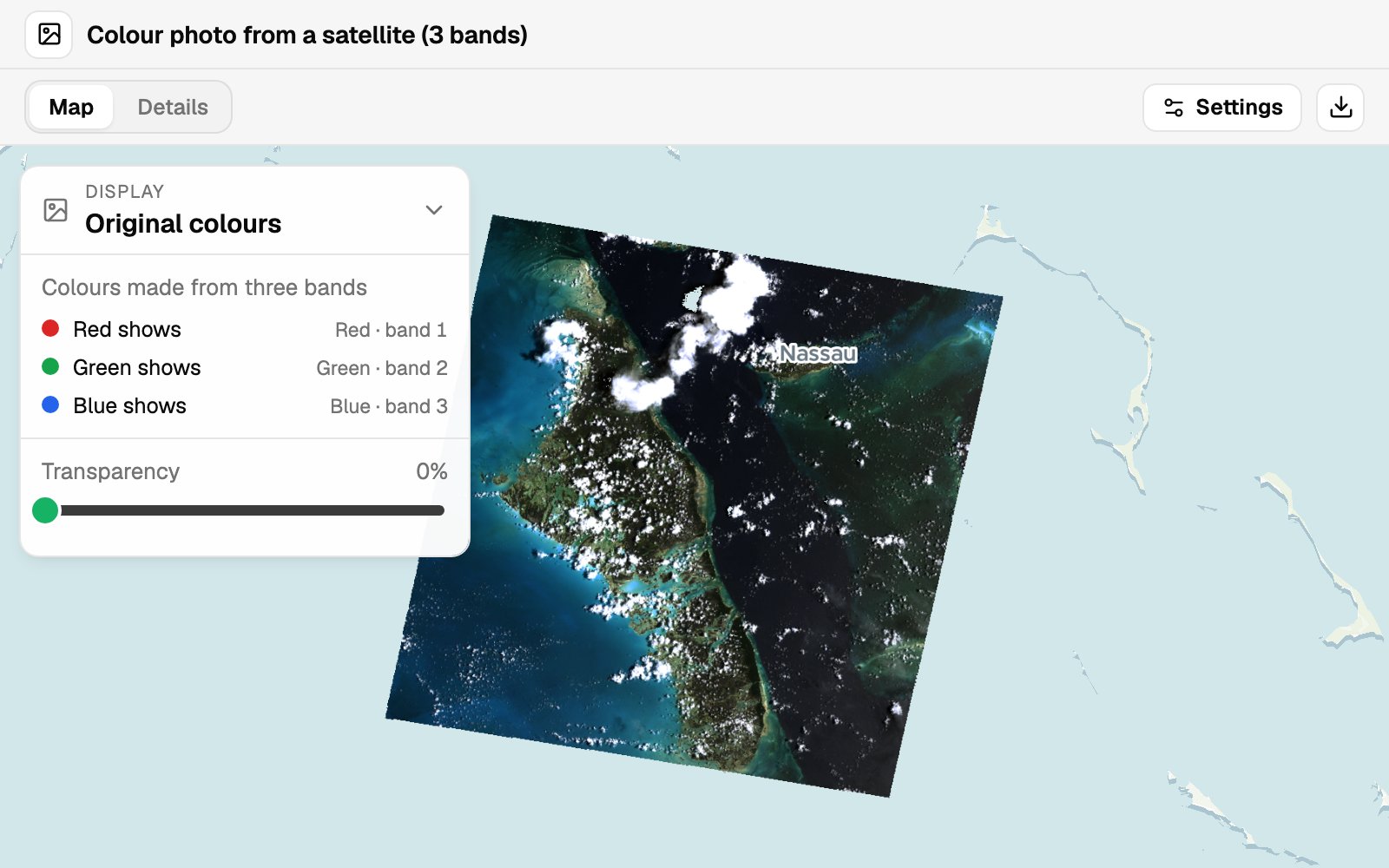
Photos from above
Drone orthophotos, aerial and satellite images.
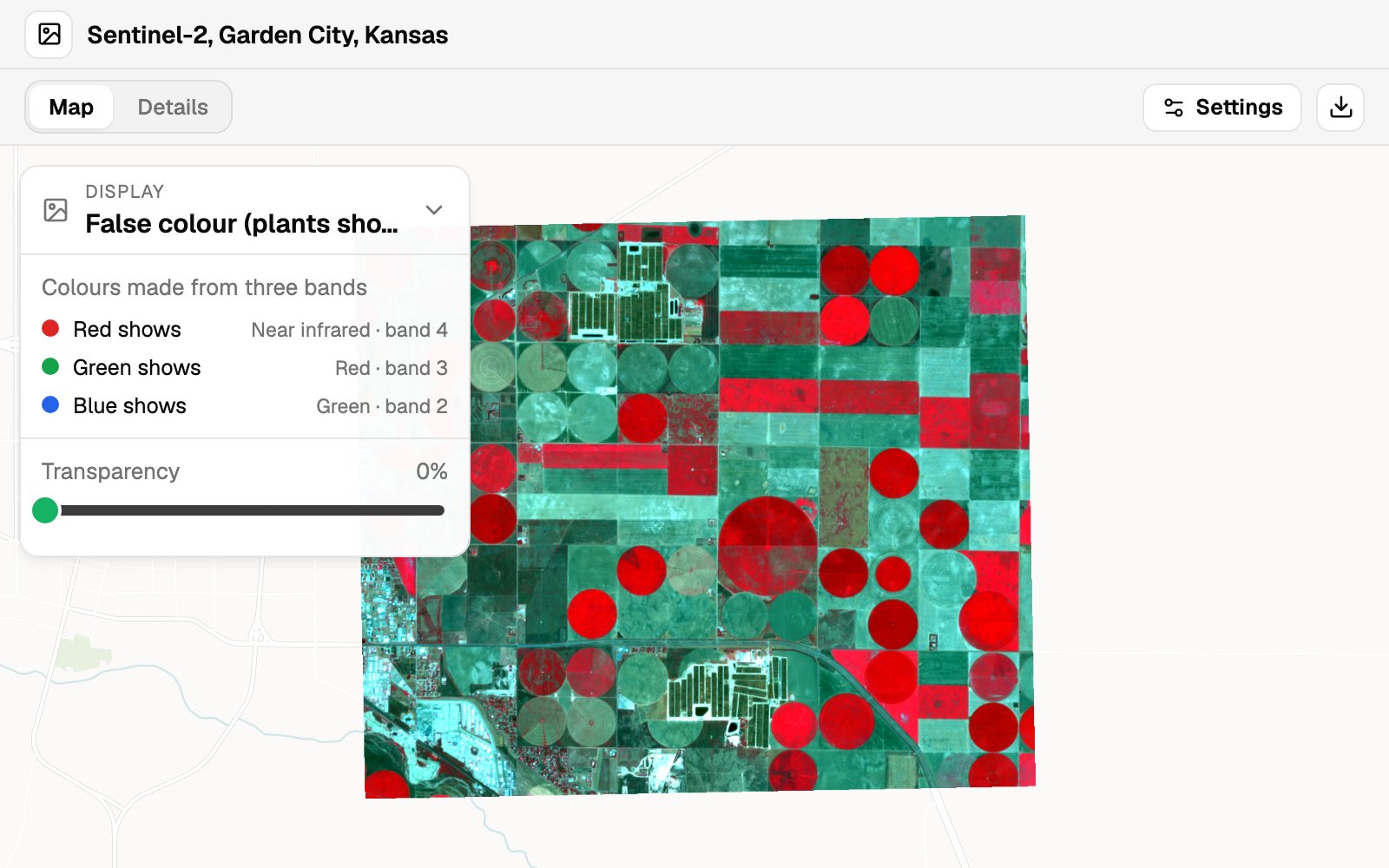
Multi-band imagery
False colour, single bands, vegetation and water views.
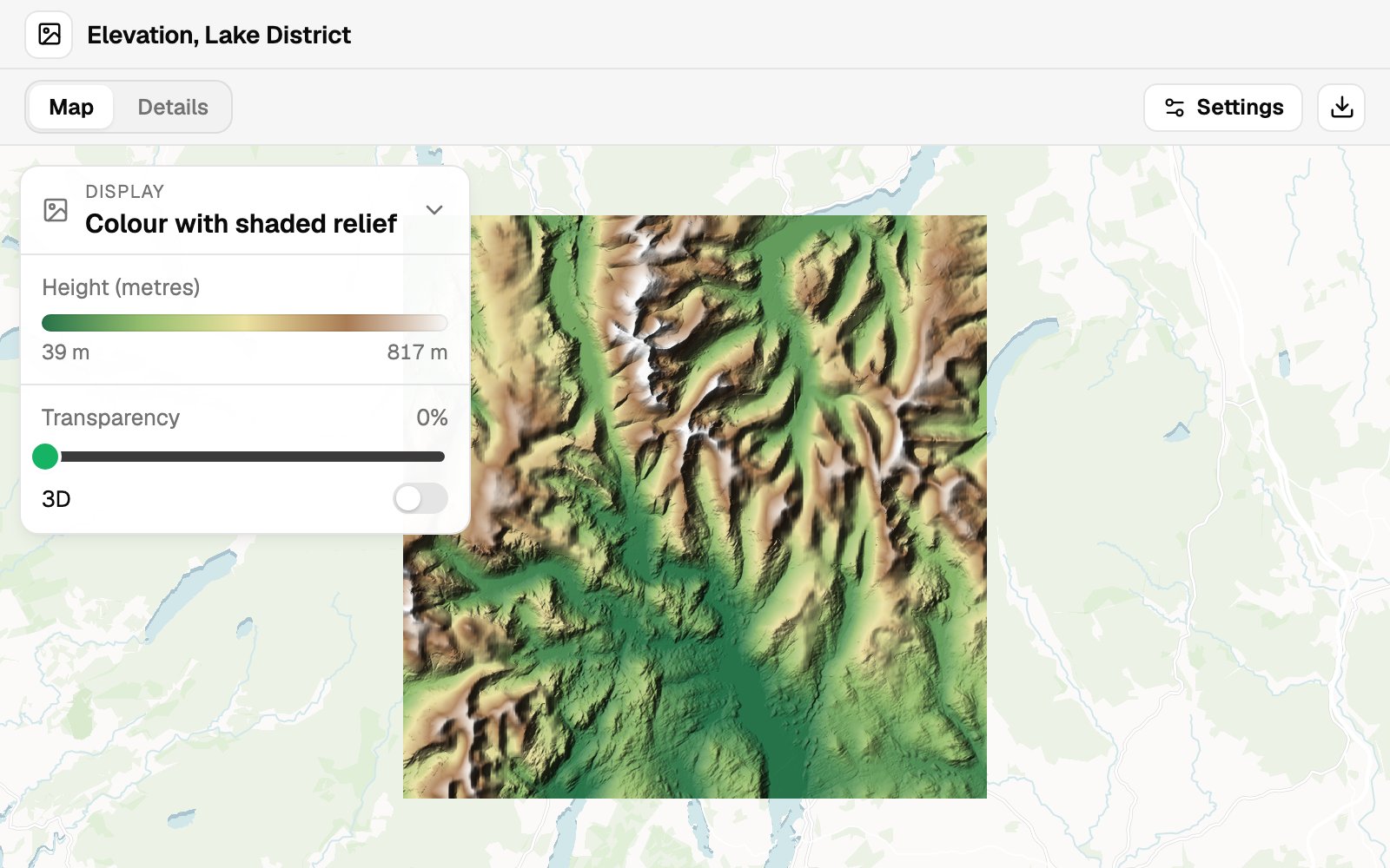
Elevation
Colour, shaded relief, or both, flat or in 3D.
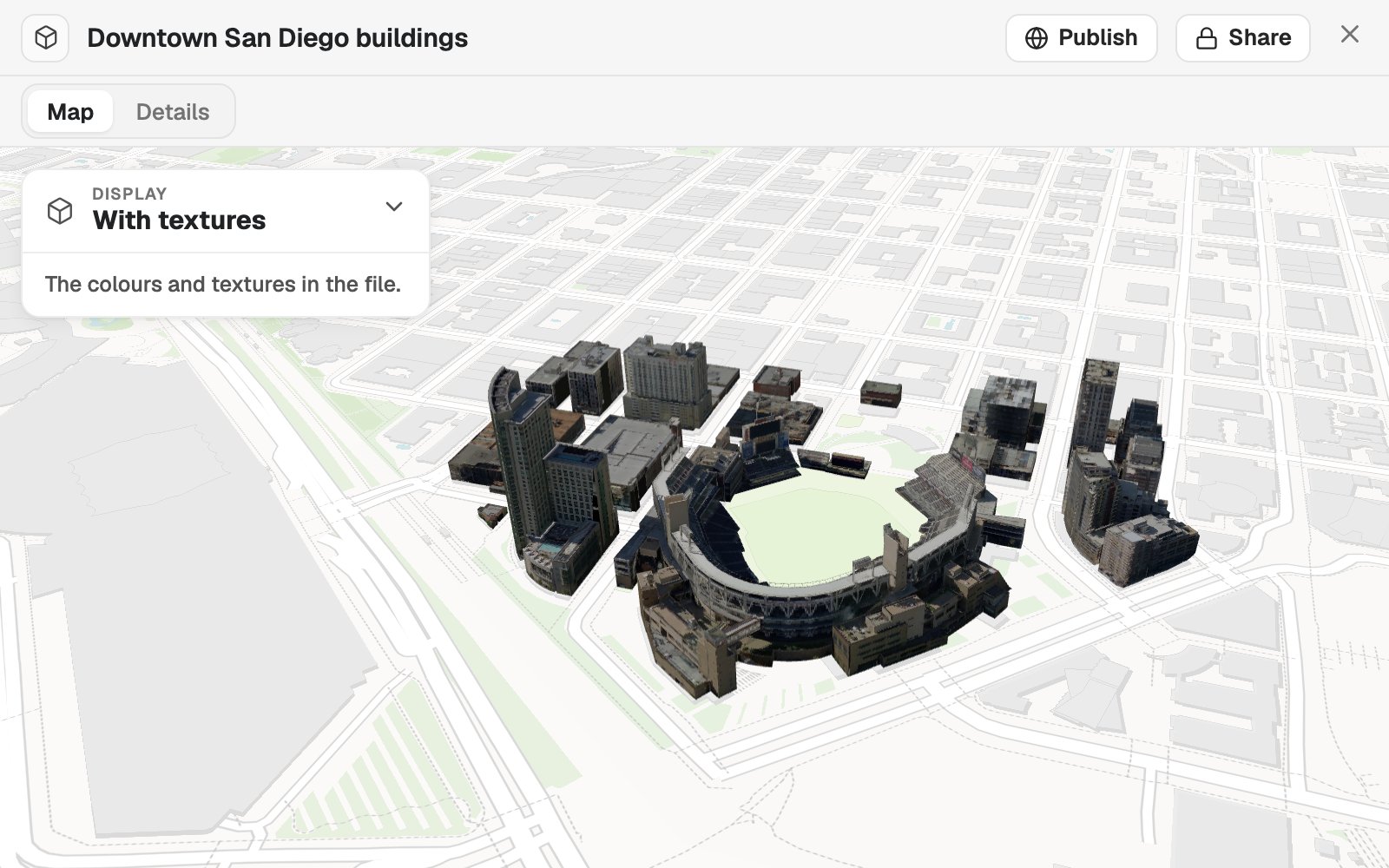
Point clouds and models
Lidar, photogrammetry, meshes and building models.
Every scene is ready to look round
The controls a viewer needs are already on it, in plain words. Nobody has to learn a point-cloud viewer to see what you surveyed.
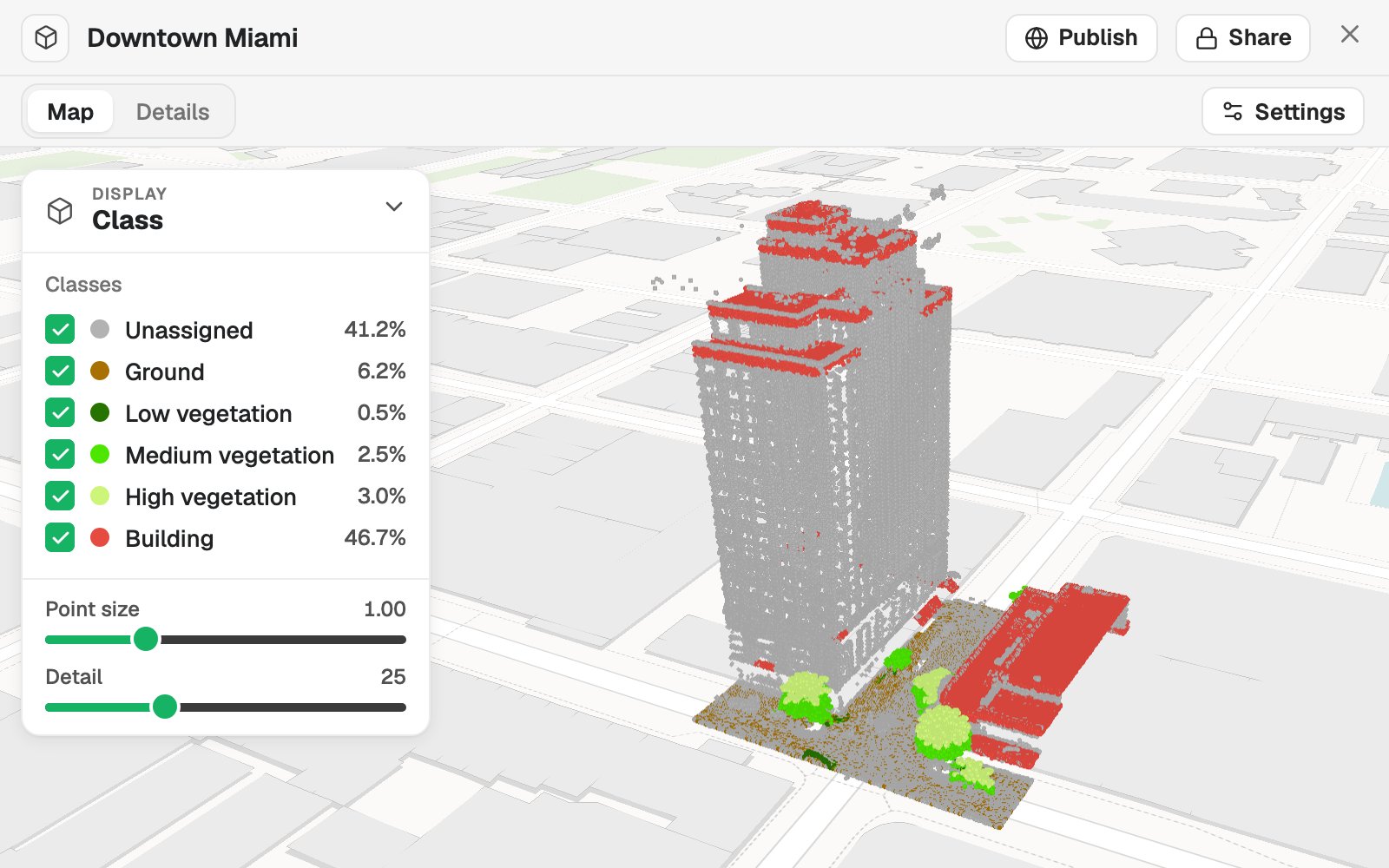
- Choose how it is shown. Photo colour, class, height or return strength.
- Classes you can switch off. Each with its share of the points, hidden one at a time.
- Point size and detail. Set for the screen and the connection it is viewed on.
- What the file says about itself. How it was captured, its coordinate system, its point count and density.
- Private until you publish. Open to your team, or to anyone with the link.
Show people what you captured
Four requests, as someone would type them, and what came back.
Hand a client the survey itself
Vantage, a drone survey firm delivering a stadium survey
The request
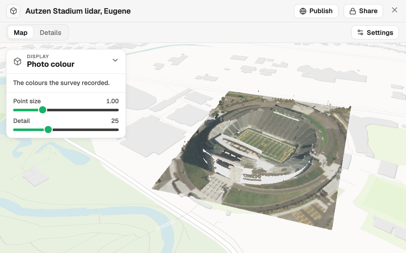
Attached is the stadium survey as a LAZ file. Put it on a map in its photo colour so the client’s project team can look round it before the handover meeting.
What came back
- The survey placed from its own coordinate system
- Shown in the colours the survey recorded
- A link the client opens in a browser
See the fields the way an agronomist does
Tillage, a precision-farming advisor
The request
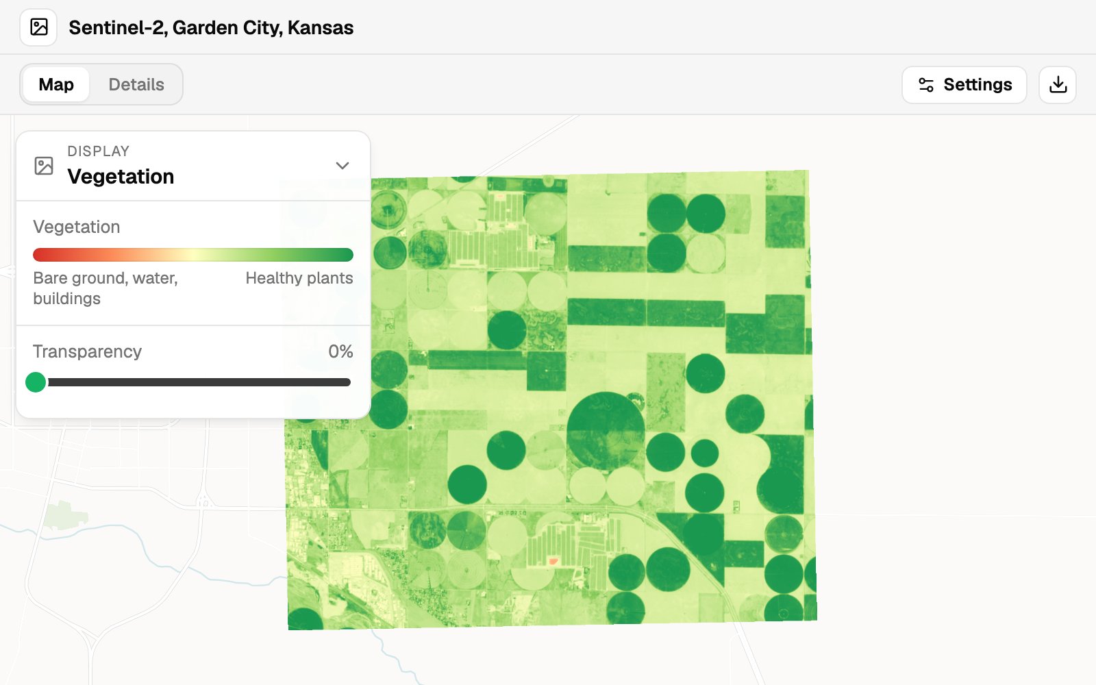
Attached is this week’s Sentinel-2 image for the client’s farms. Show the vegetation view so we can see which pivots are behind before Friday’s visit.
What came back
- The bands recognised from the sensor
- A vegetation view, bare ground to healthy plants
- Natural and false colour one click away
Stand the terrain up
Fellrunner, an organiser of mountain trail races
The request
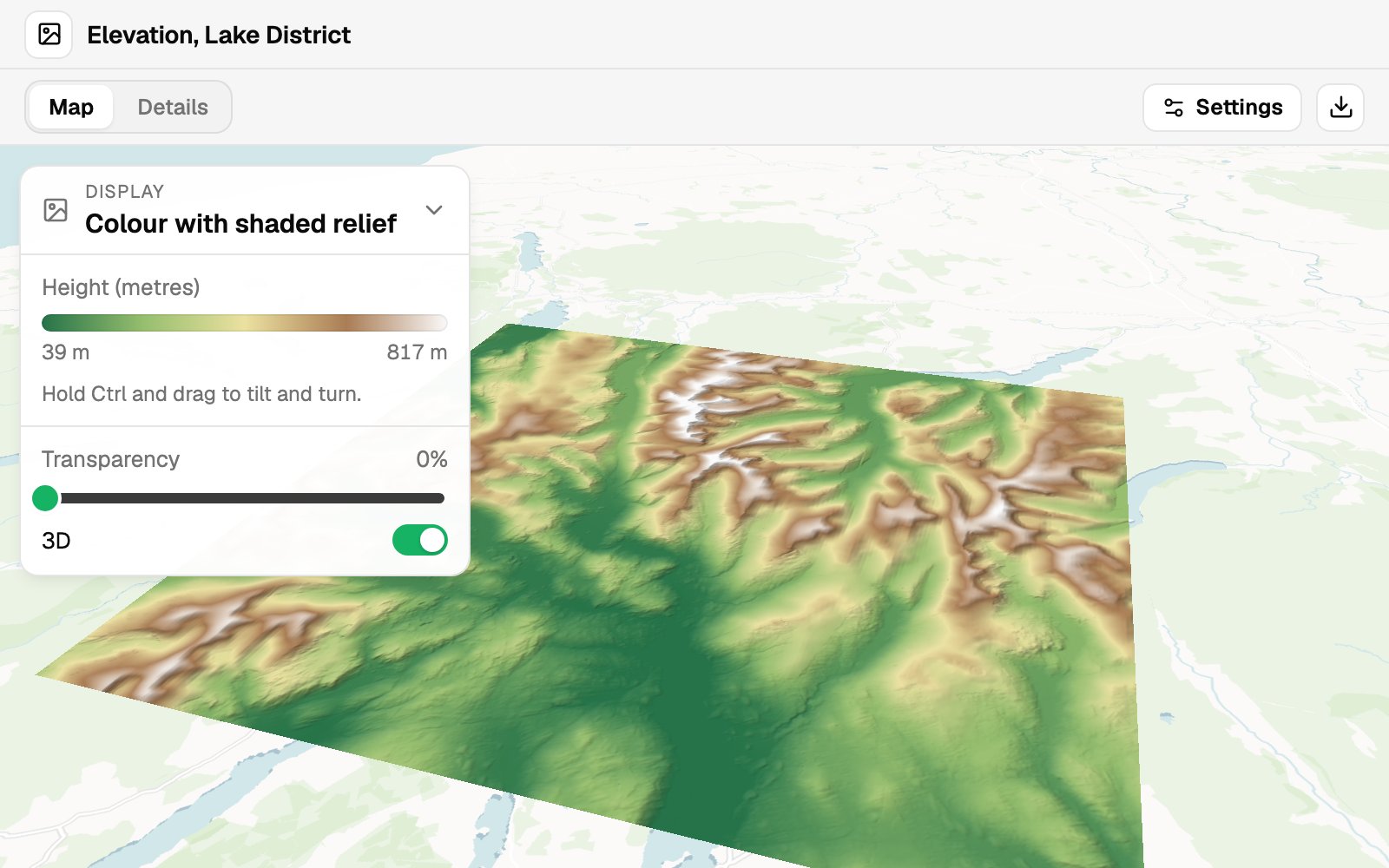
Attached is the elevation model for the race area. Show it in 3D with colour and shaded relief so the course team can see the climbs.
What came back
- Heights coloured and shaded
- The ground raised in 3D, tilted and turned at will
- Lowest and highest heights stated
Put the model on its site
Studio Marin, an architecture practice presenting a district
The request
Attached is the textured model of the downtown blocks. Place it on the map so the planning panel can see it in its surroundings.
What came back
- The model on the map, where it really stands
- Shown with the textures in the file
- Streets and neighbours around it for context
Works with what your sensors and software produce
Process the survey where you do now. Mapstack is where people see it.
- Imagery you bringWith its location in the file, or in the files beside it.
- GeoTIFFJPEG 2000ERDAS IMGASCII gridDEMTiles joined into one image
- 3D you bringPoint clouds, meshes and models that know where they are.
- LAS and LAZCOPCE57SLPK3D TilesIFC
- Who can open itIn a browser, on the map, with your other layers.
- Your teamClients, by linkThe public, if you publishThe original file, for download
Mapstack places it. You confirm it is right.
A survey in the wrong place is worse than no survey. So nothing about where it sits is left to a guess.

- The coordinate system is never guessed. If the file and what you say do not settle it, Mapstack stops and asks.
- It tells you what it found. Capture method, coordinate system, point count, density, classes and heights are all reported.
- Your original is kept. Download returns the file you brought, unchanged.
- Asked, not assumed. When a file could be read two ways, or tiles overlap, Mapstack checks with you first.
- Private until you publish. Only your team sees a survey until you choose to open it up.
An example of how it goes
Dropped in at 3:30. Sent by 3:45.
Mei is the GIS lead at a drone survey firm. The stadium survey is finished, and the client’s project team wants to see it before Friday. None of them has point-cloud software.
- stadium-survey.laz
Put the stadium survey on a map in its photo colour for the client.
Wednesday 3:30
She drops it in
The file as it came out of processing, and one sentence. Then she gets on with the next survey.
Wednesday 3:41
The survey is on the map
Placed from its own coordinate system, with its point count and density reported.
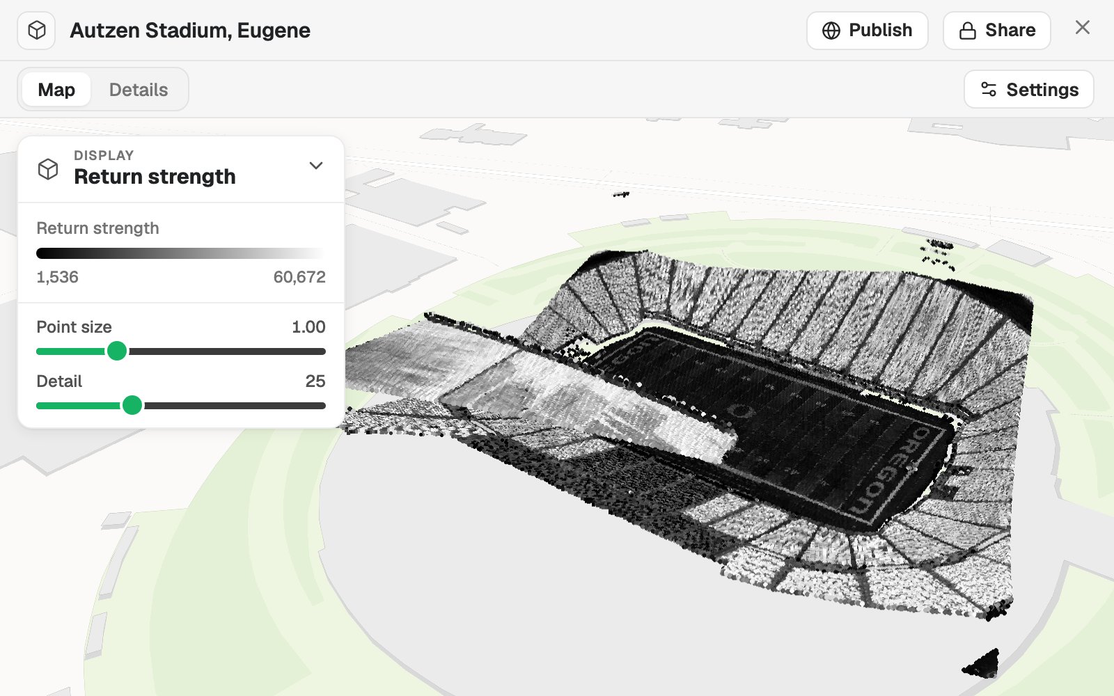
Show it by return strength as well.
Wednesday 3:43
She asks for another view
The same survey by return strength. Nothing is uploaded again.
- Sent as
One link
Opened by the client in a browser
Wednesday 3:45
The client looks round it
One link in an email. The project team opens it at their desks.
Mei sent a link, not a hard drive.
Getting a survey in front of a client used to mean a courier, a viewer to install and a call to explain it. The client saw the stadium the same afternoon.
The jobs this gets done
- Put a lidar survey on a map, in 3DA point cloud in its own colours, by height or class.
- Show an elevation model as shaded reliefThe lie of the land under your boundaries.
- See which parts of your fields are strugglingSatellite or drone imagery, as NDVI.
- Split a farm into management zones from soil and yieldLow, medium and high zones, and what sets each apart.
- Map the constraints on and around a siteWhat covers the red line, how far the rest are, and an A3 plan.
- See which facilities a sea level rise flood reachesSchools, hospitals and fire stations checked against the city’s published flood, by name.
What it costs
Mapstack is priced per person. Imagery and 3D come with a Creator seat; the people you send a public link to need nothing.
Free
$0for one person
Make maps and run analysis on your own vector files and spreadsheets. Private to you until you choose to publish.
Creator
$16a person a month, billed yearly
Adds imagery, elevation, point clouds and 3D models, and private sharing with your team.
Creator Max
$80a person a month, billed yearly
The same, with a larger monthly allowance for people who work in Mapstack every day.
Colleagues who only need to look take a Viewer seat at $10 a month. They open every image and scene in the workspace and look round it for themselves. See every plan.
Common questions
Which files can I bring?
Imagery as GeoTIFF, JPEG 2000, ERDAS IMG, ASCII grid or DEM. Point clouds and 3D as LAS, LAZ and COPC, E57, SLPK, 3D Tiles, or IFC with a site location. Matching tiles are joined into one image or one scene.
How large can a file be?
Up to 20 GB a file for imagery and point clouds, and up to two billion points in a cloud.
What can I see in multi-band imagery?
Natural colour, false colour and any single band. Once Mapstack knows which sensor the image came from, vegetation and water views are offered as well. You name the sensor from a list or set the bands yourself.
How does this fit with my photogrammetry or lidar software?
Keep processing where you do now. Mapstack takes the finished orthophoto, elevation model, point cloud or model and puts it on a map with your other layers, where colleagues and clients can open it.
Do the people I share with need special software?
No. They open a link in a browser. Imagery and scenes sit on an ordinary map, turned and tilted with the mouse.
Can I share a survey privately with a client?
Yes. Anyone with a seat in your workspace can open it, and a Viewer seat is enough. You can give a client a workspace of their own, so they see their surveys and nobody else’s. Or publish the survey and send the link, which anyone who has it can open.
Which plan do I need?
Bringing in imagery and 3D needs a Creator seat. Viewers can open everything you bring.
Is the data I upload private?
Yes, on every plan, Free included. Your files and everything made from them are private to your workspace by default. Nothing is public unless you choose to publish it, and you can make it private again.
What happens to my data?
It stays in your workspace and it stays yours. Only the people you give a seat to can see it. It is stored in the United States, it is not used to train AI, and when you delete it, it is removed.
Drop in your first survey.
Free to start. Imagery and 3D on a paid seat.