
Mapstack for environment
The AI teammate for environmental GIS work.
Ask in plain words. Mapstack makes the map, the figure or the report.
Free to start. No card.
Where environmental work stands today
The knowledge is out on the ground. Getting it into a form someone else can check is the slow part.
The people who know the ground rarely make the map
Or they do, on top of the job. Requests from ecologists, foresters, project officers and partners land on one GIS post, or wait until the end of the project.
The same work comes round for years
Monitoring is repeated every year, reports are due each funding cycle, and a project’s figures are redrawn whenever the scheme changes.
Someone outside checks it
The work goes to a regulator, a funder or a board, and a named professional answers for it. The map, the numbers and the report have to agree.
Evidence for every decision on land and water.
What changes with Mapstack
Today the mapping waits for the one person who can do it, or gets done after the real job. With Mapstack, whoever knows the ground asks and gets on with the work.
Know what is on and around a site before the fieldwork
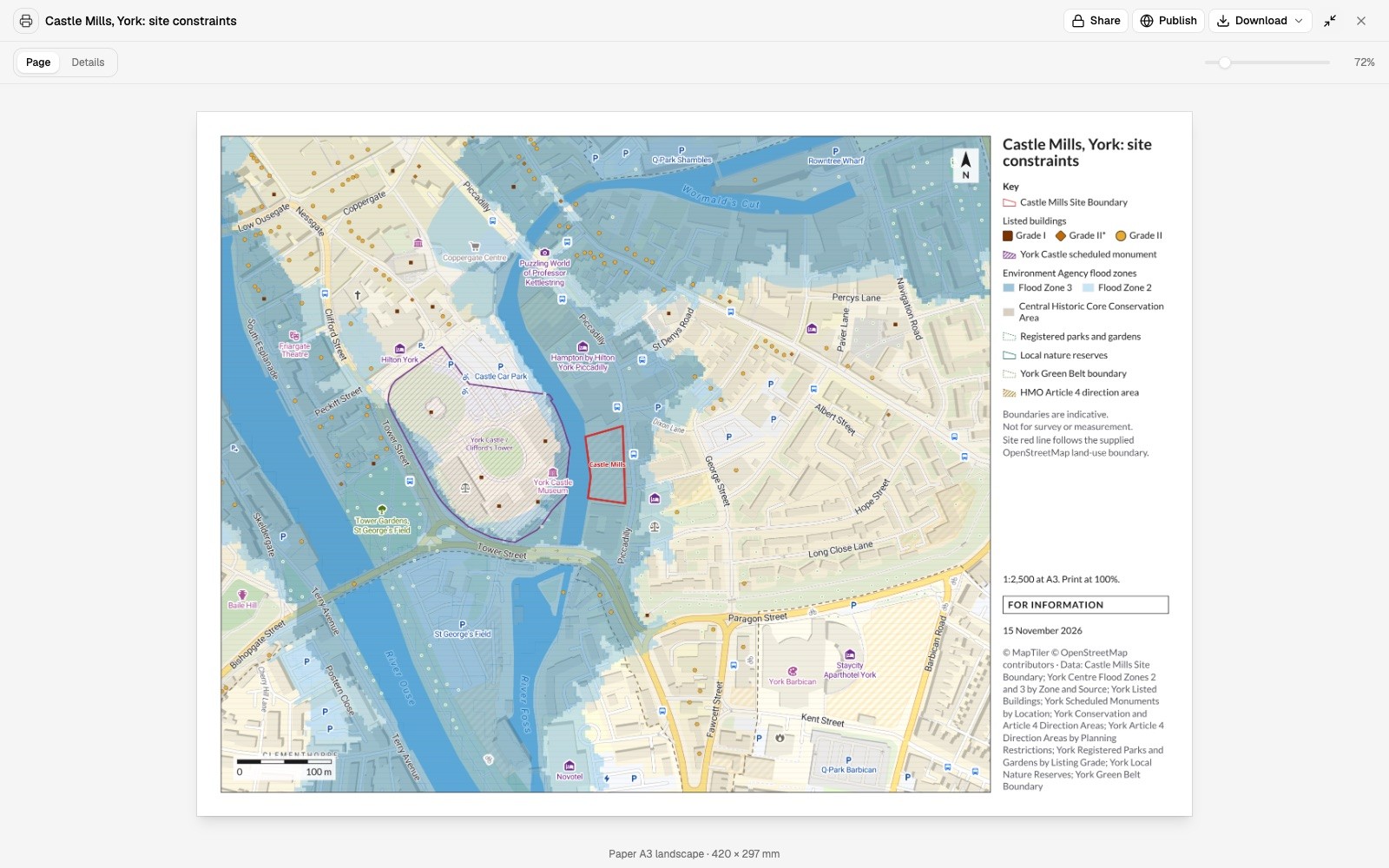
Put any boundary against published layers and your own. You get what covers it, what lies within the distance you set and how far away the rest is, whether it is a development site, a reserve, a compartment or a holding.
- Or ask
Which designated sites are within 500 m of this compartment?
Which flood zones and designations cover this site?
- Or ask
See which places need attention first
Count, measure and rank across a catchment, an estate or a region. Mapstack finds the gaps and the extremes, and gives you the list in order with the map.
- Or ask
Which fields are low on both soil and yield?
Which of our water supplies sit on the most vulnerable ground?
County Kilkenny: groundwater vulnerability and supply protection areas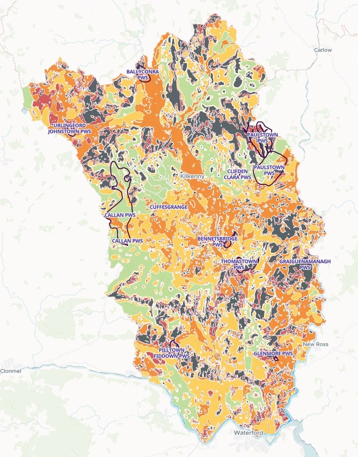
- Or ask
Keep up with monitoring that comes round every year
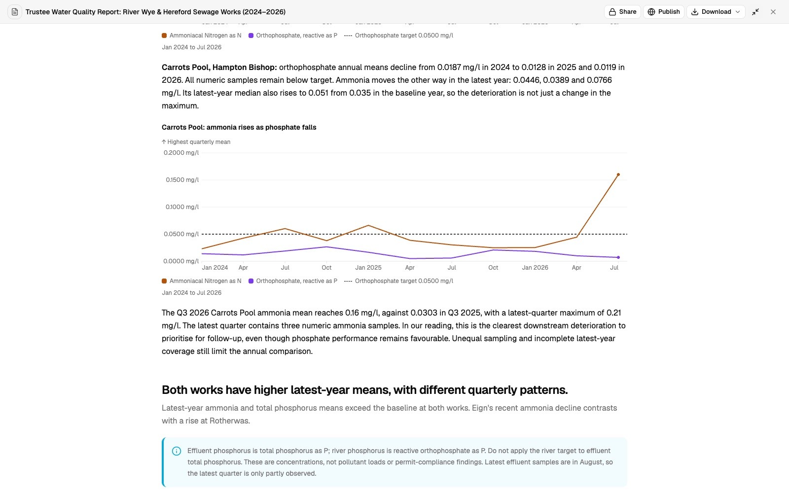
Give Mapstack this period’s results. It compares them with the last, point by point, charts them and writes them up. State the method once and the next report is made the same way.
- Or ask
Rerun last year’s monitoring report on this year’s survey data.
How does this quarter compare with last year at this sampling point?
- Or ask
Hand on figures and plans that stand up to review
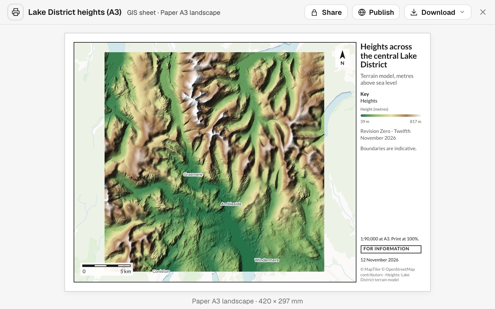
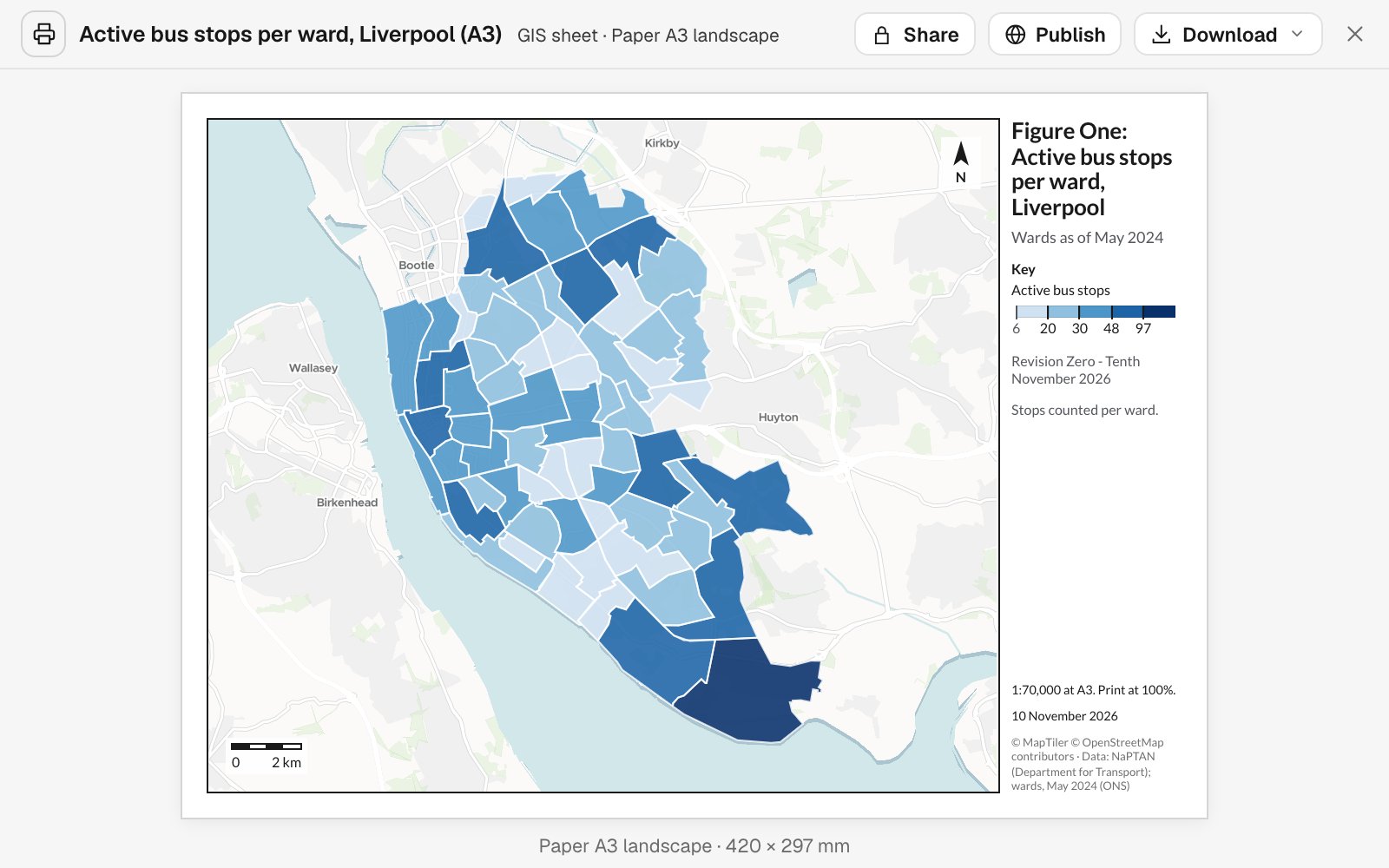
A print sheet at a stated scale with its key, north arrow, scale bar, status and revision, or a written report, or a map a partner can open. Each carries its sources, its dates and its method.
- Or ask
Write it up for the trustees, with the method and the sources.
Lay this out as an A3 figure with our title block and revision.
- Or ask
Three examples
Three of many, from different corners of environmental work. Each shows the request, what came back and who decides.
Which water bodies nobody is measuring
A catchment officer at a rivers trust, with no GIS training
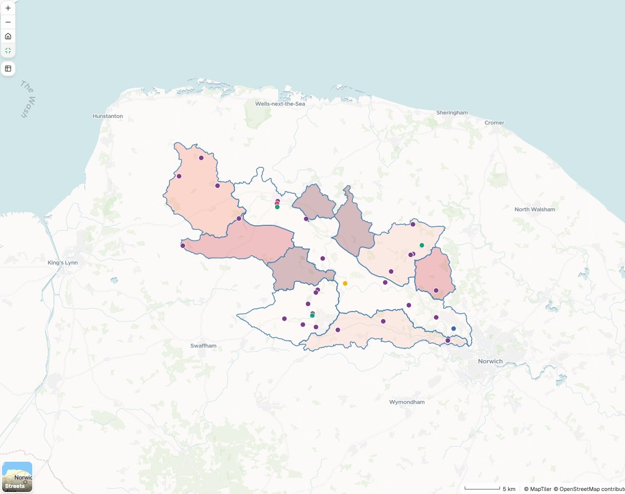
Water body catchments
Active stations in each. Lighter means more.
- Groundwater level borehole
- Rain gauge
- River flow gauge
- River level gauge
- Flow and level gauge
- 1 – 3 stations
- No stations
The request
Attached are our river’s water body catchments. Find the active flow, level, rainfall and groundwater stations inside them, and shade each water body by how many it has.
What came back
- Every active station from open data, by what it measures
- A count of each kind for every water body
- The water bodies with no station, picked out
Goes toThe catchment partnership, in the monitoring plan.
Mapstack shows what is already measured, while the partnership decides where to monitor next.
Where the reserves fall short
A conservation body in New South Wales
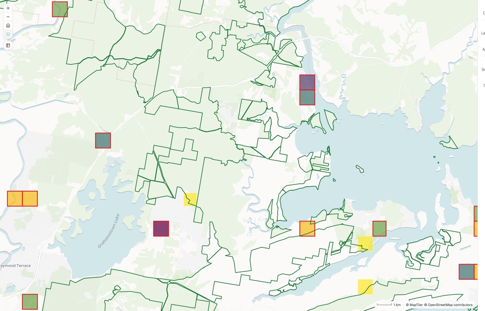
1 km squares
Threatened species recorded in each
- 19 and above
- 12 to 19
- 9 to 12
- 8 to 9
- Top 20, under half protected
- Protected areas
Squares with fewer than 8 are yellow or orange.
The request
Attached are our threatened species records and the protected areas. Count the species in each 1 km square, and rank the richest squares that are less than half protected.
What came back
- A 1 km grid shaded by threatened species recorded
- How much of each hotspot the reserves cover
- The top 20 squares to go after, ranked, as a table
Goes toThe trustees and the funder, as the case for what to protect next.
Mapstack counts and ranks, while your conservation team sets the priorities.
Five years of felling, from the stand records
A forest manager, writing the next felling plan
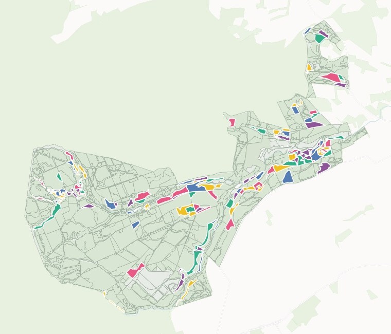
Felling year
Stands scheduled for clearfell
- 2027 · 17 stands
- 2028 · 18
- 2029 · 18
- 2030 · 18
- 2031 · 18
- Retained forest
The request
Attached are our stand records and yield table. Estimate each stand’s volume, choose what to clearfell over the next five years, and map the programme by felling year.
What came back
- A volume for each stand, from your own yield table
- The stands chosen, with each year’s area and volume
- The stands your table does not cover, listed and left blank
Goes toThe forest plan, and the team that schedules the work.
Mapstack applies your table and your rule, while the forester approves the programme.
An example of how it goes
Four colleagues asked on Monday. None of them waited.
Priya is the GIS officer at a wildlife and rivers trust in the east of England, and the first it has had. On Monday morning the planning officer, the catchment officer, the reserves manager and the bid writer each have a request in.
- allocated-site.geojson
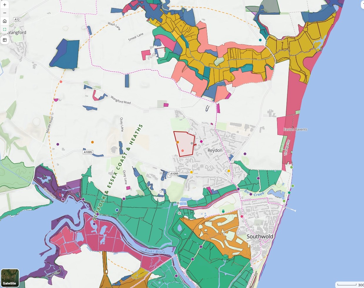
What priority habitat and protected species records are within 2 km of this site?
Monday 9:00
The planning officer asks first
One sentence and the site boundary. Priya hands it to Mapstack and opens the next request.
- Priority habitat and species records within 2 km
Monday 9:15
The map around the site is back
Habitats and records inside the 2 km line, with each layer and its date named.
- River Wensum: monitoring stations by water body
Which water bodies in our catchment have no monitoring station?
Monday 9:30
The catchment officer is next
A different question on different data, asked the same way. The reserves manager and the bid writer follow.
- River Wensum: monitoring stations by water bodyBack with colleagues
Four requests, four teams
Each checked by the person who asked
Monday 12:00
Her colleagues take over
Each one checks what came back and makes the call that is theirs to make.
Priya cleared Monday’s requests on Monday.
She checked each result and passed it on. Her colleagues had their answers while the questions were still live, and she spent the afternoon on the trust’s own records, which only she looks after.
Works with what comes back from the field
Your survey data and your records stay yours. Mapstack works from what you give it.
- What you bringFrom the field, the client or your own records.
- Habitat and species survey dataSite and scheme boundariesSampling and monitoring resultsStand and compartment recordsReserve and holding boundaries
- What Mapstack finds for youPublished data, fetched when you ask and named on the result.
- Designated sites and priority habitatFlood zones and water bodiesMonitoring stations and published resultsBoundaries and terrain
- What you hand onIn the form the reader expects.
- Report figures, to scalePlans with a key and sourcesA monitoring reportA map a partner can open
The professional’s name stays on it
A regulator or a funder reads this work, and a named person answers for it. So nothing here is taken on trust.

- It does not survey, classify or certify. Mapstack does no fieldwork, does not classify habitats or identify species, does not run flood or pollution models, and does not certify a metric or an assessment.
- The ecologist, forester or adviser signs. Mapstack draws, measures, finds the data and reruns. The judgement is yours.
- Sources and dates on every layer. Which dataset, who published it and when it was current, with the method written out.
- Gaps are shown, not filled. Where a figure cannot be worked out from what you gave, it is left blank and listed.
- Nothing is public until you publish it. Work stays inside your workspace until one of your staff chooses to open it up.
- It sits beside the GIS you have. Your records stay where they are. Mapstack reads your exports and hands data back.
The parts of Mapstack environmental teams use most
One teammate, whoever is asking.
Analysis
What is inside, what is near, where the gaps are.
Reports and print maps
Report figures and plans, to scale.
Automation
The monitoring report, rerun each period.
Data
Survey records cleaned and joined.
Looking for a particular job? These go step by step.
- Map the ecological baseline around a siteDesignated sites, priority habitat and species records within 2 km.
- Map the constraints on and around a siteWhat covers the red line, how far the rest are, and an A3 plan.
- Screen development sites for priority habitat and SSSIsThe habitat each site would take and its nearest SSSI, ranked and mapped.
- Work out biodiversity net gain and carbon for a siteUnits before and after, the shortfall to 10%, and tonnes of CO2e.
- See which stations already measure a riverFlow, level, rain and groundwater stations counted per water body, the gaps shaded.
- Turn river sampling results into a quarterly reportAbove and below the works, each point against your target.
- Map where groundwater is most easily pollutedVulnerability by class, and each supply’s inner zone on extreme ground.
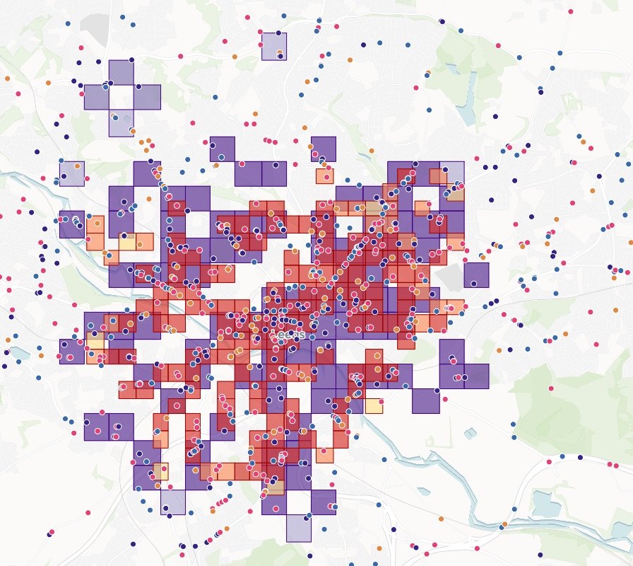
- Find the threatened species hotspots the reserves missSpecies counted per square, reserve cover measured, and the land to protect next.
- Map where your collared animals wentTracks, home ranges, and who migrated when.
- Turn stand data and a yield table into a felling programmeEach stand’s volume from your table, the stands to fell, and the years mapped.
- Split a farm into management zones from soil and yieldLow, medium and high zones, and what sets each apart.
- Turn a map into a figure that meets your standardA title block, a scale statement and a revision.
What it costs
Mapstack is priced per person and free to start, with no minimum and no sales call.
Free
$0for one person
Ask about your own files. What comes back stays private to you until you choose to share it.
Creator
$16a person a month, billed yearly
Adds sharing with your team, reports and print sheets, and work that reruns without you.
Creator Max
$80a person a month, billed yearly
The same, with a larger monthly allowance for people who ask all day.
Colleagues who only need the answers take a Viewer seat at $10 a month. They open every result and ask it their own questions. See every plan.
Questions environmental teams ask
What GIS work can Mapstack do for an environmental team?
Most of what a team asks its GIS person for: maps, spatial analysis, what falls inside or near a boundary, cleaned and joined data, report figures, print sheets, written reports and maps for partners. You ask in plain words or in GIS terms, and your staff check the result.
Is it only for GIS staff?
No. It is for GIS staff, for the colleagues who wait on them, and for the ecologist, forester or project officer who does the mapping on top of another job.
Does Mapstack do the survey or the classification?
No. It works from what you recorded. It draws, measures, finds published data and reruns. The survey, the classification and the signature are the professional’s.
Do we have to replace our GIS?
No. Mapstack reads the standard formats your GIS exports and hands data back in formats it opens. Your records stay where they are.
Where does the published data come from?
From open sources, fetched when you ask and named on the result with their dates. Data you hold under licence is yours to bring. Mapstack does not supply it.
Can it make the figures for an ecological report?
Yes. Attach the site boundary and your records and say which figures the report needs. Each comes back with a key, a scale bar and its sources, in one style, and can be redrawn when the scheme changes.
Can it write a quarterly or annual monitoring report?
Yes. Give it this period’s results and it compares them with the last, point by point, with a chart for each and the findings written out. State the method once and it is repeated the same way each time.
Can it help with a biodiversity net gain assessment?
It can map your surveyed habitats against the proposed layout and total the area of each, for you to check against the metric. It does not classify habitats, and it does not complete or certify the metric.
Is the data I upload private?
Yes, on every plan, Free included. Your files and everything made from them are private to your workspace by default. Nothing is public unless you choose to publish it, and you can make it private again.
What happens to my data?
It stays in your workspace and it stays yours. Only the people you give a seat to can see it. It is stored in the United States, it is not used to train AI, and when you delete it, it is removed.
Ask the question you are waiting on.
Free to start. No card.