
A water network register
Turn your water main layer into a register.
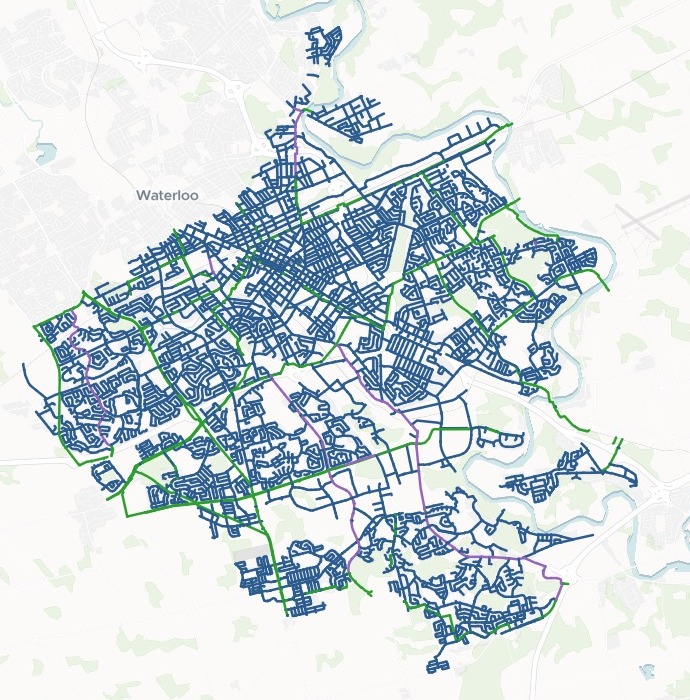
Attach the layer from your GIS. You get a map of every stretch of main by owner, the network summed up, and a list of the gaps.
Free to start. No card.
| Owner and maintainer | Stretches |
|---|---|
| City | 14,913 |
| Region | 1,020 |
| Both, City and Region | 281 |
Counted by owner, one record for every stretch.
For whoever keeps the network’s records
Asset management.Utility records.GIS teams.
Each year the asset plan needs the network by owner, and the record fixes go back to whoever keeps the layer.
A water network register is the record of every stretch of main: where it runs, who owns it, its size, its material and when it went in.
The data quality problems are rarely blanks. They are stand-ins: a pipe size of 0, a placeholder material code, a date worth a second look. Mapstack finds them, and says what each one is.
One real network
A city’s water mains, and the stretches to send back
The City of Kitchener's open water main layer, attached as a zipped shapefile: every stretch of main in the city, whoever looks after it.
- In the register
- 16,214stretches of main, and every one has an owner
- Owner spelled two ways
- 6City mains with the owner written 'Kitchener', not 'KITCHENER'
- To send
- 5stretches on the final gap list
| The final gap list | Stretches |
|---|---|
| Pipe size of 0 mm | 2 |
| Material 'XXX' | 1 |
| Installed 1889, to check | 2 |
It weighs the dates, not just the blanks.
Told the date, it kept this year's new mains off the list and flagged two cast-iron mains dated 1889 for a check.
City of Kitchener open data, Water Mains, export dated 16 October 2026, downloaded 15 November 2026. Run on 15 November 2026.
Send the list, and fix what you can by asking
Ask in plain words for the file and the fix.
Each gap stretch has a pop-up saying what is wrong.
Tidy the 'Kitchener' owners so they match the rest of the City mains. Then give me the final gap list as a file I can send to the Utilities team, and show the gap stretches on the register map so they can find them.
Mapstack changed the owners to KITCHENER, in an edit you save as a new version of the register. The gap stretches became their own dataset, to download as a CSV, GeoJSON or GeoPackage, and a layer over the register so the team can find them.
How it goes
You bring the layer. Mapstack builds the register and sums it up.
Attach your layer and say what the pop-up holds.
Mapstack makes the register, one record per stretch.
You get Mapstack’s summary by owner.
Common questions
What happens to our network data?
It stays in your workspace. Only people with a seat in your workspace can see it. Nothing leaves unless you publish it yourself.
It is not used to train AI. Your data and your conversations are not used to train AI models.
It is still yours. You keep ownership of what you bring in. Delete it and it is removed.
The full answer is in the documentation: Your data, privacy and security.
What does it cost?
Free to start. One seat, for you, with a starter amount of work each month. No card.
This job is on the free seat. Maps, datasets, analysis, your own files and public sharing are all included.
Pay per person for more. A paid seat brings more work each month, and seats for your team.
The prices are on the pricing page.
What can the team do on the map?
Find a stretch by its ID. Type the main ID to find it.
Filter the network. By owner, material, pressure zone or lining.
Open a stretch. Its pipe size, material, install year, lining, pressure zone and condition score.
Register yours.
Free to start. No card.