
Neighbour notification list and radius map
Get every address within a set distance of a site.
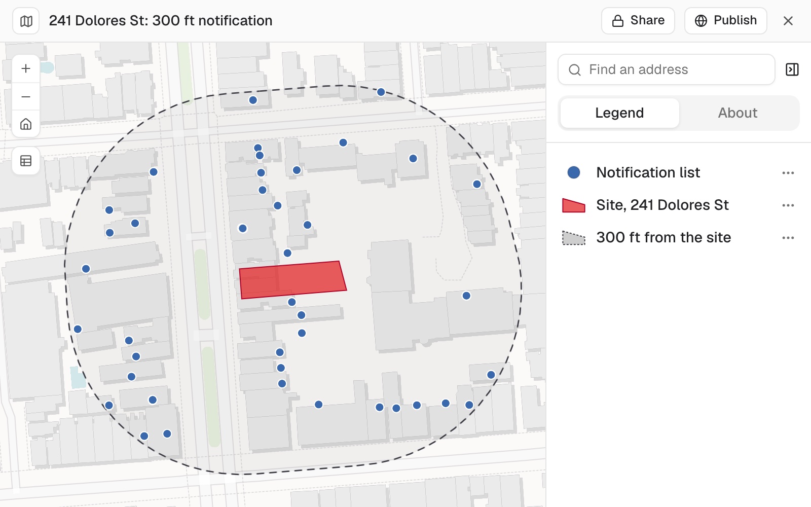
Give the site and the addresses around it. You get a mailing list of every address within your distance, and a map for the case file.
Free to start. No card.
| The list | Count |
|---|---|
| Addresses on the list | 439 |
| Buildings | 79 |
| On the site itself, left off | 6 |
The nearest address on the list is 13 feet from the site, the farthest 298.
For whoever sends the letters
A planning application.Street works.A new mast.
The rules say who must be told, and one missed address can send the whole thing back to the start.
The usual way is a ruler on a printed map and a list typed out by hand.
This gives you the list and the map for the case file from the same measurement.
One real case
One site, a 300 ft line, 439 addresses
A planning application for an eight-unit building, with the city's own address points around it: one point for each address and each unit.
- Searched
- 4,146address points around the site
- On the list
- 439addresses within 300 feet of the site boundary
- Buildings
- 79counting a building as one house number on one street
| Distance from the site boundary | Feet |
|---|---|
| The nearest address on the list | 13 |
| The farthest address on the list | 298 |
| The 300 ft line | 300 |
Ask for the distance of every address, and you can see the edges of the list.
To leave the site off, Mapstack tested every point against the site boundary and named the six it took off, the site's own addresses.
Site: planning application 2026-003165PRJ, from San Francisco's parcel map. Addresses: the city's Enterprise Addressing System. Both from DataSF. Run on 11 November 2026.
How it goes
You bring the site and the addresses, and say the distance. Mapstack does the measuring.
Attach the site and the addresses, and say the distance.
Mapstack draws the line and selects the addresses inside it.
You check the edges, then take the list away.
The step-by-step guide is in the documentation: Make a neighbour notification list for a site.
Common questions
What happens to my address data?
It stays in your workspace. Only people with a seat in your workspace can see it. Nothing leaves unless you publish it yourself.
It is not used to train AI. Your data and your conversations are not used to train AI models.
It is still yours. You keep ownership of what you bring in. Delete it and it is removed.
The full answer is in the documentation: Your data, privacy and security.
What does it cost?
Free to start. One seat, for you, with a starter amount of work each month. No card.
This job is on the free seat. Maps, datasets, analysis, your own files and public sharing are all included.
Pay per person for more. A paid seat brings more work each month, and seats for your team.
The prices are on the pricing page.
How is the list made?
True distance on the ground. Measured from the site boundary, not its centre. Mapping people call the area a buffer.
The site left off. Every point is tested against the site, and the ones taken off are named.
One row per address. With unit numbers, as a spreadsheet for a mail merge.
The map from the same data. The site, the line and the addresses, for the case file.
Build yours.
Free to start. No card.