
A heritage register on a map
Put your heritage register on a map.
Attach your sites and monuments record. You get each monument once on a map you can search by number or townland, and a list of records with no position.
Free to start. Prints and reports on a paid seat.
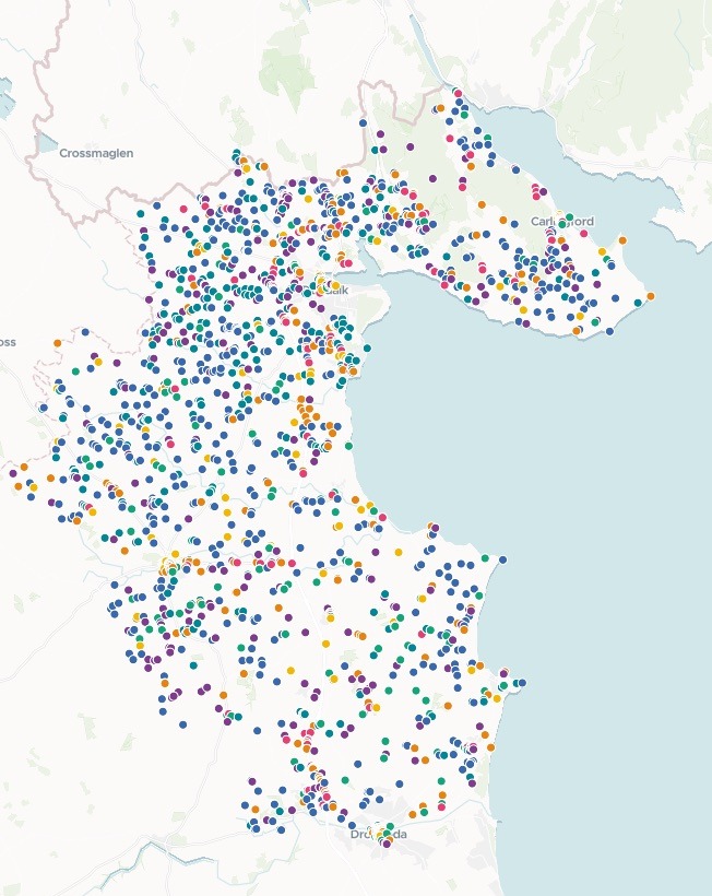
| Monuments by broad group | Monuments |
|---|---|
| Ringforts & Enclosures | 724 |
| Churches & Graveyards | 344 |
| Burial & Ritual | 339 |
| Industrial & Coastal | 310 |
| Souterrains | 308 |
| Excavations & Settlement Sites | 199 |
| Castles & Towers | 119 |
Type a record number or a townland, and the map goes straight to it.
For whoever keeps the record of a place’s past
Heritage officers.Archaeologists.Planners.
The record is a long table, and the question is always what is here.
In Ireland it is the sites and monuments record; in England, the historic environment record. Either way it is thousands of archaeological sites, each with a class, a place name and the survey’s notes.
Here you attach it once. Mapstack places each monument, sorts the survey’s many classes into a few groups that read at a glance, and holds back any record with no real position.
One real record
Every monument placed, or named
The Sites and Monuments Record for County Louth, from Ireland's National Monuments Service: all 2,461 recorded monuments in the county, each with its class, townland and the survey's notes.
- Placed
- 2,343monuments on the map, each once, in seven broad groups
- Largest group
- 724ringforts and enclosures, from raths to crannogs
- Held back
- 118records with no real position, kept off the map and listed
| Held back, by class | Records |
|---|---|
| Souterrains | 36 |
| Lithic scatters | 19 |
| Castles | 14 |
| Burial grounds | 6 |
| Churches | 6 |
Nothing is dropped quietly.
Records at 0 in the grid columns stayed off the map, and the reply listed all 27 of their classes with a count for each: sites whose position the survey never fixed, such as unlocated castles and battlefields.
National Monuments Service (Department of Housing, Local Government and Heritage), Archaeological Survey of Ireland: Sites and Monuments Record, County Louth, from data.gov.ie, downloaded 15 November 2026 (Creative Commons Attribution 4.0). Run on 15 November 2026.
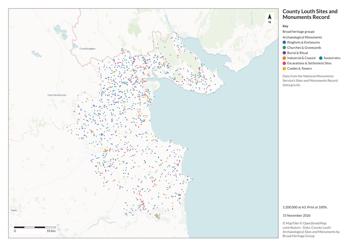
The whole county on one A3 sheet
One more sentence turned the map into a print for the county heritage plan.
- Titled and keyed. The record’s name at the top, the seven groups in the key, and the source named beneath.
- Ready to measure from. A north arrow, a scale bar and the scale stated: 1:200,000 at A3.
- PDF or PNG. Download it at full resolution for the plan, or copy the image into a document.
How it goes
You bring the record. Mapstack builds the inventory.
Attach the record and say who will use it.
Mapstack maps every monument by its group.
Search a number and its record opens. Here, a portal tomb, with the survey’s notes and a link to the national record.
Go further
The same record, put to the next use.
Against an application
What a planner checks first.
- Attached is the site boundary of a planning application. List every recorded monument within 500 metres of it, and map them.
Where they cluster
One kind of monument across the county.
- Show where the souterrains are most concentrated across the county.
- Compare where ringforts and souterrains cluster.
In writing
A summary for the planning team.
- Write a planning summary report on the county’s monuments, group by group.
Common questions
What happens to our record?
It stays in your workspace. Only people with a seat in your workspace can see it. Nothing leaves unless you publish it yourself.
It is not used to train AI. Your data and your conversations are not used to train AI models.
It is still yours. You keep ownership of what you bring in. Delete it and it is removed.
The full answer is in the documentation: Your data, privacy and security.
What does it cost?
Free to start. One seat, for you, with a starter amount of work each month. No card.
The map, its search and pop-ups are on the free seat. With your own files and public sharing.
The print and a written report are on a paid seat. Paid seats are per person, and bring more work each month.
The prices are on the pricing page.
How are the groups chosen?
By what each monument is. High crosses go with churches and graveyards, crannogs and ring-ditches with enclosures, tower houses with castles.
From the groups you name. Here it used the ones in the request and added one for mills, quays and fish traps. Name all of yours and it keeps to them.
With the working shown. Each group’s count comes with the classes that went into it.
Map yours.
Free to start. Prints and reports on a paid seat.