
Clean up a messy file
Clean up a messy file.
Hand Mapstack an export that is not ready to use. You get a clean file, a report of what was dropped, and a log of every change.
Free to start. No card.
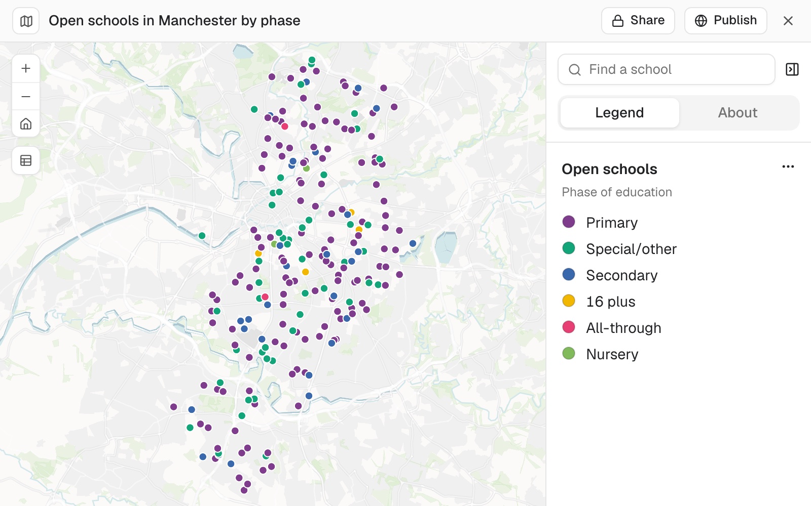
| From 475 rows | Rows |
|---|---|
| Open schools, placed and kept | 222 |
| Closed schools, dropped | 251 |
| Phase tidied, logged | 48 |
Two open schools had no coordinates but a full address. They were placed from it.
For whoever is handed the file
A colleague's export.A client's register.
Closed records mixed with open ones, locations in the wrong system, and points that showed up in the sea.
Cleaning it by hand takes the afternoon, and nobody can say afterwards what was changed.
Here each step is kept as a dataset you can open, and every change is logged with its count.
One real export
475 rows in, 222 open schools out, and a reason for every drop
The Department for Education's register of schools for Manchester, open and closed together, with locations as eastings and northings.
- Kept
- 222open schools, each one placed on the map
- From an address
- 2open schools with no coordinates, placed from their address
- Logged
- 48rows changed from 'Not applicable' to 'Special/other'
| The 475 rows | Rows |
|---|---|
| Open schools, kept | 222 |
| Closed schools, dropped | 251 |
| A school changing to an academy, held back | 2 |
It says what it dropped, and why.
Seven of the closed rows had no location at all, and it reported them: schools that closed between 1987 and 1997. The two held back were one school becoming an academy next April, listed twice; say so if you want rows like those kept.
Department for Education, Get Information About Schools, cut to Manchester on 11 November 2026.
Ask why it went wrong elsewhere
A file that misbehaved in another tool usually has one cause.
A point far from the rest is the quickest check. Here the furthest were in Wythenshawe, where the city runs south to the airport.
A colleague mapped the original file in another tool and some schools ended up in the sea off Africa. Why would that happen, and is it sorted here?
Mapstack explained: the other tool most likely read the empty coordinates as 0, 0, a point in the Atlantic that GIS people call Null Island, or read the eastings and northings as if they were degrees. Here, rows with no location were left out and the rest were converted from British National Grid.
How it goes
You say what clean means. Mapstack does it a step at a time, and keeps the record.
Attach the export and say what to keep.
Mapstack places it, filters it and maps what is left.
You get the log, and a file.
The step-by-step guide is in the documentation: Clean up a messy file and hand it back in a format another GIS can open.
Common questions
What happens to the file?
It stays in your workspace. Only people with a seat in your workspace can see it. Nothing leaves unless you publish it yourself.
It is not used to train AI. Your data and your conversations are not used to train AI models.
It is still yours. You keep ownership of what you bring in. Delete it and it is removed.
The full answer is in the documentation: Your data, privacy and security.
What does it cost?
Free to start. One seat, for you, with a starter amount of work each month. No card.
This job is on the free seat. Maps, datasets, analysis, your own files and public sharing are all included.
Pay per person for more. A paid seat brings more work each month, and seats for your team.
The prices are on the pricing page.
What do I hand back?
A clean dataset. On a map, with each cleaning step kept as its own dataset.
The log. Each original value, its new value and the number of rows changed.
A file their GIS opens. Download it as a GeoPackage, which opens in QGIS or ArcGIS, or as GeoJSON or a spreadsheet.
Clean yours.
Free to start. No card.