
A slide, a print or a link
Hand your map to people who never open Mapstack.
Start from a map you have made. You get a picture sized for slides, a PDF to print, or a link, each with a title and a key.
Free to start. Slides and prints on a paid seat.
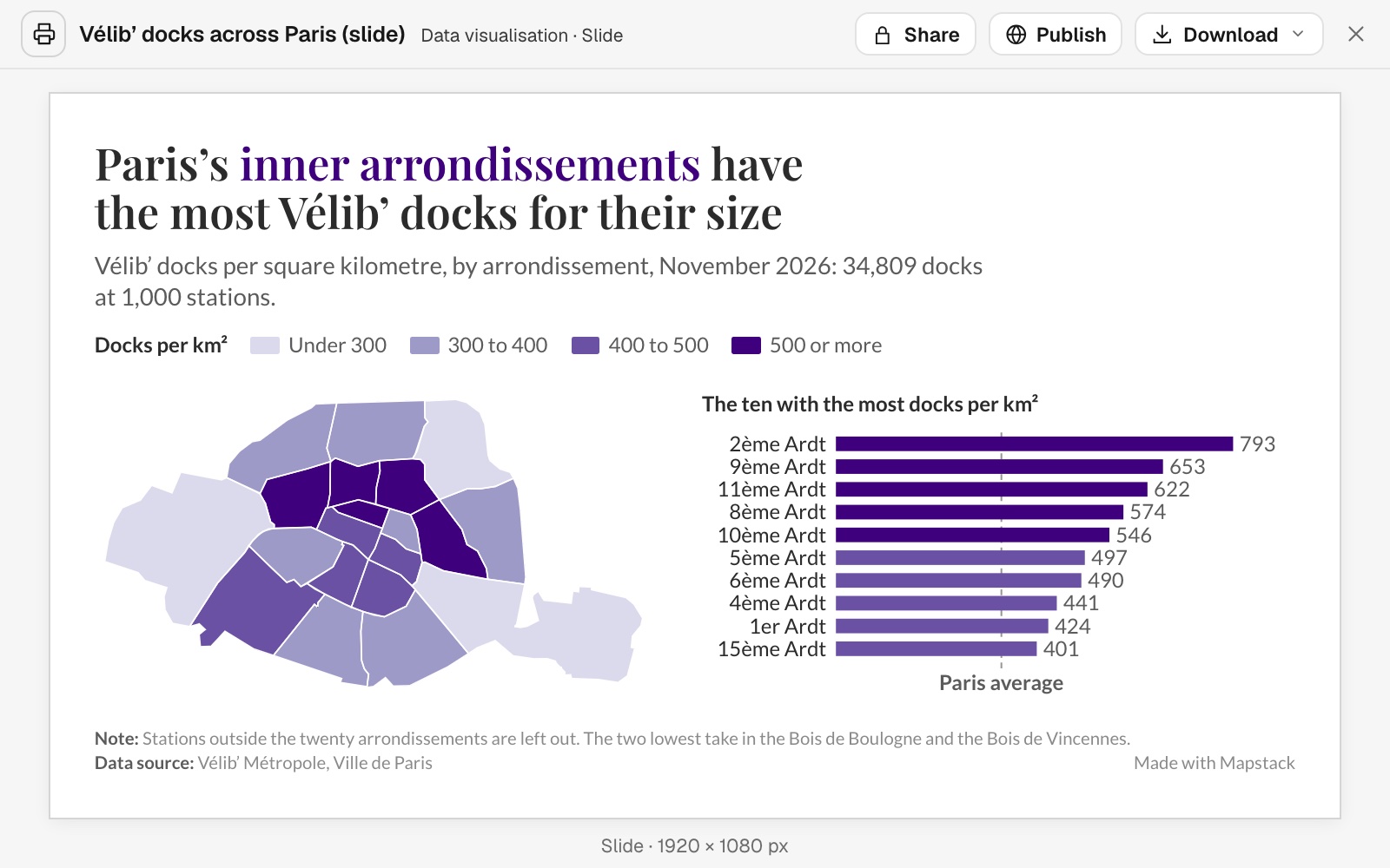
| From one ask | |
|---|---|
| Stations counted, inside Paris | 1,000 |
| Docks at those stations | 34,809 |
| Docks per km², across Paris | 330 |
It wrote the finding as the headline, and set the ten highest beside the map.
For anyone whose map has to travel
The map is done.
Now it has to work in an inbox, in a slide deck or on paper, for people who will never open the tool you made it in.
That usually means screenshots, a legend pasted on by hand and a credit line forgotten.
Here you tell Mapstack who will receive it. It makes the format, with the title, the key and the credits on it.
Ask who can see it
Tell Mapstack who the map is for, and it sets out the choices.
A public link opens for anyone who has it, including anyone it is forwarded to.
I want to send this to three people at another organisation and nobody else. What are my options?
Mapstack set out three: send the file, make it public, or give them a seat. For three people and nobody else, it said, send the file: download the PDF or the picture and attach it to an email. They need nothing to open it.
How it goes
Start from a map you have. Say who it is for.
Ask for the format your audience needs.
Mapstack lays it out, with the title, key and credits.
You download it, or send the link.
The step-by-step guide is in the documentation: Hand a map to other people: a link, a print or a picture for your slides.
Common questions
What does it cost?
Free to start. One seat, for you, with a starter amount of work each month. No card.
The map and its public link are on the free seat. With your own files and public sharing.
The slide and the print are on a paid seat. Paid seats are per person, and bring more work each month.
The prices are on the pricing page.
Who can open what?
A file you send. Only the people you send it to have it.
A public link. Anyone with the link, with no sign-in.
A seat in your workspace. A Viewer seat, which is paid, opens everything in the workspace, not one map.
What do they get?
A slide. A 1920 by 1080 picture. Copy it into PowerPoint, Keynote or Google Slides.
A print. A PDF laid out for the paper, with a north arrow, a scale bar and a note to print at 100%.
On both. A title, a key, the date and the data credits.
Send yours.
Free to start. Slides and prints on a paid seat.