
An interactive map for visitors
Make a visitor guide map that opens on a phone.
Attach your lists of toilets and car parks. You get one map with what to see and where to eat, which opens on a phone from your website.
Free to start. Printed maps on a paid seat.
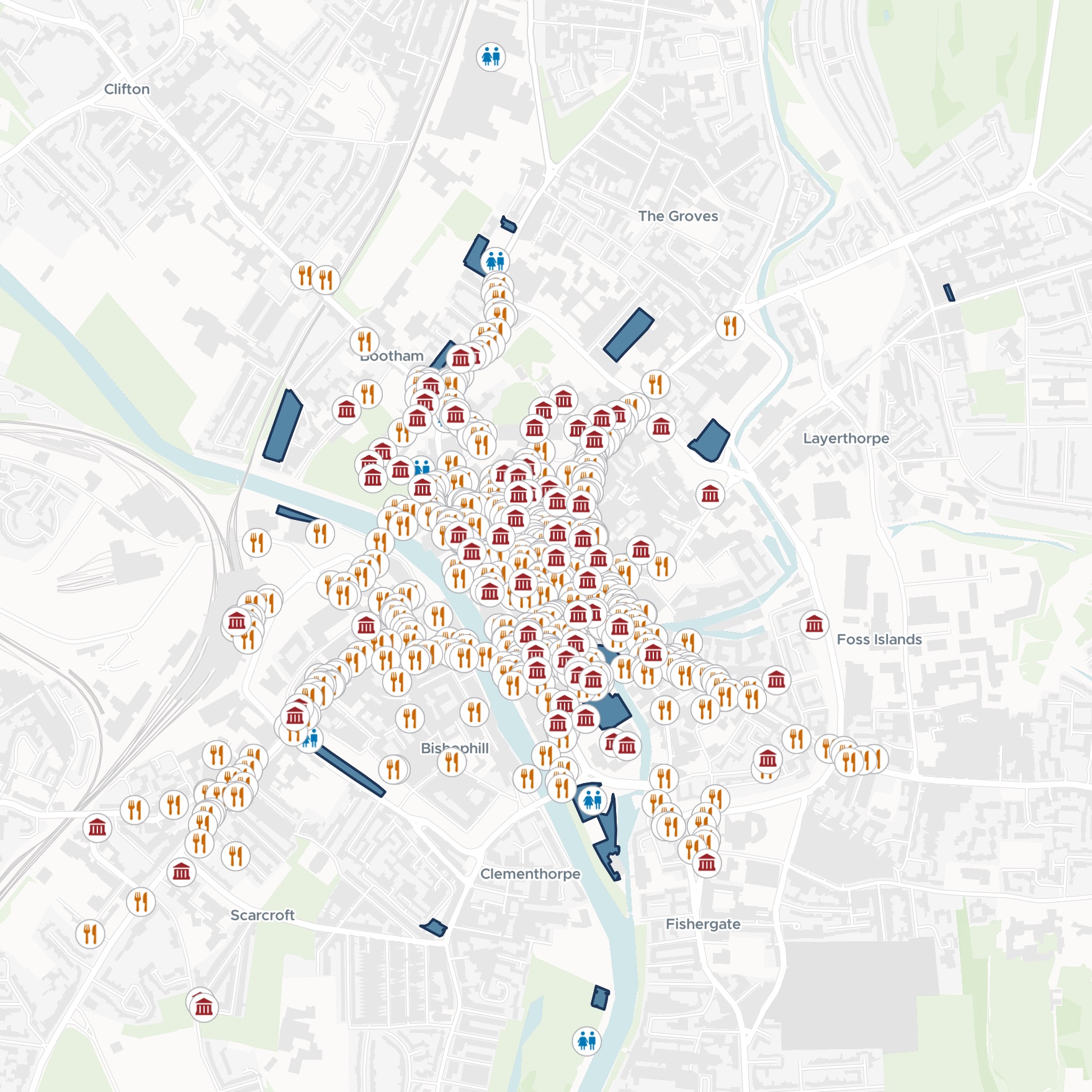
| Four groups, one symbol each | Tap for |
|---|---|
| Attractions and historic sites | Category, address, website |
| Places to eat and drink | Address, website, phone |
| Public toilets | Type, address, council page |
| Council car parks | Spaces, disabled bays |
Everything a visitor looks for in the old city, on one map.
For whoever helps visitors find their way
Tourism offices.Visitor desks.Town centre partnerships.
Visitors want what to see, where to eat, and where the toilets and car parks are, on one screen.
Mapping people call these places points of interest. Some you keep yourself, like the toilets and car parks. The rest are in published place listings.
One map carries both. It goes in a visitor’s pocket as they walk, and opens from your website for planning the day.
One real city centre
York's old city, ready for its visitors
The City of York Council's own lists of public toilets and car parks, from York Open Data. Mapstack found the attractions, the places to eat and drink, and the edge of the old city.
- To eat and drink
- 518cafés, tearooms, restaurants and pubs, found by Mapstack
- To see
- 74museums, monuments and historic buildings, found by Mapstack
- Kept to
- Old cityonly, inside the council's own conservation area boundary
| Found by Mapstack | Across York | Left outside the centre |
|---|---|---|
| Places to eat and drink | 1,071 | 553 |
| Attractions and historic sites | 101 | 27 |
Say where the centre ends, and the map keeps to it.
Asked for the old city, inside and just around the walls, Mapstack found the council’s Central Historic Core Conservation Area and kept only the places inside it. Listings marked as permanently closed were left out, and duplicates merged.
City of York Council, York Open Data: Location of Public Toilets in York, and Car Parks. Attractions and places to eat and drink from published place listings. Run on 15 November 2026.
Make it in Spanish too
Ask for a second language, and you get a second map.
Atracciones y Monumentos Históricos. Dónde Comer y Beber. Aseos Públicos. Aparcamientos Municipales.
Two links, so each visitor opens the guide in their own language.
We get a lot of visitors from Spain and Latin America, so please make a Spanish version of the map as well, with the title, the group names and the popup labels in Spanish. Keep the English one as it is.
A second map, Guía Turística del Centro de York, with the same places. The title, the four groups, the pop-up labels and the search box are in Spanish. The English map was kept beside it.
How it goes
You bring the lists you keep. Mapstack finds the rest and makes the map.
Attach your own lists and name the area.
Mapstack finds the places and keeps them to the centre.
Visitors find their way.
Go further
The same guide, tuned for the phone, taken onto paper and asked about.
On the phone
Change how the guide looks in the hand.
- Adjust the colours of the groups so each one stands out on a phone screen.
At the desk
Something to hand over the counter.
- Create a printable A4 map of the city centre for our information desk.
For the questions
Answers from the places on the map.
- Which car parks are within 400 metres of York Minster?
Common questions
What happens to our lists?
It stays in your workspace. Only people with a seat in your workspace can see it. Nothing leaves unless you publish it yourself.
It is not used to train AI. Your data and your conversations are not used to train AI models.
It is still yours. You keep ownership of what you bring in. Delete it and it is removed.
The full answer is in the documentation: Your data, privacy and security.
What does it cost?
Free to start. One seat, for you, with a starter amount of work each month. No card.
The guide map and its public link are on the free seat. With your own files and public sharing.
A printed map is on a paid seat. Paid seats are per person, and bring more work each month.
The prices are on the pricing page.
How do visitors open it?
You publish it. Select Publish at the top of the map and set it to Public.
A link for phones. Copy the share link for visitors to open as they walk.
From your website. Put the link on your visitor pages, one for each language.
Make yours.
Free to start. Printed maps on a paid seat.