
Spreadsheet to map, geocoding included
Turn your address list into a shared map.
Give Mapstack a spreadsheet, Excel or CSV, with an address or postcode on every row. You get a map to share by link. Geocoding is included.
Free to start. Seats for your team are paid.
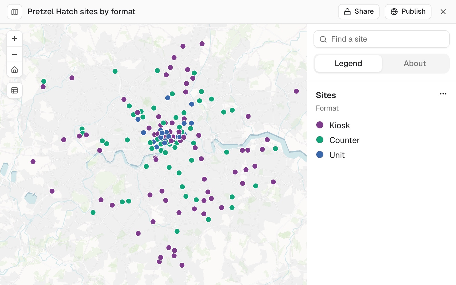
| Format | Sites |
|---|---|
| Kiosk | 71 |
| Counter | 56 |
| Unit | 22 |
All 149 sites, placed from their postcodes alone.
From rows to a map, without placing a single pin
Columns: Site (the station it trades at), Postcode (no coordinates), Format (Kiosk, Counter or Unit), Covers (customers a weekday). 149 rows. A postcode on every row, no coordinates.
What you get
- Every address placed, each with a note of how well it matched.
- A legend, a search box and filters, added without being asked.
- The record behind any point, shown when someone selects it.
- A link to send: to your team, or to anyone.
For whoever keeps the list
The list lives in a spreadsheet.Everyone else wants it on a map.
So someone has to make one, and make it again each time the list changes.
Usually that means waiting for the one person who can make maps, or pasting postcodes into a web tool a few at a time.
This is a map you make by asking for it, check the way you would check a colleague's first draft, and send as a link.
Check it like a colleague's first draft
An address can be matched to a street of the same name in the wrong town. So ask where everything landed.
Mapstack fetches the boundary and tests every point against it.
A point outside the area is a question to answer, not an error. Here the place is right. When one is wrong, you move it.
Are any of our sites placed outside Greater London?
One: Whyteleafe, postcode CR3 0AD, just over the line in Surrey, where the station really is.
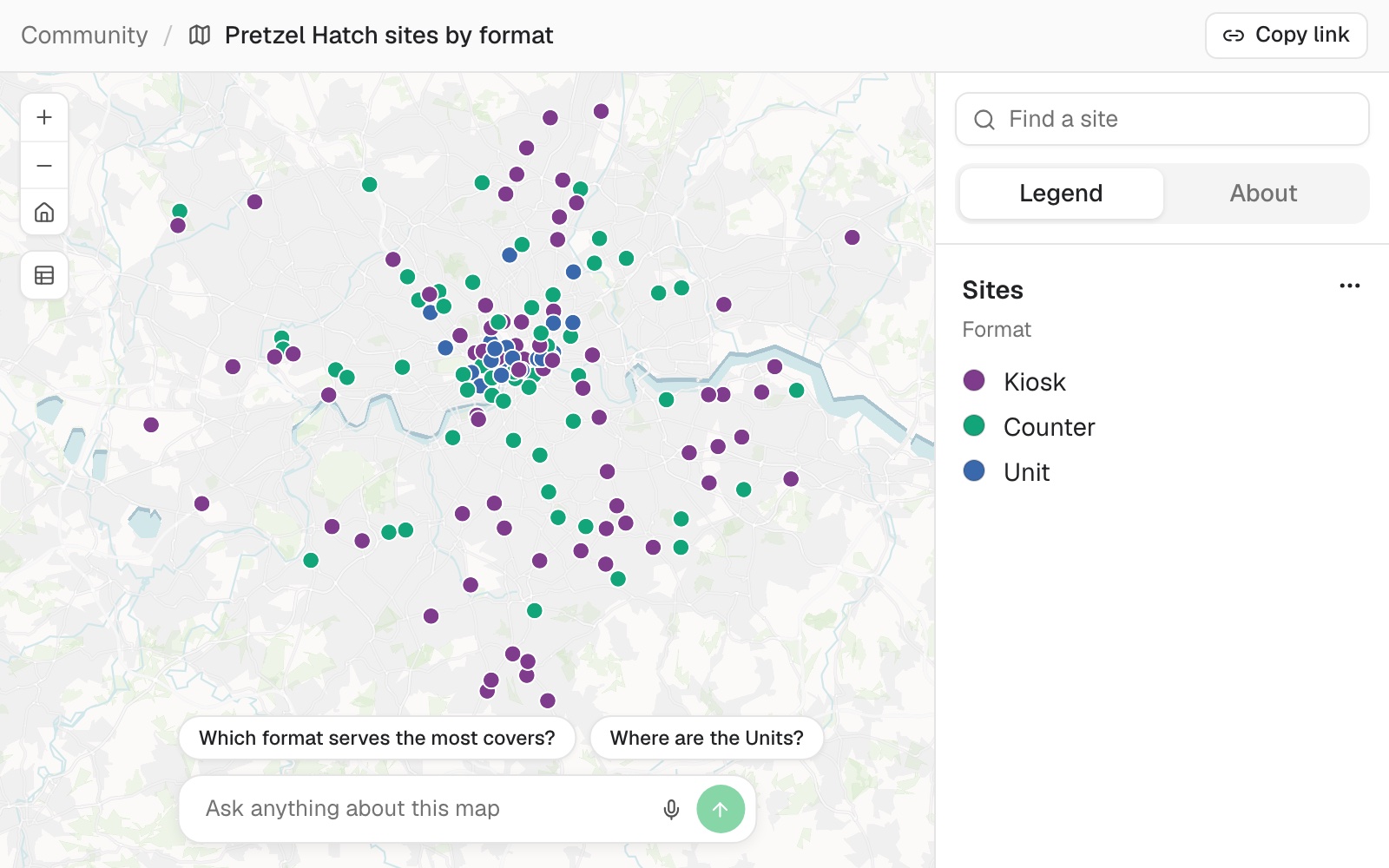
What they see when they open the link
The map stays private until you publish it.
- The map itself, with its legend, search and filters.
- A box for asking questions about what is on it.
- No sign-in for a public link.
How it goes
You say what the map should show. Mapstack does the placing.
Attach your spreadsheet and say how you want it coloured.
Mapstack places every address and makes the map.
You check it, then send the link.
The step-by-step guide is in the documentation: Turn a spreadsheet of addresses into a map you can share.
Common questions
What happens to my address list?
It stays in your workspace. Only people with a seat in your workspace can see it. Nothing leaves unless you publish it yourself.
It is not used to train AI. Your data and your conversations are not used to train AI models.
It is still yours. You keep ownership of what you bring in. Delete it and it is removed.
The full answer is in the documentation: Your data, privacy and security.
What does it cost?
Free to start. One seat, for you, with a starter amount of work each month. No card.
The map is on the free seat. With your own file, and a public link anyone can open.
Seats for your team are paid. One for each person who opens the map privately, charged per person.
The prices are on the pricing page.
Who can open the map?
Your team. Share, then Copy link: everyone with a seat in your workspace can open it.
Anyone you choose. Publish, then Public, then Copy link: anyone with the link, with no sign-in.
Nobody, again. Set it back to private whenever you like.
Map yours.
Free to start. Seats for your team are paid.