

Turn a spreadsheet of addresses into a map you can share
Go from a spreadsheet of addresses to a checked map that other people can open from a link.
Best for
Anyone with a list of customers, sites or premises in a spreadsheet who wants other people to see it on a map. You need no mapping experience. You end up with a map you have checked, and a link to send.
The example in this guide is the site list of Pretzel Hatch, the kiosk chain these docs return to: 149 sites, each a row with the site's name (the London station it trades at), its postcode, its format (Kiosk, Counter or Unit) and its covers, the customers it serves on an average weekday. There are no coordinates. The stations and postcodes are real; the company and its figures are made up for the example. With your own data, keep the shape of the asks and change the words.
What you need
- A spreadsheet with one row for each address (.csv, .xlsx or .xls), with the town or postcode on every row.
- A Free, Creator or Creator Max seat. You can start on mapstack.io without an account and make one when you send your first message.
Before you start
- Very large files. See Sizes and limits. A file over a limit is refused, never cut short.
- Public means public. A public map opens for anyone with the link, with no sign-in. Check what is in your columns first.
The prompt
Map our sites and colour them by format
What to expect
Mapstack places your addresses
It looks up each address with a geocoding service and gives you a dataset: your 149 rows, each with a place and a match quality. You do not have to ask for this step.
It makes the map
The map is made from the dataset and coloured by format, as asked: 71 kiosks, 56 counters and 22 units. Mapstack also adds what a reader would want without being told: a legend, a search box for site names, filters, and the record for anything you select.
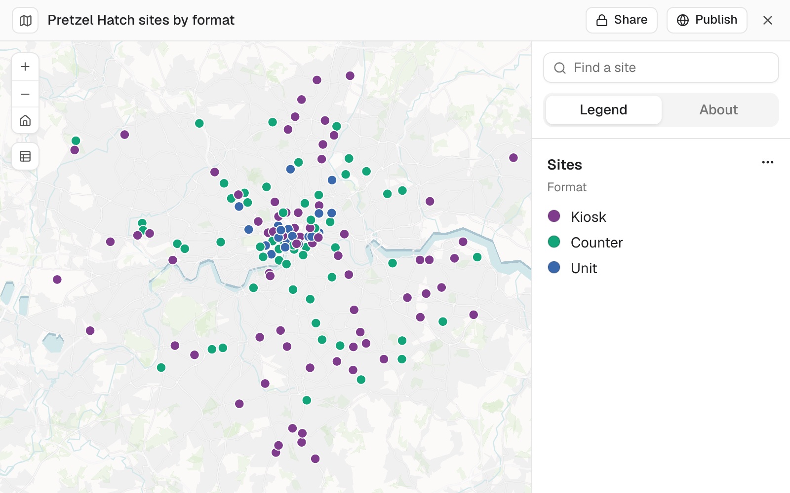 Example: the map made from the request above, 149 sites coloured by format. The point at the bottom, Whyteleafe, sits apart from the rest.
You check where things landed
Treat the map as a colleague's first draft. The geocoding service matches each address the way a person would, and like a person it can pick a street of the same name in the wrong town. Ask Mapstack to check every point against the boundary of where they should be:
Are any of our sites placed outside Greater London?
Mapstack fetches the boundary and tests every point. In the example one site is outside it: Whyteleafe, postcode CR3 0AD, just over the line in Surrey, where the station really is. A point outside the area is a question to answer, not an error: here the place is right. When one is wrong, move it by editing the dataset; the steps are on Map a spreadsheet of addresses.
You make it say what you want
Ask for changes in plain words. A request that says exactly what you want is carried out without further questions, and the rest of the map stays as it was.
You share it
Sharing is done on the map itself, not by asking.
For people in your workspace, select Share, then Copy link. Everyone with a seat in the workspace can open it.
For anyone else, select Publish, then Public, then Make public, then Copy link. The map stays private until you select Make public. Someone opening the link sees the map with its legend, search and filters, and a box for asking questions about it. See Make something public.
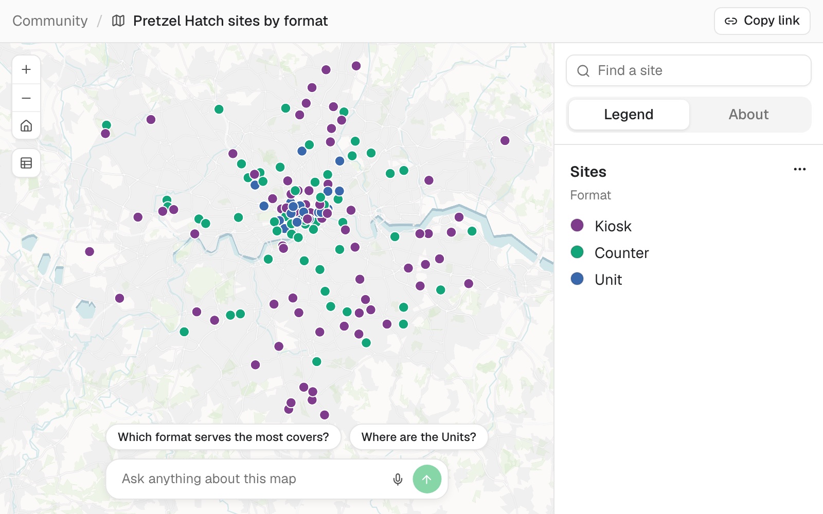 Example: the same map published, as anyone with the link sees it, with suggested questions above the box for asking about it.
Make it your own
On the map, make the Units red so they stand out
Which of our sites were only matched to an area, not to the premises or the street?
Common questions
How do I check where my addresses landed?
Ask Mapstack to check them against the area they should be in: "Are any of our sites placed outside Greater London?" A point outside can be right, as Whyteleafe is here, or a street name that also exists in another town. Move a wrong one in the dataset, or add the town and postcode to the file and attach it again, saying which area the places are in.
How big a file can I bring?
See Sizes and limits. A file over a limit is refused, never cut short, so split it or keep only the area you need.
Who can open the link?
It depends which link. Share, then Copy link gives a link that everyone with a seat in your workspace can open. Publish, then Public, then Make public, then Copy link gives a link anyone can open, with no sign-in.
Can I make it private again?
Yes. Select Publish again and choose Private (default).