
A study-area figure for a paper
Make the study-area figure for your paper.
Attach your study sites. You get the study-area figure reviewers expect, with a locator map inset, a scale bar and a north arrow, as a PDF or a picture.
Free to start. Print-ready sheets on a paid seat.
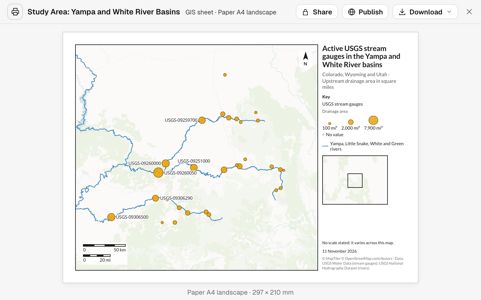
| On the figure | |
|---|---|
| Gauges, sized by drainage area | 30 |
| The largest, labelled | 6 |
| Rivers, fetched and drawn | 4 |
One gauge has no drainage area. It stays on the map as a small grey circle, listed as No value.
For researchers and students
Every paper, thesis and poster needs one.Where the sites are.What they measure.
Where in the world this is.
It is the figure reviewers look at first, and the one that takes an afternoon in desktop GIS to get right.
Here you attach the site list and say what the figure needs. Mapstack fetches the rivers and lays out the page.
From a list of sites to a figure
Columns: Site number (the gauge ID), Drainage area (square miles), Latitude, longitude (where it is). 30 rows. One gauge has no drainage area.
What you get
- Sized symbols in colour-blind-safe colours, with a key.
- The rivers, fetched from the national hydrography dataset.
- A locator inset, a scale bar and a north arrow.
- The sources and the date, in the credits.
Add what reviewers will look for
The first figure is a draft. Name what to add.
Check the edges of the frame. A site under the scale bar or the inset can hide a label; name it, and the frame is widened.
Label the six gauges with the largest drainage area by their site number, small enough to stay legible at print size.
Mapstack picked the six from the file, 7,931 down to 2,530 square miles, and labelled them in 8 pt with a white halo.
How it goes
You bring the sites. Mapstack brings the rivers and the layout.
Attach your sites and say what the figure needs.
Mapstack lays out the figure.
You download it for the journal.
The step-by-step guide is in the documentation: Make a study-area figure for a journal paper.
Common questions
What does it cost?
Free to start. One seat, for you, with a starter amount of work each month. No card.
The map of your sites is on the free seat. With your own files and public sharing.
The figure as a PDF or picture is on a paid seat. Paid seats are per person, and bring more work each month.
The prices are on the pricing page.
What happens to my data?
It stays in your workspace. Only people with a seat in your workspace can see it. Nothing leaves unless you publish it yourself.
It is not used to train AI. Your data and your conversations are not used to train AI models.
It is still yours. You keep ownership of what you bring in. Delete it and it is removed.
The full answer is in the documentation: Your data, privacy and security.
What do I download?
A PDF at its true paper size. With real text, ready to place in a manuscript.
Or a PNG. For a poster or a slide.
Set to your journal. Open the PDF in drawing software to set the width the journal asks for.
Make yours.
Free to start. Print-ready sheets on a paid seat.