
Hurricane evacuation planning
Know who lives in your evacuation zones.
Attach your evacuation zones, centers and care homes. You get the people, the households with no car and the people 65 or older counted in each zone, and mapped.
Free to start. Printed maps on a paid seat.
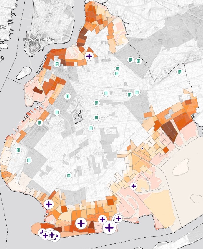
| Zones 1 and 2 | |
|---|---|
| People living there | 369,685 |
| Households with no car | 70,320 |
| Care homes, sized by beds | 15 |
| Evacuation centers | 18 |
228 census tracts touch zones 1 and 2, from Greenpoint round to Canarsie.
For whoever plans the evacuation
A storm is coming and the first zones will be ordered out.
Who lives there, who has no car, and which care homes must move?
Hurricane evacuation zones are a shape on a map. The people are in the census, the care homes in a state list, the evacuation centers in another.
Here you attach the zones, the centers and the care homes. Mapstack adds the census and does the counting.
One real borough
Brooklyn’s first two zones, counted tract by tract
New York City's hurricane evacuation zones and evacuation centers for Brooklyn, and the state's list of care homes. Mapstack fetched the census figures for all 804 Brooklyn tracts itself.
- Zone 1
- 145,747people, where the storm-surge risk is highest
- Zone 2
- 223,938people, where it is moderate
- Aged 65 and over
- 74,025people across the two zones, the ones most likely to need help
| Zone | Aged 65 and over | Households with no car |
|---|---|---|
| Zone 1 | 34,026 | 32,588 |
| Zone 2 | 39,999 | 37,732 |
A tract that crosses a zone edge is shared out.
Where a census tract is only partly inside a zone, it is counted by the share of its area inside, so each zone gets its own figures.
NYC Emergency Management, Hurricane Evacuation Zones and Hurricane Evacuation Centers (NYC Open Data). New York State Department of Health, health facilities and bed counts. US Census Bureau, American Community Survey 2019–2023 5-year estimates. Run on 15 November 2026.
The care homes that would have to move
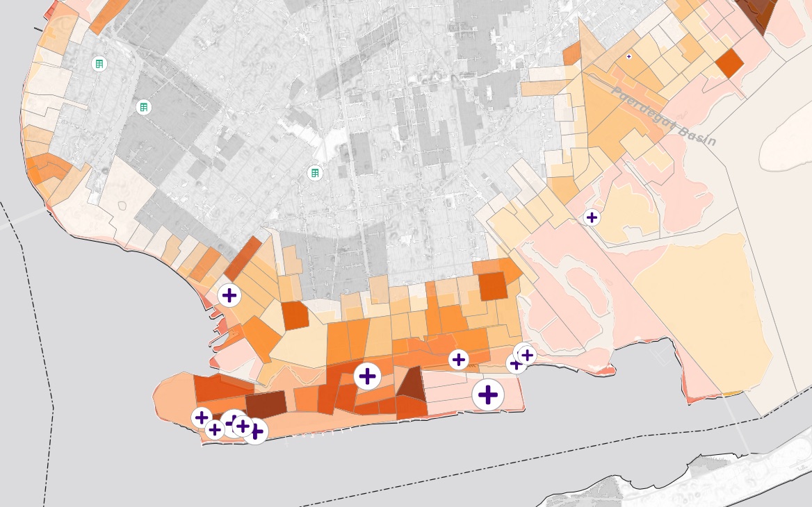
The south shore, closer in. Each purple cross is a care home, sized by its beds.
- 3,404 beds to move. The nursing homes, adult homes and enriched housing inside zones 1 and 2, each with its type, address and zone.
- Most are in zone 1. 10 homes with 2,528 beds. Zone 2 has 5, with 876.
- One center is nearest for most. By road, 12 of the 15 are closest to the same evacuation center, P.S. 226.
How it goes
Three files, one request, one answer.
Attach your three lists and name the zones to count.
Mapstack counts each zone and maps the tracts, the homes and the centers.
Every care home gets its nearest center by road, with the drive in minutes.
Go further
The same zones, taken on to the next question.
The next zone
Count it the same way, for when the order widens.
- Check zone 3: the people, the households with no car, the people 65 and over, and the care homes in it.
The care homes
Look harder at the biggest moves.
- Which care homes in zones 1 and 2 have the longest drive to their evacuation center?
Something to hand out
Put the zones on paper for the room.
- Make a printed map of zones 1 and 2, with the care homes and the evacuation centers.
Common questions
What happens to our care-home list?
It stays in your workspace. Only people with a seat in your workspace can see it. Nothing leaves unless you publish it yourself.
It is not used to train AI. Your data and your conversations are not used to train AI models.
It is still yours. You keep ownership of what you bring in. Delete it and it is removed.
The full answer is in the documentation: Your data, privacy and security.
What does it cost?
Free to start. One seat, for you, with a starter amount of work each month. No card.
The counts, the care-home list and the map are on the free seat. With your own files and public sharing.
A printed map of the zones is on a paid seat. Paid seats are per person, and bring more work each month.
The prices are on the pricing page.
Where do the figures come from?
People, cars and ages. The American Community Survey, 2019–2023 5-year estimates, tract by tract. No car means no vehicle available, in the census’s words.
Zones, centers and care homes. The files you attach, as you attach them.
Drive times. The nearest center by road, with the distance and the minutes.
Count yours.
Free to start. Printed maps on a paid seat.