
Crop health from imagery
See which parts of your fields are struggling.
Bring in satellite imagery or a drone image of your fields. You get crop vigour as a vegetation index, NDVI, on a map a scout can open.
Imagery is on a paid seat.
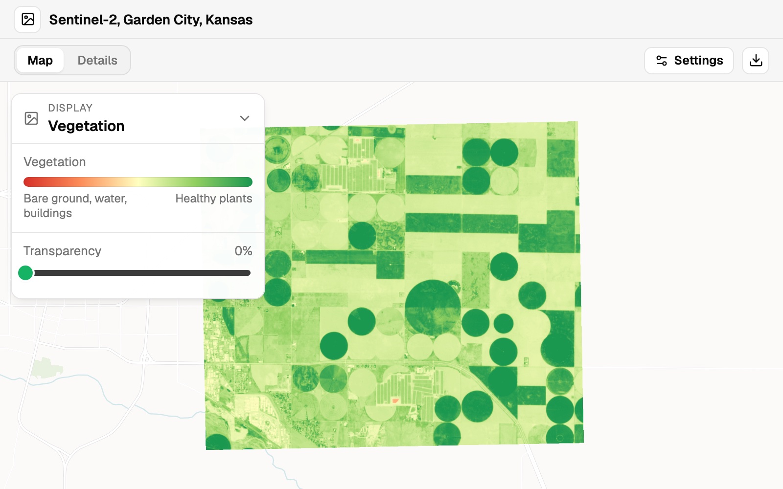
| The image | |
|---|---|
| Cloud cover | 0% |
| Bands | 4 |
| Pixel size | 10 m |
About 10 by 9 km of irrigated and dryland fields, with 0% cloud.
For farmers, agronomists and crop insurers
A field looks even from the road.From above, in the near infrared, it does not.
The weak patches show before anyone walks the rows.
NDVI, the normalised difference vegetation index, is near infrared minus red, divided by the two added together. Healthy plants reflect far more near infrared than red, so they score high.
You bring the image and name its bands. Mapstack draws the index and makes the map to send.
Make it a map for the scout
The vegetation view is for you. A map is what you send.
Select any spot on the map to read its band values there.
Put it on a satellite base map and make the colours run red for stressed to green for healthy, with a legend that says what the numbers mean.
Mapstack made a map with the vegetation view over a satellite base map, and added the natural-colour and false-colour views of the same image, which anyone opening the map can switch between. The legend names the two ends of the scale in words.
How it goes
Naming the bands is what makes the vegetation view possible.
Attach the image and name its bands.
Choose Vegetation under Display.
You send the map.
The step-by-step guide is in the documentation: See which parts of your fields are struggling, from satellite or drone imagery.
Common questions
What does it cost?
Imagery is on a paid seat. Paid seats are per person, and bring more work each month.
Free to look around. Maps, datasets and analysis are on the free seat. No card.
The prices are on the pricing page.
What happens to my imagery?
It stays in your workspace. Only people with a seat in your workspace can see it. Nothing leaves unless you publish it yourself.
It is not used to train AI. Your data and your conversations are not used to train AI models.
It is still yours. You keep ownership of what you bring in. Delete it and it is removed.
The full answer is in the documentation: Your data, privacy and security.
Which imagery works?
Any with a red and a near-infrared band. Satellite, drone or aircraft.
Free satellite scenes. The example is a Copernicus Sentinel-2 scene, a 6 MB GeoTIFF.
Name the bands. Say which satellite took it, or what each band holds.
See yours.
Imagery is on a paid seat.