
Broadband coverage gaps by area
Find the areas a service has not reached.
Give Mapstack the published coverage figures for your areas. You get coverage mapped area by area, and a list of the areas under your threshold with the premises still waiting.
Free to start. Reports on a paid seat.
| Of 151 electoral divisions | Areas |
|---|---|
| No gigabit option at all | 3 |
| Under 80% passed | 55 |
| Still under 80% after planned build | 8 |
Of the 8 still short, the largest gap is Ballycastle: 57% passed, about 187 premises waiting.
For whoever writes the bid
A funding bid has to show the gap.Where the service has not reached.How many homes and businesses are waiting.
What is left once the planned build is done.
The regulator publishes the figures. Turning them into a map, a list and a page of evidence is usually a consultant's job.
This starts from the published file and ends with the summary, with the data date and the threshold on it.
One real county
151 areas, an 80% threshold, 8 still short after planned build
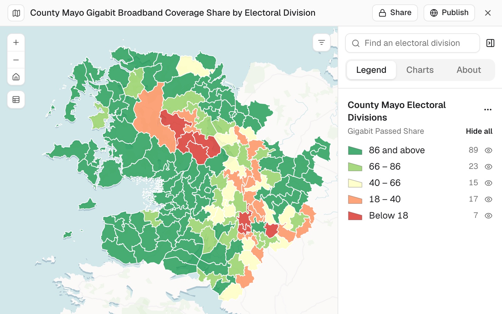
The communications regulator's published gigabit coverage for every electoral division of County Mayo, as downloaded.
- No option at all
- 3divisions with no gigabit broadband today
- The largest gap left
- 57%passed in Ballycastle, after the planned build too
- Waiting there
- 187premises, about, in Ballycastle alone
| Electoral divisions | Number |
|---|---|
| In the county | 151 |
| Under 80% passed today | 55 |
| Still under 80% after planned build | 8 |
A bid has to show the gap that remains after build already committed.
Mapstack read the planned-build figure as the total expected coverage, not an addition to today's, and named the largest remaining gap: Ballycastle, which the planned build does not change.
ComReg, Gigabit Statistics, by electoral division, County Mayo. Downloaded 11 November 2026.
Name the places
A list of area codes means little to a panel. Ask for the places.
Where it fills a gap from general knowledge, it says it has not checked it against your data.
Which towns and villages sit in those divisions? Put their names on the map.
Mapstack fetched the official settlement boundaries, matched them to the divisions and added them to the map with name labels. It named five places, and said where a division holds no settlement, only scattered townlands.
How it goes
You bring the published figures and set the threshold. Mapstack does the mapping, the listing and the writing.
Attach the coverage file and say your threshold.
Mapstack maps it and lists the gaps, with the premises waiting.
You get the summary for the bid.
The step-by-step guide is in the documentation: Find the areas with no gigabit broadband, for a funding bid.
Common questions
What happens to my file?
It stays in your workspace. Only people with a seat in your workspace can see it. Nothing leaves unless you publish it yourself.
It is not used to train AI. Your data and your conversations are not used to train AI models.
It is still yours. You keep ownership of what you bring in. Delete it and it is removed.
The full answer is in the documentation: Your data, privacy and security.
What does it cost?
Free to start. One seat, for you, with a starter amount of work each month. No card.
The map and the list are on the free seat. With your own files and public sharing.
The written summary is on a paid seat. Paid seats are per person, and bring more work each month.
The prices are on the pricing page.
What goes in the summary?
The headline and the counts. Before and after planned build.
The map. With the remaining priority areas marked.
The date and the threshold. So the panel can see what the figures are.
The method. Premises waiting are an estimate: the premises in an area times the share not yet passed.
Find yours.
Free to start. Reports on a paid seat.