
A figure-ground plan of a site
Draw the figure-ground plan of your site.
Attach the building footprints around your site. You get a figure-ground plan, buildings solid black on white, on a sheet ready to print.
Free to start. Print-ready sheets on a paid seat.
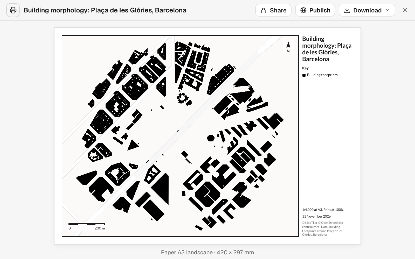
| On the sheet | |
|---|---|
| Buildings, solid black | 552 |
| Scale at A3 | 1:4,000 |
| Labels | None |
Courtyards and light wells stay open, as they are in the footprints.
For architects, urban designers and students
Every design statement opens with the context.Black buildings, white ground, nothing else.
It takes longer than it should.
Some call it a Nolli map. The footprints are free from OpenStreetMap. Turning them into a clean drawing at a stated scale is the slow part.
Here the footprints become a dataset, and the drawing is made from it. What is in the file is what is on the drawing.
Mark the site
Attach the boundary with the buildings, and say what to draw.
Your own boundary is the reliable route. A place looked up by name is drawn as it comes back from the gazetteer.
Draw our site boundary in red, with a 500 m ring around it.
Mapstack draws the ring as a buffer around the boundary, not around a point, and widens the frame to fit it.
How it goes
You bring the footprints. Mapstack draws the sheet.
Attach the footprints and name the sheet.
Mapstack draws the plan at a stated scale.
You download it.
The step-by-step guide is in the documentation: Make a black-and-white figure-ground drawing of the buildings around a site.
Common questions
What does it cost?
Free to start. One seat, for you, with a starter amount of work each month. No card.
The buildings dataset and the map are on the free seat. With your own files and public sharing.
The sheet as a PDF or picture is on a paid seat. Paid seats are per person, and bring more work each month.
The prices are on the pricing page.
What happens to my files?
It stays in your workspace. Only people with a seat in your workspace can see it. Nothing leaves unless you publish it yourself.
It is not used to train AI. Your data and your conversations are not used to train AI models.
It is still yours. You keep ownership of what you bring in. Delete it and it is removed.
The full answer is in the documentation: Your data, privacy and security.
Can the architects draw over it?
Download the outlines. The buildings dataset downloads as GeoJSON or GeoPackage, real outlines for CAD or GIS.
At a true scale. 1:4,000 at A3 in the example, with a note to print at 100%.
Or the sheet. A PDF or PNG, at the true A3 size, 300 dpi.
Draw yours.
Free to start. Print-ready sheets on a paid seat.