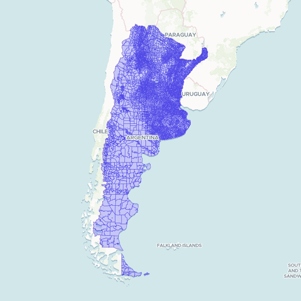
Built from INDEC's 2022 census cartography (the geography the Censo 2022 was enumerated in); unit names from IGN. Covers Argentina's undisputed territory only: the Falkland Islands (Islas Malvinas), South Georgia and the South Sandwich Islands, and the Antarctic sector claimed by Argentina are not included. Radios in departments 94021 and 94028 are omitted. Radio 860630701 (fracción 8606307, Choya, Santiago del Estero), which the census enumerated, has no polygon in this edition of INDEC's cartography. One stretch of the Argentina–Chile border is undemarcated: the Southern Patagonian Ice Field (Campo de Hielo Patagónico Sur) between Mount Fitz Roy and Cerro Daudet, in the department of Lago Argentino, province of Santa Cruz. It is drawn on INDEC's line, which is Argentina's position and not an agreed international boundary. Join on radio_code, the 9-digit INDEC code.
INDEC's published radio layer (datos.gob.ar, Radios Censo 2022), 66,502 units, with the 2 units in departments 94021 and 94028 excluded; 13 invalid source polygons repaired with MakeValid. Geometry otherwise unchanged; names joined by code. Not simplified.
Showing 10 of 66,500 rows — open the Table tab for the full, sortable dataset.
We use cookies to improve your experience. Read our privacy policy.