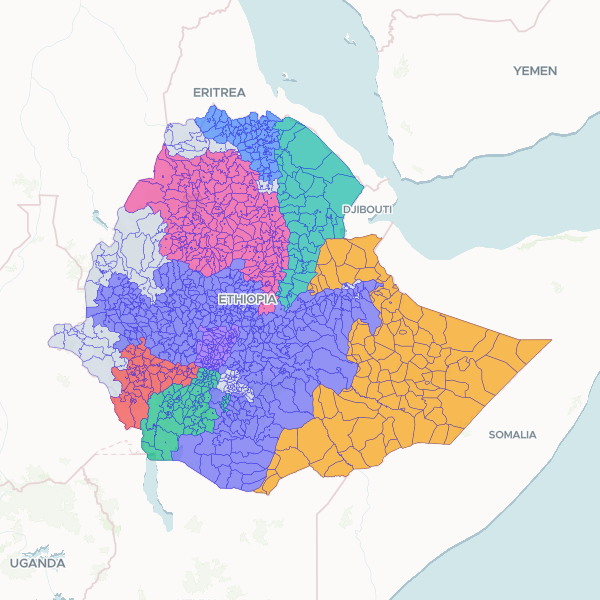
All 1,148 woredas (ADM3, administrative districts) of Ethiopia, the level below zones, as of the 2025 administrative division. Each woreda carries its official P-code (adm3_pcode) and name (adm3_name), both unique across the set, plus the names and P-codes of its parent zone (ADM2) and region (ADM1) — 107 zones and 15 regions. Alternative and reference names are included where the source records them (58 and 23 woredas respectively). Join your data on adm3_pcode for official statistics, or on adm3_name where you have woreda names. Note on names: woreda names have many English transliterations, and this set uses the official spellings (for example "Abay Chomen", "Debre Libanos", "Gonder Zuria"). A table using different transliterations may need its names reconciled before it will join. Two woredas that the source lists in its gazetteer — Dawe Serer (ET042199, Oromia) and Quarsadula (ET050905, Somali) — are not drawn here because their boundaries are contested; they appear in the publisher's statistical tables, which is why a gazetteer count of 1,150 does not match the 1,148 mapped units.
Prepared from the UN OCHA Common Operational Dataset for Ethiopia (COD-AB v04, admin level 3 layer), whose geometry comes from the Ethiopian government — the Central Statistics Agency (now the Ethiopian Statistical Service) and the regional Bureaux of Finance and Economic Development — with P-codes adapted to OCHA standards. Boundaries were created by the source in August 2023 and the dataset is published as valid from 1 January 2025. Only names and identifiers were retained; the source's area, centroid and empty alternative-language columns were dropped. Geometry is published at full source resolution with no simplification; the only processing applied was normalising single and multi-part polygons to MultiPolygon. All 1,148 source units are present — none were dropped or filtered.
Showing 10 of 1,148 rows — open the Table tab for the full, sortable dataset.
We use cookies to improve your experience. Read our privacy policy.